The Hot and Cold of It
Tuesday, July 3, 2018
Heat advisories were issued in Eastern Iowa for two straight days--June 29 and 30, 2018--where a combination of high temperature, dew point and humidity created dangerous situations for many. Looking for an ideal location to capture this photographically, I chose the grounds at Echo Hill Presbyterian Church in north Marion, Iowa, with its abundance of wildflowers and corn fields. Water vapor from the corn was contributing to the sultry conditions seen in the image above, looking west from the north border of the property at 3:44 pm CDT. Air temperature was 93 degrees, dew point 78 degrees and humidity 62%, creating a heat index of 106 degrees. The previous day's heat index topped out at 110 degrees.
I could just feel this cornfield aspirating humidity! The image looks north from the church grounds at 3:46 pm. The elevated view seen here was achieved by setting the camera's timer to a two second delay, pressing the shutter button, then quickly raising the camera-on-tripod as high as I could before it took the picture.
With the hot, many times comes the cold. This College of DuPage GOES16 satellite image shows high cloud tops (circled) at 6:36 pm in Marshall County--storm initiation fed by an approaching cold front.
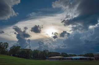
6:55 pm. I began monitoring the storm's progress as it moved eastward and selected this vantage point in Bowman Woods Park in Cedar Rapids to view it. The anvil of the now-severe storm--located some 65 miles distant near Marshalltown--has nearly obscured the sun. In the foreground is Bowman Woods Elementary School.
Radar frame capture of the event, corresponding to the time of the image above it. My location is marked by the target icon at right, with the arrow pointing to the area of the storm.
7:09 pm. Now in my backyard and looking west over the park. The anvil is so large it required me to shoot a five image panorama to include its entire structure.
8:32 pm. I had in the last half-hour repositioned myself to a new open spotting location on the grounds of Noelridge Christian Church in Cedar Rapids. The cold front churned on. Despite the storm due west of here losing its severe warning, it sported a very impressive shelf cloud which dominated its leading edge. This panoramic image captured the incoming storm when it was about 11 miles distant, near the town of Shellsburg.
Looking northwest at a smaller visual slice of the shelf cloud at the same time.
Radar frame capture of the storm's appearance at nearly the same moment as the photograph above it. Again, my location is shown as a target icon. The arrow points to the leading edge of the gust front.
8:55 pm. The leading edge of the storm has passed through in this image looking southwest. Surprisingly, winds were less than 50 mph here, and lightning and rain were minimal. A much different situation than what the city of Des Moines found themselves in--10 inches of rain in some places--causing massive flash-flooding!


0 comments:
Post a Comment