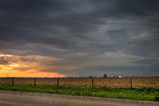
May 26, 2020 Severe Weather in Benton County, Iowa

Friday, May 29, 2020


Storm Prediction Center (SPC) Convective Outlook, posted at 7:50 am CDT, Tuesday, May 26, 2020. Categorical, tornado, wind and hail outlooks are shown, with the greatest potential for all forecasted over central Iowa.


By 12:30 pm CDT Tuesday the SPC posted a Mesoscale Discussion (735) with a 60% probability of a severe thunderstorm watch (above).


At 1:20 pm Tornado Watch 229 was issued (above) including all of central Iowa.


Only five minutes later a tornado warning was issued for an area of Dallas County, just west of Des Moines (WeatherTap radar images above), then at 1:45 pm a severe thunderstorm warning was issued for Washington County in southeastern Iowa. All storms in Iowa had a peculiar NNW track this day. Because of that, I had a particular interest in the Washington County severe storm as its track would most likely bring it west of Cedar Rapids. With spotting equipment already packed and ready to go, my target was US Highway 30, and I quickly departed for an intercept.


2:12 pm CDT. Westbound on US Highway 30, .75-mile east of Highway 287 (27th Avenue) in Benton County. A forming wall cloud is evident, located about 20 miles to my southwest.


2:15 pm. Continuing westbound on Hwy. 30. Wall cloud is becoming more defined.


2:15 pm. Wall cloud looking southwest from near the construction site of US Highway 30 at US Highway 218 in Benton County.


2:16 pm. Zoomed-in capture of the wall cloud.


2:16 pm. Similar capture. Wall cloud is located near the town of Hartwick, in Poweshiek County.


Radarscope image capture corresponding to the time of the photo above it, showing my position (blue target) in relation to the newly designated tornado-warned storm polygon area.


2:23 pm. Continuing westbound on Hwy. 30. Looking southwest at the wall cloud from about .2-mile east of Highway 200 in Benton County.


Weather.us base velocity (left) and echo top captures for 2:27 pm, also showing my position (target icon) in relation to the hot spots.


Pulling off Hwy. 30 at County Road V40 (13th Avenue) in Benton County around 2:25 pm, I began spotting operations and phoned-in a wall cloud report to the National Weather Service in the Quad Cities. The wall cloud (seen above at 2:27 pm) was about 8 miles to my southwest and moving left-to-right in the image.


Radarscope capture for 2:29 pm.


2:30 pm. Wall cloud is about 6 miles to my west (background).


2:30 pm. Panoramic version of the scene.


2:33 pm. Deciding to stay with this storm as it began to move past me, I headed north on V40 and almost immediately received a tornado warning emergency alert on my cell phone.


2:35 pm. Looking west while northbound on V40 (13th Avenue). The wall cloud is beginning to exhibit a more outflow appearance.


2:37 pm. Looking west at storm from V40, 1.5 miles north of US Highway 30 in Benton County.


2:39 pm. Horizontal version of image above it.


2:41 pm. Looking northwest from V40, 1.5 miles north of Hwy. 30. Departing tornadic storm is now about 10 miles distant.


2:41 pm. Departing storm with my spotting vehicle in foreground.


2:56 pm. All tornado warnings in the state had now been lifted. This image looks west at a distant towering updraft with a lowering beneath it while northbound southwest of Vinton, Iowa. I briefly considered intercepting this storm--located about 35 miles away in Tama County--but deemed it a waste of time due to the cancellations.


3:05 pm. Rain curtains southwest of Vinton.


3:10 pm. GoPro Hero 4 Silver video frame capture. Caught in a brief, but intense wind and rain storm southeast of Dysart, Iowa. Rain was blowing across the highway reminiscent of those from RFD winds.


3:12 pm. A stationary look at the departing storm that had rolled over me two minutes before.


3:34 pm. GoPro video frame capture. Westbound on gravel road about 2.5 miles east of Elberon, Iowa in Tama County. Scud is rising into distant cloud feature, located about 5 miles distant.


3:35 pm. GoPro video frame capture. Northbound on gravel road. Most intense part of storm in background was located about 23 miles to the NNE, near the town of Raymond, in Black Hawk County.


3:39 pm. More scud feeding into previously viewed cloud, seen here to my west from 63rd Street, about 3.5 miles southwest of Vinton. Cloud is about 17 miles distant.


3:47 pm. Panorama looking north at storm cell from 19th Avenue, about 5 miles southwest of Vinton in Benton County.


3:47 pm. Similar capture.


4:05 pm. Looking southeast while southbound on US Highway 218 (65th Street) at 24th Avenue, about 5 miles south of Vinton. The approaching line of severe-warned storms in the distance was located about 60 miles away, near the town of Bennett in Cedar County. I was returning home at this moment. These storms would eventually roll through Cedar Rapids, but without much impact. Total driving distance: 132 miles. Nikon D7200 DSLR camera.

Read more...

May 14, 2020 Severe Wx In SE Iowa

Sunday, May 17, 2020


This was the Storm Prediction Center (SPC) Convective Outlook posted on Thursday afternoon, May 14, 2020, with a Slight Risk for severe weather extending through a swath of southern Iowa.


A growing line of storms west of Des Moines became severe-warned at 3:40 pm CDT and were tracking east. On the heels of this development, the NWS SPC issued Severe Thunderstorm Watch 182 at 4:25 pm, which included portions of south-central Iowa (above).


As this line of storms progressed east, a tornado warning was issued at 4:50 pm for an area southeast of Indianola, Iowa (above) and it remained as such until about 5:15 pm. I had my spotting gear all ready in my vehicle, so shortly after the tornado warning was issued I headed south from Cedar Rapids on Interstate 380/US Highway 218 for an intercept location that would give me plenty of time to reach before its arrival.


5:52 pm CDT. This was my view of the western sky with its growing storm clouds while southbound on US Highway 218 just north of Hills, Iowa in Johnson County. Monitoring my radar at this time I determined the storm track was going to most likely move through the Washington, Iowa area to my south.


6:15 pm. I arrived at my spotting position, a longtime favorite of mine, located on Yucca Avenue, .1-mile south of Highway 92, about 1 mile east of US Highway 218 and about 1.8 miles east of the town of Ainsworth in Washington County. Temperatures in Cedar Rapids upon my departure were in the mid-sixties with similar dews, at my arrival here it had increased to 76 degrees F, also with a similar dew point. My spotting position was on a farm field drive-in area, allowing me off the road safety and a clear 360-degree view of the sky. A spent shotgun shell there (above), however, left me a little on the uneasy side...


6:17 pm. Panoramic view of the west sky, looking toward Ainsworth.


Radarscope frame capture corresponding to the photograph above it, with my stationary position indicated by the blue target icon. A severe thunderstorm watch was extended for the rest of southeast Iowa at 6:20 pm.


6:27 pm. My spotting position on Yucca Avenue, looking west.


Radar update for 6:39 pm.


7:27 pm. Looking northwest at an initial area of interest, which eventually moved out (toward the right), without any reportable criteria.


7:35 pm. A new area of interest--wall cloud--to my southwest. This I did report after checking into the Washington County ARES net (147.045 MHz) and net controller Lynn Reasor (N0XOB).


Radar image corresponding to 7:35 pm. My spotting area has now become severe-warned, with an obvious intense area of lightning and hail approaching to my west.


7:38 pm. Closeup of the ragged wall cloud to my southwest. The distance (about 30 miles) and its low contrast (due to fading daylight) made observing any rotation very difficult. The wall cloud was located near the town of Packwood in Jefferson County.


7:43 pm. Similar capture. The intense area was now 22 miles distant and located near the town of Fairfield in Jefferson County.


7:48 pm. Go Pro Hero 4 video frame capture of yours truly racing back to the car after shooting storm from other side of the road amid CG lightning.


7:49 pm. Storm now southwest of the town of Brighton in Washington County, 20 miles distant.


7:51 pm. Wall cloud exhibiting a funnel-like appendage.


Radar image corresponding to 7:50 pm. Note the lavender-colored areas of intense hail in this reflectivity image.


7:53 pm. Closeup of wall cloud and its ragged base.


7:55 pm. Similar closeup of the wall cloud.


7:56 pm. Most intense area of the storm now moving more to my south.


Radar image corresponding to the photograph above it.


7:57 pm. Wall cloud is reflecting the little sunlight that is still available.

Weather.us base velocity map for 8:00 pm. Arrow points to area of greatest intensity southwest of Brighton, Iowa in Washington County, in relation to my stationary spotting position.


8:00 pm. Storm area now contains an inflow cloud. Image looks SSW. The wall cloud is about 16 miles distant, southwest of the town of Brighton.


Radar image corresponding to 8:00 pm. The target icon is my spotting position, with the white arrows showing storm motion.


8:03 pm. Similar view looking down Yucca Avenue and facing SSW. Storm is about 14 miles distant, just west of the town of Wayland in Henry County.


8:05 pm. Growing dark, with fading contrasts. Nikon D7200 DSL camera.


Corresponding radar image. With growing darkness and the incoming threat of lightning, high wind, heavy rain and hail (outlined area), I decided my spotting time here was at end. I politely checked out of the Washington County ARES net and hightailed it back north on US Highway 218 and headed for home.


GoPro Hero 4 video frame captures (8:33 pm, top, 8:35 pm bottom) of lightning on the way home while northbound on Highway 218 south of Hills, Iowa. I evaded the hail and most of the heavy rain by leaving when I did and experienced some beautiful and vivid lightning displays. Finally back home after 9:00 pm.

Read more...

  © Blogger template On The Road by Ourblogtemplates.com 2009

Back to TOP