Nighttime in Yellowstone

Thursday, August 30, 2018


A recent family vacation took us to the national parks of Yellowstone and the Grand Tetons in Wyoming, a seemingly safe haven from light polluted skies at night. As I found out though, several factors conspired against the crystal-clear vistas I had expected. First, the areas where I captured the Milky Way were not "dark-dark" (like the Badlands of last year). Location "A" on the map above is at the north entrance gate to the park and inhibited slightly by the lights of the small town of Gardiner, Montana. Location "B" is at the popular Old Faithful Geyser site, which included several lodges--and window lights. Other negative factors included humidity and the presence of high altitude smoke from nearby wild fires, creating haze.


Fortunately for me, my Nikon D7200 DSLR camera and Tokina f/2.8 11-16mm lens could discern faint light much better than could my eyes. Above is a test shot looking west from near the Roosevelt Arch at the northern entrance of Yellowstone at the edge of the town of Gardiner, Montana. The foreground is lit brilliantly from shop and store lights to my back. It was very difficult here to even see the Milky Way with the naked eye. This image, captured at 1:32 am MDT on Monday, August 20, 2018,  is a 15-second exposure at f/2.8, ISO 6400 and 11 mm focal length.


Ever wary of wild things that go "bump in the night," this image looks northwest from inside the Roosevelt Arch (US Highway 89) at 1:37 am. Settings are identical to the test image above it. Ambient light from Gardiner is seen at right.


Now at the Old Faithful Geyser the following early morning, and even more cognizant of possible bear or bison unseen presence in the dark. Image looks west and was captured from the geyser's viewing boardwalk at 3:07 am MDT, Tuesday, August 21, 2018. Old Faithful is venting steam, which along with the foreground is illuminated from light emanating from a building behind me. Image is a 15-second exposure at f/3.2, ISO 4000 and 12mm focal length. In the background at left are lights from the Old Faithful Inn.

Read more...

2018 Edition of the Perseids Did Not Exactly Wow Me

Tuesday, August 14, 2018


On paper the 2018 Perseids Meteor Shower promised to be a good show on its peak night of August 12-13 in the Cedar Rapids Iowa metro area. Clear skies were forecast and the moon would not interfere during the early morning hours before dawn. As it turned out though, drifting smoke from the large wildfires out west created a milky-hazy effect aloft, humidity on this night was near 100% and of course there was the ever-present light pollution factor. Be that as it may, I set up around 3:20 am CDT in Lowe Park just north of Marion, looking northeast. Illuminated at right is the park's amphitheater. The image above is a capture from 3:31 am, when my brightest meteor streak occurred. It is a composite photograph containing another meteor streak (left) added from 3:41 am. My Nikon D7200 DSLR (with Tokina 11-16mm lens) settings were: 13 second exposure at f/2.8, ISO 640 and 14mm focal length. The attached remote cord was locked so my camera took continuous shots. After 3:41 am the sky went into pure drought mode. I never saw another photographable bright meteor again before I finally packed it up and went home around 4:20 am.


Continuous camera shooting allowed me to create a star trails image in StarStax2, seen above. The image is a stack of 249 images with a time duration from 3:23-4:17 am. Air temperature was a comfortable 64 degrees and bugging from insects was nearly non-existant.

Read more...
Minuteman on Bunker Hill Road

Wednesday, August 8, 2018


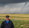
There were a line of storms rolling toward Independence, Iowa on the afternoon/evening of Saturday, August 5, 2018, to which I initially gave an unimpressed glance. At 5:08 pm, however, the area near Independence went severe-warned. Because of the timing and close proximity of this storm to home, I was only able to grab my spotting essentials in a "minute's notice." No mag mounted antennae, no anemometer, no Go Pro camera--there was not enough time. Gear consisted only of my Nikon D7200 DSLR camera, tripod, handheld weather radio and handheld ham radio. I hastily headed east through Marion, then north on Highway 13 in an effort to intercept the storm. The radar image above from 5:24 pm CDT shows my mobile position (target icon) and the approaching severe-warned storm to my northwest.


5:27 pm. Looking northwest while northbound on Highway 13 just north of Marion, Iowa. The western edge of the storm can be seen at left (just right of the barn), while its most intense area--about 16 miles distant--is at right.


5:28 pm. About 1.4 miles south of County Home Road. Note the cloud striations classic to this type of severe weather just above the northern horizon. The most intense area of this storm (left) was located near the town of Walker in northwest Linn County.


5:29 pm. Similar image, now just south of County Home Road.


This radar screen capture corresponds to the photograph above it. My northbound location is shown as the target icon, the black arrow points to the most intense area of the storm, and the white arrows show storm direction.


5:32 pm. Now stationary on Prairie Chapel Road at Highway 13, one mile north of County Home Road. Image looks WNW. Storm is north of me and moving east.


5:32 pm. Panorama image stretching from northwest (left) to northeast (right). Most intense part of storm was located about 16 miles distant (left-center in image).


5:33 pm. My vehicle facing north toward the storm on Prairie Chapel Road, just east of Highway 13.


5:40 pm. Relocated now to my northernmost and final spotting position on Bunker Hill Road at Rowley Road, less than a mile southwest of Central City in northeast Linn County. At this moment the severe warning for the storm was lifted.


Radar image corresponding to 5:40 pm, when the severe warning was lifted. My stationary position is
shown by the target icon.


5:42 pm. The storm's severe warning was gone, but volatile cloud formations remained impressive in the area. This cloud formation was to my northeast.


5:48 pm. Looking north from Rowley Road at Bunker Hill Road. Though somewhat resembling a wall cloud, this intense area of the storm was very outflow dominant and would roll over me in just minutes with winds probably approaching 60 mph. This scenario caused me to rethink my position--which was directly under a utility pole--so I relocated to a short distance away!


5:50 pm. The western edge of the (5:48 pm) storm image contained large scud, and appeared as if it were almost touching the ground as it moved swiftly along. The clouds were moving from right-to-left in this image, which looks west from Bunker Hill Road, above .6-mile east of Highway 13.


5:59 pm. Homeward bound now and traveling south on Highway 13 at County Home Road. One quick capture eastward (above) shows the rustic water tower located there with turbulent clouds behind it.

Read more...

Sunsets and Sunflowers

Monday, August 6, 2018


A mostly cloudy sky all day yielded briefly to a glimpse of a clear western horizon just before sunset as seen from Lowe Park, just north of Marion, Iowa on Saturday, August 4, 2018. Above, the setting sun is perched on the horizon at 8:16 pm CDT. At right background are ball diamond lights at Oak Ridge Middle School in Marion. This image is a 1/50 second exposure at f/5.6, ISO 200 and 55mm focal length.


8:17 pm. Sun dipping deeper. 1/80 second exposure at f/5.6, 200 ISO and 55mm focal length. Official sunset was at 8:21 pm.


8:24 pm. Large sunflowers in Lowe Park, looking west. Image is an exposure of 1/50 second at f/5.6, ISO 200 and 24mm focal length, but the foreground plants were copied to a second layer, lightened, then added to the background as a composite.


8:24 pm. Portrait version of image above it, with identical settings and procedures. Nikon D7200 DSLR camera.

Read more...

  © Blogger template On The Road by Ourblogtemplates.com 2009

Back to TOP