Smoke Plume From Early Morning Fire

Sunday, July 31, 2011

A smoke plume from a major fire rises and drifts in the southwestern sky around 12:48 AM, Saturday, July 30, 2011 as seen from Boyson Road near Timber Oak Court in Marion, Iowa. The fire was located at a mixed-housing and commercial complex under construction at 6th Street and 12th Avenue SE in downtown Cedar Rapids, about 5.3 miles away. Despite the distance, the smell of smoke was noticeable from this position. The fire reportedly started around 12:15 AM and was put under control about an hour later, but the building was a total loss. This image was captured using a 6-second exposure at f/5.3, 400 ISO and 40mm focal length.

Read more...

Uranus And Neptune--With An 'Aided' Eye

Saturday, July 30, 2011

It took this exposure of one minute at f/3.4, and 320 ISO to resolve the planets Uranus and Neptune through hazy summer night skies around 12:55 AM, Saturday, July 30, 2011. This view looks southeast toward Marion, Iowa from Boyson Road near Timber Oak Court. The light source at lower left is a transformer power station on Alburnett Road. The 5.78 magnitude Uranus is identified by the left arrow and the 7.83 magnitude Neptune by the right arrow. Neptune's streak has been slightly enhaced for better visibility. It is possible to view the faint Uranus with the (good) naked eye, but Neptune is invisible to it. Both planets can be easily observed by using a simple pair of binoculars. Uranus was probably seen but not identified as a planet centuries before its official discovery in 1781. Neptune was discovered in 1846, mainly because of its mathematically predicted orbit. Neptune will reach its 2011 peak visibility on August 22.

Read more...

Giant Venus Fly Trap?

Friday, July 29, 2011

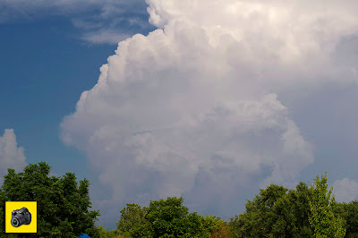
Resembling a huge Venus Fly Trap plant, the edge of this anvil cloud stretched nearly all the way across the sky around 7:25 AM, Thursday, July 28, 2011, from Progress Drive and Martha's Way in Hiawatha, Iowa. In fact, the capture was too wide for my 18mm lens to get everything in, so this is a created two-shot composite giving it a panoramic effect. The cumulonimbus cloud was located about 35 miles to the east, near the town of Onslow in Jones County and had cloud tops above 45,000 feet. About an hour and a half later at this Hiawatha location, strong thunderstorms produced lightning and heavy downpours.

Read more...

Illuminated Shelf Cloud

Thursday, July 28, 2011

A portion of a shelf cloud, about 15 minutes away from arriving at this location at Noelridge Christian Church in Cedar Rapids, Iowa, is illuminated by an unknown light source in this 3-second exposure at f/5.6, 200 ISO and 18mm focal length. This view looks west around 9:00 PM, Friday, July 22, 2011.

Read more...

Stopped For Circulation

Wednesday, July 27, 2011

Cloud-to-ground lightning strikes the countryside to the northeast as storm chase driver Ryan Alliss surveys possible tornadic circulation in front of our vehicle, stopped on County Highway E16--a quarter-mile east of 180th Street and 3.75 miles west of Schleswig, Iowa around 7:55 PM, Saturday, April 9, 2011. After a few minutes of checking our situation along the roadside, we resumed driving and just under 8 miles later ran into stronger RFD winds to the northeast at Keystone Avenue and 330th Street. This is a video frame capture.

Read more...

Cumulonimbus Calvus With Pileus Belt

Tuesday, July 26, 2011

This growing cumulonimbus calvus tower sported a pileus belt at its middle as seen from Lininger Park in Marion, Iowa around 5:20 PM, Tuesday, July 26, 2011. Pileus are formed by strong updrafts acting upon moist air at lower altitudes. The pileus slowly migrated from left to right at the cloud's midsection. This calvus cloud was located about 22 miles to the east, in the Cedar Island/Morley/Olin area of Jones County. Cloud tops spiked above 55,000 feet.

Read more...

Dark Curtain

Monday, July 25, 2011

This very intimidating looking shelf cloud quickly and silently approaches the parking lot at Noelridge Christian Church in Cedar Rapids, Iowa just before 9:00 PM, Friday, July 22, 2011. The gust front produced high winds, heavy rain and lightning but did not cause damage at this location. This view looks northwest. Shelf clouds are often mistaken for wall clouds by some laypeople.

Read more...

Sunset Palette of Colors

Sunday, July 24, 2011

The western sky was awash with this wide range of colors at sunset as seen from Bowman Woods Park in Cedar Rapids, Iowa at 8:50 PM, Saturday, July 23, 2011. In the background is Bowman Woods Elementary School. The Cedar Rapids area was spared a severe storm taking place at the same time about 90 miles to the south and southwest.

Read more...

Stealth Shelf

Saturday, July 23, 2011

Though initially inaudible to the ear, this advancing shelf cloud as seen from the parking lot at Noelridge Christian Church in Cedar Rapids, Iowa looked very ominous indeed. The shelf cloud approached from the northwest (upper right), borne upon severe weather in the adjacent counties north and west of Linn County and overrunning the very muggy air present at the time. The gust front produced a mix of high wind, rain and lightning. Top wind gusts were in the 40-50 mph range here, not quite attaining severe levels. Shelf clouds are produced by the cool sinking air from a storm cloud's downdraft. As the cool air mixes with warm moist air, water condenses creating the classic rolling look of the structure. This image, shot at 8:53 PM, Friday, July 22, 2011, looks west.

Read more...

Changed Face of a Tornado

Friday, July 22, 2011


Video frame captures 1-3 show a wedge-type tornado on the ground between the towns of Ida Grove (to the west) and Arthur (to the east) in western Iowa. Frames 1-3 were captured from around 8:21-8:25 PM, Saturday, April 9, 2011 from our chase vehicle northbound on County Highway M31, about five miles south of Arthur. By frame #4--about three miles later--the twister had morphed into a stovepipe shape. Frames 4-6 show the tornado just west of Arthur (city lights) as seen from about one mile south of town and five minutes after the first frame. These video frame captures were made visible from flashes of lightning.

Read more...

Meso Lightning

Wednesday, July 20, 2011

Lightning forks from the edge of a large mesocyclone structure in this view looking north from County Road D15 (left-to-right in image) in northwest Iowa around 9:35 PM, Saturday, April 9, 2011. The road leading off into the horizon at left is County Road N33. The red lights in the background belong to a wind farm. This was our last-hurrah encounter on a storm chase that produced six tornadoes or more--starting around 7:20 PM in the Mapleton area. Strong winds made shooting this exposure of 11 seconds difficult for clarity and sharpness, even on a tripod. It was shot at f/8, 250 ISO and a focal length of 18mm. From here it was a stop in Ames for six ISU meteorology students from the chase, then home to Cedar Rapids for my son Ryan and me--finally arriving there around 1:45 AM Sunday. Ryan drove our chase vehicle (his car) the entire 640-odd miles of the chase.

Read more...

Field of Steams

Monday, July 18, 2011

The cicadas were singing, a breeze was stirring and this field of Black-eyed Susans, Queen Anne's Lace and corn were baking under an open sun just north of Echo Hill Presbyterian Church in Marion, Iowa around 4:40 PM, Monday, July 18, 2011. The steamy and oppressive conditions at this moment included a temperature of 96 degrees F and a heat index of 107.

Read more...

Obscured Scorpius

Sunday, July 17, 2011

A combination of light pollution and haze all but obscured the fainter stars of the prominent summer constellation Scorpius (center) as seen from the grounds at Noelridge Christian Church in Cedar Rapids, Iowa around 10:10 PM, Saturday, July 16, 2011. The brightest of the visible stars is the red giant Antares (left center), a 1.03 magnitude star 800 times the size of the sun located 600 light-years away. Here on Earth, the heat from the day had not all left at this hour: it was still 81 degrees F outside. This view looks south over the Colton Condominiums and Boyson Road NE. The image is a 30 second exposure at f/16, 250 ISO and 18mm focal length.

Read more...

Beautiful But Ominous Clouds

Saturday, July 16, 2011

Gathering photogenic supercell storms clouds--with a hint of fading sunlight behind them--build to the southwest in this view from just west of Smithland, Iowa. The time and date was 6:48 PM, Saturday, April 9, 2011. Our two-vehicle storm chase team was proceeding east along Highway 141 and our next town after Smithland was Mapleton. We drove through Mapleton minutes later then observed the area southwest of town being in the direct path of an EF3 tornado, occurring around 7:25 PM.

Read more...

Twister Road

Thursday, July 14, 2011

These three video frame captures show a tornado

about 1.5 miles SW of Mapleton, Iowa around
7:25 PM, Saturday, April 9, 2011. Our chase
vehicle, driven by my son Ryan Alliss (silhouette
lower left in images), was northbound on Sumac
Avenue between 190th and 170th streets, about
six miles SE of Mapleton at this moment. Note
the dirt and debris being kicked up on the
ground ahead of the EF3 tornado (toward
the north or right). The tornado would cause
damage to about 60% of the town.

Read more...

Sumptuous Sunset

Saturday, July 9, 2011

This beautiful summer sunset lit up the surrounding clouds in the sky as seen from just west of the grounds at Christ Community United Methodist Church in Marion, Iowa at 8:45 PM, Saturday, July 2, 2011.

Read more...

Cumulonimbus Calvus and Pileus

Thursday, July 7, 2011

These isolated multi-cellular cumulonimbus calvus clouds appeared in skies at Noelridge Christian Church in Cedar Rapids, Iowa on the evening of Thursday, July 7, 2011. The left panel shows a large bank of the calvus clouds in the north sky around 6:05 PM. Its center was located approximately 50 miles away, near the town of Oelwein in southern Fayette County. Cloud tops at places reached 35,000 feet. The right panel shows a calvus with a pileus cap. This cloud, shot at 5:50 PM, was located about 30 miles to the northeast, in southern Delaware County. Pileus are made of ice crystals high in the troposphere directly above another cloud. The pileus layer forms when the cumulus cloud thrusts a moist layer of air above it upwards, causing condensation in the layer. The cumulus cloud may eventually grow to penetrate the pileus layer.

Read more...

Early Warning

Wednesday, July 6, 2011

An EF2 wedge tornado is shown on the ground near the town of Early in northwest Iowa around 9:00 PM, Saturday, April 9, 2011. This view looks north from along Lee Avenue just north of US Highway 20 and about 2.25 miles SE of Early. The image is a video frame capture, seen courtesy of a lightning flash in pitch darkness, and therefore is of poor quality. It has been electronically enhanced to bring out brightness. As our storm chase team proceeded northeast from this location, we encountered our final tornado--another wedge just west of Nemaha, Iowa--around ten minutes later. We found ourselves a little too close to that one and just escaped being in its outer fringe, speeding away from it through driving rain and golf ball size hail. The overall chase produced a least a half dozen tornadoes viewed. *** The "F"-scale was introduced by Dr. Tetsuya "Ted" Fujita in 1971. In 2007 a new scale, Enhanced Fujita (EF), became operational. The old F-scale related the degree of damage to the strength of the wind but did not take into account the typical strengths and weaknesses of different types of building construction, which would become the measure of the new EF-scale. An EF2 tornado typically produces wind speeds up to 135 mph.


Read more...

Arachnid Cloud

Tuesday, July 5, 2011

Looking spider-like, this lone cloud is brilliantly tinted by the sun which had disappeared below the horizon about 15 minutes earlier. This photograph looks northwest over East Robins Road from near the grounds of Christ Community United Methodist Church in Marion, Iowa just after 9:00 PM on Saturday, July 2, 2011. The image was shot at 1/200 second, f/9 aperture, 320 ISO and 55mm focal length.

Read more...

Fireworks Moon

Monday, July 4, 2011

A fireworks burst sparkles the night sky beneath a waxing crescent moon and over the Newcastle Road neighborhood in Marion, Iowa just after 9:15 PM, Saturday, July 2, 2011.

This view looks west. The image was shot at 1/25 second at f/9, 320 ISO and 116mm focal length.

Read more...

Dazzling Day's End

Sunday, July 3, 2011

Clouds in the northwest sky are painted and illuminated by the already-set sun at 9:05 PM, Saturday, July 2, 2011. Sunset on this day was 8:45 PM. The faint headlights of cars seen at lower left are on East Robins Road in Marion, Iowa.

Read more...

Moon 'n' Mercury

Saturday, July 2, 2011


A waxing crescent moon and the planet

Mercury (upper right) are in close
proximity to one another in the WSW
sky around 9:10 PM, Saturday, July 2,
2011. The small dark puffs of smoke seen
at lower left are from spent firework
bursts. This image, shot at 1/30 second,
at f/9, 320 ISO, 55mm focal length, looks
over East Robins Road in Marion, Iowa.
The location of the camera was just west
of Christ Community United Methodist
Church, just off Alburnett Road.

Read more...

Dancing With The Stars

Friday, July 1, 2011

Stars appear to "dance" around the birch tree at lower right in this five-minute exposure captured at 11:25 PM, Tuesday, June 28, 2011. The image, shot at f/3.5, 320 ISO and 18mm focal length, looks northwest over Bowman Woods Park in Cedar Rapids, Iowa. The bright stars a center lower belong to the asterism "Big Dipper" in Ursa Major.

Read more...

  © Blogger template On The Road by Ourblogtemplates.com 2009

Back to TOP