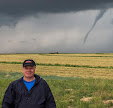
Into the Whale's Mouth

Tuesday, June 30, 2020


Traveling to Des Moines from Cedar Rapids, Iowa on Saturday morning, June 27, 2020 via US Highway 30 and Highway 330, a large obstacle loomed in the distance. As the radar image for 9:00 am CDT above shows, the large stormy system stretched some 125 miles across Central Iowa!


9:03 am. Looking southwest from Highway 330, just after turning onto it from US Highway 30 in Marshall County, Iowa. Only a portion of the cloud system on the horizon was captured in this image.


9:03 am. Similar view. Storm was located about 25 miles distant.


9:04 am. Growing dark clouds are beginning to materialize along the horizon.


9:06 am. Ever closer on Highway 330, just northeast of 265th Street in Marshall County.


9:08 am. Continuing southbound (SW), just southwest of Highway 562 near Melbourne, Iowa in Marshall County. Storm is now less than 20 miles distant.


Radar frame capture corresponding to 9:15 am. Our mobile position is indicated by the target icon, and the arrow points to the most intense area of the storm to our southwest.


9:16 am. Sky is becoming more turbulent in appearance, and there is an ominous dark feature straight ahead on the horizon. Image captured from Highway 330 in northwest Jasper County. Storm is now only about 8-10 miles away.


9:18 am. Probable wall cloud with inflow tail to the southwest, as seen while mobile on Highway 330 at N 99th Avenue W in northwest Jasper County. A wall cloud was reported via Spotter Network in this area. From here on we encountered torrential rain as we continued to our destination. iPhone 6 Plus camera.

Read more...

Ten Years of Sky & Weather Photography

Monday, June 29, 2020

Today marks a decade of my Sky & Weather Photography website postings. Above is my first effort, posted on June 29, 2010. My wife and I had been dining at a local Buffalo Wild Wings restaurant on June 18 of that year. While there, a thunderstorm with frequent and intense CG lightning was occurring. So much so that we had to delay our departure for home until the danger subsided. Upon reaching home, the storm was passing and a brief window of sun along the horizon opened up, producing a breathtaking beacon of sunbeams. This caused me to scramble for my camera to capture it.

As a severe weather spotter and photographer, it was at that time I got the idea to post my work online via Blogger.com, and Sky & Weather was born. For much of the first few months I assembled past photos I had taken pertaining to the sky or the weather and posted them--as sort of a backlog inventory. Also needed was a profile and visual header bar for my website, which I readily created.


An early header for my website, with past and present camera images having been used included.

The first few years of my website featured a single image with limited description. Now, ten years and 1,174 postings later, multiple images with maps, charts and graphs and descriptive detail included are the norm. Photographic enhancements for all images in post processing are scrubbed through Adobe Lightroom and Photoshop. Terrestrial locations for images are researched in Google Earth, sky locations in Starry Night Pro.


With the future firmly in my camera lens, I look forward to continuing this website and capturing the sky and weather opportunities I love so much that are still waiting out there. Here's to the next ten years!

Read more...

Near Bust in Iowa, Busting Out in Illinois

Sunday, June 28, 2020


A severe weather Enhanced Risk was posted by the Storm Prediction Center (SPC) on Friday, June 26, 2020 for Eastern Iowa east into parts of the states of Indiana, Michigan and even Ohio. A 5% hatched chance for tornadoes was included for Eastern Iowa, with The Weather Channel giving the area a Tor Con (Tornado Condition) of 3.


Mesoscale Discussion 1006 was posted at 12:38 pm CDT for areas of Iowa, Minnesota, Illinois and Wisconsin--with the probability for a severe thunderstorm watch calculated at 80%.


A severe thunderstorm warning was issued for an area of NE Iowa near Decorah in Winneshiek County at 1:25 pm, and Severe Thunderstorm Watch 305 went up ten minutes later.


And so I set out for a possible intercept. This was shortly after departure at 2:09 pm, and I am northbound on Highway 13, just south of County Home Road north of Marion, Iowa. Distant storm clouds can be seen through a gap just above the horizon.


Radarscope frame capture corresponding to 2:27 pm, showing my mobile position near Strawberry Point, Iowa. The storm was to my north and northwest, with a severe warning polygon ahead of the storm.


2:59 pm. Looking northwest while northbound on Highway 38, about 2 miles northwest of the town of Greeley in Delaware County. The storm, which had now lost its severe warning and located about 15 miles away, was beginning to appear on the horizon.


3:08 pm. Northbound (NW) on Highway 13 between Strawberry Point and Edgewood Iowa. The ominous looking but still sub-severe storm is now very apparent and only 10 miles distant.


3:10 pm. Probable wall cloud looking north while westbound on Highway 13 between Strawberry Point and Edgewood in SW Clayton County. Storm is about 10 miles distant.


3:11 pm. Similar capture.


3:16 pm. Stationary and looking northeast from East Mission Road, about .8-mile east of Strawberry Point, Iowa. Departing storm--a wall cloud with feeding inflow--was about 11 miles distant.


3:21. Spotting vehicle with view of departing storm.


3:44 pm. Had to get back on the highway and head east to catch up with this storm. I had hoped it would re-intensify to a severe-warned state (it didn't). In this image I am eastbound on Highway 3, about 1.3 miles east of Colesburg in northeast Delaware County. The storm is about 7 miles distant and still visually appealing.


Radar frame capture corresponding to 3:50 pm. My mobile position is shown by the target icon. The black arrow points to the most intense area of the storm, the two white arrows indicated storm movement.


3:52 pm. Non-severe, but very photogenic low-base storm. Eastbound on Highway 3, about 2.3 miles west of Luxemburg in northwest Dubuque County, looking northeast. Storm is about 10 miles away.


Similar capture one minute later. This storm continued east but my pursuit of it was interrupted and ended by a detour that took me out of the chase, as it had nearly reached the Mississippi River. With no other storms in the reachable vicinity, it was time to give up the intercept and head for home. Pretty much a bust in Iowa.


4:12 pm. A brief stop on Little Road just west of Highway 136 in Delaware County, and 1.5 miles south of Dyersville, Iowa. The sky had cleared, but an interesting updraft was seen in the west sky.


4:53 pm. Looking south at post-stormy sky while southbound (SW) on US Highway 151 southwest of Cascade, Iowa in Jones County. All told, 160 miles of driving with a very limited yield.


While storms were impotent in Iowa, they intensified and grew as they moved into the state of Illinois, as this radar capture from 7:00 pm shows. Severe weather stretched from western Illinois into Chicago.


8:59 pm. All was not completely done in Iowa, however. After the sun went down (8:46 pm), mild mammatus formations were illuminated in pinks and oranges by the sun. This view looks southeast from Brentwood Drive NE in Cedar Rapids.


9:01 pm. Similar capture looking southwest, including a waxing crescent moon. Nikon D7200 DSLR camera.


Read more...

Mild Storms but Good Visuals

Thursday, June 25, 2020


Storms neared the Cedar Rapids, Iowa area just after 3:00 pm on Wednesday, June 24, 2020. The storms were below severe limits, but still had enough aesthetic quality to be photographed. Above, storm clouds gather behind Bowman Woods Elementary School in Bowman Woods Park at 3:15 pm CDT. This image looks west.


3:20 pm. Even better to the northwest and north were mammatus formations, seen along the anvil. The storm was about 25 miles distant. Views like this one begged for a panoramic capture!


3:20 pm. Zoomed-in view of the mammatus area.


Radar view (for 3:20 pm) showing my location (target icon) and the location of the storm.


3:24 pm. Similar panoramic view.


Around 5:50 pm a storm cell located near the town of Decorah in northeast Iowa was moving SSE and became severe-warned. The warning would only last about 25 minutes, but the storm retained a nice appearance. This view looks north at the storm at 6:42 pm from Eastview Avenue at Irish Drive in Marion, Iowa. Its most intense area (left) was about 53 miles distant, near Fayette in Fayette County Iowa. Nikon D7200 DSLR.


Closely corresponding radar reflection to that of the image above it, showing my position and the position of the stated area of intensity.

Read more...

Pre-dawn Perfect-Pictured Planets

Wednesday, June 24, 2020


The planets Saturn (center, upper) and Jupiter (center, right) shone brightly in the southern sky and were framed nicely inside tree limbs during the pre-dawn hours of Wednesday, June 24, 2020. Saturn's apparent magnitude was 0.26, Jupiter's was -2.69. If you look closely at Jupiter you will see what appears to be a small appendage at its 10 o'clock position. This was caused by its moons Io and Europa, who at this time were very close to each other in their orbits around Jupiter. Speaking of close, Saturn and Jupiter were only about 1 degree apart in the sky. The planets were located in the constellation Sagittarius. This image was captured from Brentwood Drive NE in Cedar Rapids, Iowa at 3:50 am CDT and is a 10 second exposure at f/5, ISO 400, 45mm focal length. Air temperature at this time was a cool 57 degrees F.


3:56 am. 15 second exposure at f/5.6, ISO 320, 55mm focal length. Nikon D7200 DSLR camera.

Read more...

Popcorn Thunderstorms...Needed More Butter

Monday, June 22, 2020


There were numerous "popcorn thunderstorms"--defined as "single cell types that are small, brief, that grow and die within an hour or so"--in eastern Iowa on the afternoon of Sunday, June 21, 2020. I found myself caught up in believing every severe-warned cell I saw on this day would maintain its intensity. On the contrary, each one weakened and died as I approached it--a sort of storm "swoon." I set out toward the first of these "phantoms" in the image shown above. Here, I am northbound on Highway 13 just north of County Home Road (E34), north of Marion, Iowa at 1:40 pm CDT.  The severe-warned storm was about 23 miles to my WNW, near the town of Vinton in Benton County.


Ten minutes later the storm weakened and the severe warning was lifted. I was still able to capture a photogenic part of it however. This image looks northwest at 1:53 pm from Sutton Road at Central City Road (E16), west of Central City in Linn County.


A turnaround and back home. It's now 2:39 pm and more storm cells are popping up and advancing. This one exhibited a nice updraft looking west over Bowman Woods Park in Cedar Rapids.


In a little while a cell just east of Cedar Rapids intensified and became severe warned. This image looks east at funnel-like scud at 3:39 pm from Quiver Court, part of Bowman Villas just south of Boyson Road. While driving, I had been unable to capture a very striking wide and ragged low-hanging scud from the backside of that storm just minutes before.


4:01 pm. Still spotting from Quiver Court. The distant updraft to the southwest in this image was from a large storm cell that had also been previously severe-warned. The storm was located about 57 miles away, just northwest of the town of Barnes City, in Poweshiek County.


4:17 pm. Now deciding to give chase to the storm to the east. This panorama looks east from North 10th Street, about a quarter mile south of County Home Road, north of Marion. The storm was still severe-warned, but departing fast and within 15 minutes would have its warning lifted as well.


Radar frame capture corresponding to 4:15 pm. Target icon shows my location, with the black arrow looking in the direction of the storm. White arrows indicate storm movement.


5:11 pm. Back home again and another popup storm. This cell was very rumbly from thunder, but remained under severe limits. Image looks west from Bowman Woods Park. Nikon D7200 DSLR camera.

Read more...

Swollen Creeks and Rivers

Sunday, June 14, 2020


A substantial system of torrential rain on Wednesday, June 10, 2020 prompted the flash flood warning box (above) by the National Weather Service (NWS) in Linn County, Iowa, even before the rains had arrived. The Radarscope image above corresponds to 9:49 am CDT. My position is indicated by the white target icon. The system was tracking to the northeast. Heavier rains to the north were also contributing to the warning for Linn County.


This panorama from the Dry Run Creek footbridge at the border of the cities of Cedar Rapids and Marion from 11:03 am shows water up to the creek's banks but not overflowing.


Looking north from the footbridge at 11:03 pm.


11:12 am. AccuWeather severe weather torrential rainfall alert that included five counties. The alert was to be in effect until 12:45 pm, but was later continued. (Updates to area river statuses continued into Sunday).


11:13 am. Dry Run Creek just east of the footbridge. Swirling debris and brown water can be seen in this image. Water was flowing left-to-right.


11:15 am. High water in the culvert area along Boyson Road. The .7-inch of rain on this day added to the previous day's 1.81 inches here, totaling about 2.5 inches. Despite this, Dry Run Creek did not spill its banks.


Fast forward to the next day, Thursday, June 11, along the Cedar River near the Chain Lakes Bridge, about 1 mile southeast of Palo, Iowa in western Linn County. This west view of high waters and fog on the river was captured from the bridge at 7:59 pm CDT.


Similar shot at 8:01 pm.


8:04 pm. Looking south from the bridge.


8:04 pm. Flooded lowlands surrounding the north end of the bridge.


8:07 pm. Brown swirling water from the same area.


8:08 pm. Looking southwest over the Cedar River from the north end of the bridge.


8:13 pm. Sunset through the trees from the south end of the bridge.


8:13 pm. Chain Lakes Bridge, looking northeast. Creeks and rivers in the area over the past two days were swollen to their banks, but never achieved a true flood status. Nikon D7200 DSLR camera.

Read more...

  © Blogger template On The Road by Ourblogtemplates.com 2009

Back to TOP