Most Impressive Non-Impressive Storm

Thursday, June 28, 2018


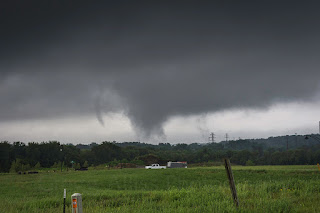
A severe storm cell moving east in Franklin County in north central Iowa late in the afternoon on Monday, June 18, 2018 lost that designation just before 5:00 pm CDT. Because of that, it went largely unnoticed by me while at Noelridge Park in Cedar Rapids until around 6:40 pm, when I turned around and beheld the beautiful anvil cloud vista seen in the panoramic image above at 6:44 pm. Despite its impressive structure, the cell--now located 28 miles to the northeast in Delaware County--remained non-severe. Collins Road NE is seen in the foreground.


A zoomed-in view at 6:46 pm. iPhone 6-Plus camera.


Radar screen capture of my position in Cedar Rapids and that of the storm (arrow).

Read more...

No Opposition To Saturn Opposition

Wednesday, June 27, 2018


...well, maybe just a little one: A nearly full moon shone just right of it, stealing a bit of its 0.02 magnitude thunder, the brightest Saturn will be all year. Time and date was 3:07 am CDT, Wednesday, June 27, 2018. This day was Saturn in opposition--when the Earth is directly between it and the sun--officially occurring at 8:00 am CDT. This moon, just hours shy of being full, is known as a "strawberry moon." Native American Algonquin tribes gave it this name as it coincided with their harvesting of strawberries. Not to be outdone in the image is the -2.04 magnitude planet Mars (left), moving toward its own opposition next month. Image is a 15 second exposure at f/4.5, ISO 125 and 18mm focal length, and looks southwest from Bowman Woods Park in Cedar Rapids, Iowa. Air temperature was 64 degrees F.

Read more...

Morning Mammatus

Tuesday, June 26, 2018


Eerie amber sky casts in the morning usually spell impending rain and Thursday, June 14, 2018 in Cedar Rapids, Iowa was no exception. Before the rains came on that morning, a beautiful sunlit mammatus display occurred, residing under the anvil of an approaching storm cloud. Above, the mammatus are seen in the northwest sky, overlooking Bowman Woods Park at 5:45 am CDT. About a half-inch of rain would fall from the thundershower that moved through the area.

Read more...

More June 20 Storm Images

Monday, June 25, 2018


This group of images are all Go Pro Hero 4 Silver video frame captures from the same event I posted yesterday. Again, this location is on Oliver Court in Marion, Iowa, looking southeast at the meso/wall cloud/funnel which is about 7 miles distant. Time for the above image was 3:50 pm CDT, Wednesday, June 20, 2018.


3:52 pm.


3:52 pm.


3:54 pm.


3:55 pm.

Read more...

Tornadic Circulation Under the Radar

Sunday, June 24, 2018


A Slight Risk convective outlook was posted by the SPC for the central part of the state of Iowa for Wednesday, June 20, 2018. The eastern limit of the Slight Risk stretched to about Cedar Rapids, my location. At 3:05 pm CDT, Tornado Watch 195 was issued for much of central and eastern Iowa. Severe weather was already under way, with a tornado warning having been issued for eastern Mahaska and western Keokuk counties in southeast Iowa around 2:30 pm. At that time the storm was about 50 miles distant and tracking to the northeast. Local surface conditions at 3:00 pm included: 70 degrees F, 69 degree dew point, 82% humidity and winds out of the ESE.


With the severe-warned box now placed just southwest of Iowa City and the system moving northeast, it was time to get out and select a spotting position. With limited confidence that the storm would hold its severity, I set up shop around 3:45 pm on Oliver Court in Marion, less than a mile away from home. Oliver Court is located in a yet-undeveloped part of the Bowman Meadows housing area, and affords clear views of the sky in all directions. In just minutes, I was facing a very low cloud base (above) with interesting activity beneath it in the southeast sky. This mildly rotating ragged cloud base was located about 7 miles distant, near the town of Bertram.


3:49 pm. This panoramic image stretches from the east sky (left) to the south sky and shows the true overall structure of the cell, which was not as obvious to the naked eye. Striations accent this storm's rotating structure.


3:49 pm. Extreme zoomed-in shot of the rotating low cloud base.


3:50 pm. Medium distance zoom of the underside of the low cloud base. It was exhibiting mini funnels around the periphery of the rotation and prompted me at this time to make an amateur radio report to the Linn County ARES net.


3:52 pm. Radarscope Pro screen capture of my position (blue icon), with the white arrow pointing to the area of interest (note the lack of a severe warning there).


3:53 pm. This obvious funnel (or funnels) formed and I suddenly began to wonder "Am I missing something??" The radar showed no severe weather boxes, the weather radio produced no alerts and there was minimal if any amateur radio traffic for my immediate location.


3:54 pm. The same funnel as it continued to approach my position. Now though, in less than five minutes the low cloud base and lowering had completely dissipated. My experience here in this short ten minute time span feeling alone in my observations significantly illustrated the National Weather Service's credo for spotting: "Don't assume everybody else has seen and reported this event." Nikon D7200 DSLR camera.


IEM radar base reflectivity map for 3:55 pm. Note the severe-warned area located south of my position (target icon).


Interior view of my spotting vehicle, showing my communication and informational devices.


Read more...

Mighty Mars

Tuesday, June 19, 2018


With the planet Mars approaching a once-in-a-couple of decades close encounter with Earth in late July, it was time to get out there early and capture some images. In this case, one had to rise very early to effectively see it. Mars (magnitude -1.72) at this time outshines the brightest star in the sky, Sirius. The above image looks toward Mars in the SSE sky from a seemingly barren landscape, which is actually a hillock of dirt in the Bowman Meadows housing development in Marion, Iowa. All images in this posting were captured with a Nikon D7200 DSLR camera with a Nikkor AF-S 35mm 1:1.8G lens. This image, captured at 3:23 am CDT on Sunday, June 17, 2018, is an 8 second exposure at f/5.6, ISO 1000. The foreground is illuminated both by the street lights behind me and my cell phone flashlight.


3:25 am and closer to the hillock. Same settings as the top image.


3:30 am. 6 second exposure at f/2.5, 200 ISO. Mars currently resides in the constellation Capricornus.


While I was out there, I also captured the 0.07 magnitude planet Saturn (bright object), which is approaching opposition later this month. I was hoping to capture even a small bit of the Milky Way's galactic core--which should be just right of the planet--but light pollution (below) from the city of Marion completely washed it out. This image looks SSW at 3:26 am. Settings identical to the first two Mars images.

Read more...

Bonfire Show Out, Thunderstorm Show In

Thursday, June 14, 2018


We were planning a relaxing night sitting in front of a large bonfire at my sister and brother-in-law's acreage near Shueyville, Iowa on Saturday evening, June 9, 2018. But as the time for the event drew nearer, mother nature had other ideas. My photography equipment was intended for capturing images of the bonfire but now I turned my attention to a severe storm cell suddenly appearing on the western horizon and approaching fast. The storm cell in the image above--captured at 8:03 pm CDT--was about 25 miles distant. In fact, in just about five minutes it would go tornado-warned. The most intense area of the storm at this moment was located near the town of Luzerne, in SW Benton County.


8:21 pm. As the storm drew nearer, it began to sport huge elongated crepuscular rays above its cloud tops.  I had never seen rays this big and long emanating from behind a storm cloud--almost like racing stripes! Crepuscular rays form when large objects such as mountains or clouds block sunlight. The storm cell, seen above and now tornado-warned, was located about 20 miles distant near Blairstown in southern Benton County.


8:38 pm. The approaching storm cell's anvil was now occupying most of the western sky. The most intense area was only 15 miles away, located near the town of Norway, in southern Benton County.


Radar screen capture corresponding to the photo above it, showing our location (target icon at right).


Soon after, the closest area of the storm system lost its tornado warning, but a new area a few miles farther back near Newhall, Iowa now attained one. This image, captured around 9:06 pm and backlit by a lightning flash, looks northwest in that direction.


One minute later. The camera has apparently captured a wall cloud with a funnel (at left under the tree branches and above the houses). An inflow cloud feeds into the storm from the upper right.


9:10 pm. iPhone video frame capture showing the wall cloud, backlit from a lightning flash.


A radar screen capture corresponding to the time of the video frame capture above. The white target icon is our position, with the arrow pointing to the area of interest.


9:12 pm. More CC lightning in this potent area of the storm.


Having retreated from the property line fence and back toward the house for safety purposes, I paused to capture the pond with backlit CC lightning at 9:17 pm (above), and 9:21 pm (below).


Nikon D7200 DSLR camera. Both pond images were captured with a Tokina AT-X Pro DX II 11-16mm f/2.8 lens at 1.6 seconds, f/3.5, 400 ISO and 11mm focal length. Vanguard Alta Series 70 tripod. 

Read more...

Floods Of Memories From 2008

Wednesday, June 13, 2018


From the archives:

Ten years ago today the Cedar River in the downtown area of Cedar Rapids, Iowa reached a crest of an unprecedented 31.2 feet. The far reaching implications of this were not yet completely felt by the ravaged homes and businesses there. This nightmare scenario was the culmination of non-stop rain upstream and in the city for many days previous. Fear and apprehension was in expressed by many, including me on Wednesday, June 11, 2008, two days before the crest. I left for work downtown a little earlier than normal that morning, hearing of the rising water levels and wanting to document photographically at least some part of the event before access to the river area became restricted or denied. Above, the Interstate 380 5-in-1 Bridge is captured from the First Avenue Bridge at 6:45 am CDT. Little did anyone know that in just two days the I-380 bridge would be the only access across the Cedar River.


6:48 am. Looking SE toward the Second Avenue Bridge and City Hall. Water levels here at this time was about 19.6 feet.


6:50 am. Another view of the Second Avenue Bridge from the First Avenue Bridge, with the Alliant Tower seen at left.


About 7:00 am and now relocated to the Third Avenue Bridge. Looking NW toward the Second Avenue Bridge.


Seen here from the Third Avenue Bridge is the City Parkade with the Alliant Tower in the background. This and the previous four images were captured from my Kodak Z812 digital camera.


Just after noon on Wednesday, June 11, 2008. With reports that the Second and Third Avenue bridges would be closing soon, I walked down to the river (in the rain) on my lunch hour, borrowing a co-worker's HP Photosmart M730 digital camera to capture some shots. This was the scene from the east side of the Third Avenue Bridge looking west, with water now almost to the top of the bridge's arch structures. The bridge would be closed to the public in less than an hour.


Closeup of the City Parkade from the same location.


Same location and a view of City Hall on May's Island.


My wife and me are photographed as cleanup volunteers in the basement of Cedar Christian Church on Saturday, June 21, 2008.

Read more...

Spectating From Outside the Playing Field

Saturday, June 9, 2018


A small storm cell began forming just south of Waterloo, Iowa around 4:00 pm CDT, Wednesday, June 6, 2018. With severe weather potential predicted for the afternoon in central Iowa I went into monitoring mode. By 4:35 pm this cell had grown sufficiently in strength to become severe-warned. I gathered my gear with an intended target area for interception not far south or west of Cedar Rapids. Alas, what generally happens at this hour is rush-hour traffic gridlock, and the Boyson Road/Center Point Road/Interstate 380 on ramp area was near a standstill. Hurry up and wait! While waiting in line to turn south on Interstate 380 from Boyson Road at 4:53 pm, I shot this image of the looming storm cell, moving from the northwest in a SSE direction. The most intense part of the storm was located about 40 miles distant, near the town of Traer in northern Tama County.


5:09 pm at the I-380 rest area just south of Cedar Rapids. Looking northwest. Storm cell is beginning to show structure, with curious whitish striations. Only a brief stay here.


Off the I-380 Swisher/Shueyville exit and west on County Road F12 (120th Street NW) for just under a mile. This spotting position was about .3-mile east of the town of Swisher. This panoramic image-- which looks west-to-north at 5:15 pm--includes the sun shining feebly through the storm's anvil cloud.


Radar capture corresponding to the time of the photograph above it, showing my position (target icon) and arrow pointing to the leading intense area of the severe storm.


5:43 pm. My new purposed spotting location, from the parking lot at the University of Iowa Community Credit Union (UICCU), looking northwest. The seemingly approaching storm now sported an ominous striated "cake-layer" appearance. At this point, it ceased its earlier southeast track and was almost moving due south, about 30-40 miles west of me. I had the option of taking Interstate 80 west to intercept it, but chose to stay in my current location for the duration.


Radar capture of the severe-warned cell, roughly corresponding to the time of the image above it. My location is at lower right. The white arrows indicate storm direction movement.


5:46 pm. Panoramic view of the storm from the same location at UICCU. Very pronounced cake layer structure. This storm was now tracking almost due south, some 40 miles to my west.


A vertical slice of the panorama image above it.


5:53 pm. What parts of this storm system that did move over me is shown above, looking east toward the UICCU building. The anvil from this cloud contained smaller mammatus formations.


6:13 pm. With the storm having never affected my location and now moving away, I just decided to take an auto timer "selfie" and head back home. I only experienced a few rain drops on the windshield going home, and observed this potent storm at all locations from a safe and dry distance. Nikon D7200 DSLR camera.

Read more...

  © Blogger template On The Road by Ourblogtemplates.com 2009

Back to TOP