Dense Fog Advisory

Saturday, January 27, 2024


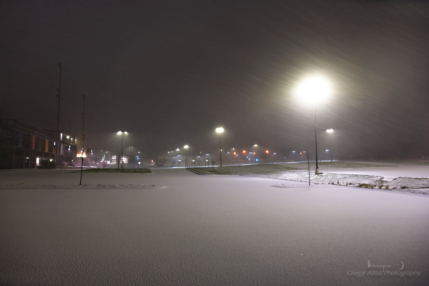
An extended period of temperatures in the middle 30s during the week of January 21-27, 2024 in the State of Iowa produced areas of thick fog during the overnight hours. Both of the posted images look north from Bowman Woods Park in Cedar Rapids. Above is a capture from 7:55 pm CST, Friday, January 26 and is a 15 second exposure at f/6.3, ISO 100, 24mm focal length. Air temperature was 36 degrees F with 100% humidity.


1:57 am CST, Saturday, January 27. Similar Bowman Woods Park view. Lights in the background are from Bowman Woods Elementary School along Boyson Road. Air temperature was 34 degrees F. Image is a 15 second exposure at f/9, ISO 100, 43mm focal length. Nikon Z6ii camera.


National Weather Service (NWS) alert notification for a dense fog advisory, released at 3:27 am, Saturday, January 27. Advection fog like this occurs when warm moist air flows over a cold surface (snow).

Read more...

Blazing Sky Over Frigid Landscape

Monday, January 22, 2024


Sunrise on Sunday morning, January 21, 2024 produced brilliant and breathtaking color in the skies of Cedar Rapids, Iowa. The blazing sky spectacle lasted maybe 20 minutes at most before being clouded-over. All images posted here look southeast. The above image was captured at 7:21 am CST from Brentwood Drive NE. Air temperature was -1 degree F. 


7:26 am. Viewed from Noelridge Christian Church in Cedar Rapids.


7:31 am. Similar view with a more turbulent cloud appearance on the horizon. Nikon Z6ii camera.


Read more...

Sundogs Aplenty in the Wake of Big Snowstorm

Sunday, January 14, 2024


Frigid air plowed south in the wake of the snowstorm that occurred in Eastern Iowa from January 11-12, 2024. With the frigid air came sundogs in the mornings of Saturday and Sunday, January 13, 14. Sundogs form when sunlight is refracted from ice crystals in the atmosphere and appear around 22 degrees to the left and right of the sun. The above image, captured at 9:13 am CST, Saturday, January 13, looks southeast from Bowman Woods Park in Cedar Rapids, Iowa. Air temperature was 8 degrees F.


Similar image at 9:14 am.


The next day, Sunday, January 14, 8:11 am CST. Looking southeast from the parking lot at Noelridge Christian Church in Cedar Rapids, Iowa. 


Similar view at 8:13 am. My idling vehicle is seen in the background, with the heater running full blast. My exposed fingers became numb outdoors in less than 15 seconds!


My home weather station data for 8:14 am.


8:22 am. Looking southeast from Alburnett Road at Boyson Road in the Bowman Meadows housing development in Marion, Iowa. Air temperature during these times was -16 degrees F, with wind chills ranging between -30 and -45 degrees F. Nikon Z6ii camera.

Read more...

2024 Gets Under Way With Big Snowstorm

Wednesday, January 10, 2024


Winter storm warnings were posted in anticipation of a high-confidence event during the morning hours of Monday, January 8, 2024 in Eastern Iowa. Shortly after 6:00 pm the first flakes of snow began to fall, and shortly before 8:00 pm a full-blown snowstorm was under way. The image above looks south from the parking lot of Linn-Mar High School's football stadium in Marion, Iowa at 7:53 pm CST. 1/15 second exposure at f/6.3, ISO 800, 24mm focal length.


Corresponding Radarscope image to top photograph, showing medium-to-heavy snowfall (green).


Similar image captured at 7:55 pm. 1/3 second exposure at f/4, ISO 100, 24mm focal length. Nikon Z6ii camera.


The following day. The strong storm continues. This image from the National Weather Service in the Quad Cities radar at 11:21 am, Tuesday, January 9, shows heavy snowfall over Cedar Rapids (yellow).


3:06 pm CST, Tuesday, January 9. Electronic sign advises slower speeds and the presence of snow plows while northbound on Interstate 380 at the approach to the "S" curve in downtown Cedar Rapids, Iowa. Road conditions were treacherous from continued snowfall.


3:07 pm. On the "S" curve, with the Quaker Oats plant at left background.


3:08 pm. On "S" curve. Downtown buildings at right background.


3:08 pm. Leaving the I-380 "S" curve. Quaker Oats at left. iPhone 11 camera.


5:52 pm CST. Looking east from Boyson Park at the border of Marion and Cedar Rapids, Iowa. Boyson Road is at left. Storm snowfall was now winding down, while wind speeds were increasing. 3 second exposure at f/7.1, ISO 100, 24mm focal length.


5:58 pm. Similar image. 1 second exposure at f/5, ISO 100, 24mm focal length. Cedar Rapids received some 10 inches of snow from this significant event. Nikon Z6ii camera.


Read more...

  © Blogger template On The Road by Ourblogtemplates.com 2009

Back to TOP