Venus-Moon Morning

Saturday, April 30, 2011

The planet Venus (just above the trees at left center) and a waning crescent moon glow amid gathering light in the eastern sky around 5:40 AM, April 29, 2011. Venus had plenty of planetary help--Jupiter, Mars and Mercury were all in the same vicinity--but their positions below Venus got themselves caught in the glare of the rising sun. This image was shot at 1/6 second at f/14, 250 ISO, 45mm focal length on manual focus. Conditions for this time of year were chilly--clear and 33 degrees F. Some ground fog and the gobble of wild turkeys occured outside of this viewed position--just south of Boyson Road and west of Alburnett Road in Marion, Iowa-- toward the right.

Read more...

Twister At Eleven O'Clock!!

Wednesday, April 27, 2011

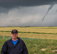
This video frame capture shows a tornado on the ground just west of Arthur, Iowa as seen from our storm chase vehicle. We were traveling north on County Highway M31 south of the town around 8:30 PM, Saturday, April 9, 2011. In the driver's seat at left is Ryan Alliss, and in the front passenger seat--out of view--was navigator and radar monitor Ethan Milius. About a minute later we stopped our vehicle to avoid getting too close and to get out and get a better look at the twister, seen only during flashes of lightning. (The month of April 2011, was one for the record books nationally, smashing the old calendar month of April record of 267 tornadoes set in 1974 by over 300--The National Weather Service's preliminary estimate is over 600! April 2011 also had the highest number of tornadoes in any calendar month, surpassing the previous record of 542 twisters in May 2003. Having been witness to just a part of this extraordinary month as a storm chaser on April 9 was without a doubt a thrilling and awe-inspiring experience for me! The serious side of this, of course, is the number of fatalities and property damage done by tornadoes in the wake of this event--especially in the southern part of the country. Our prayers and condolences go out to all of you who have had your lives tragically changed.)

Read more...

Severe Weather Closing In

Monday, April 25, 2011

This view of the southern flank of an approaching supercell was taken around 6:00 PM, Saturday, April 9, 2011, on Cherry Avenue, about .1 mile south of Highway 175 and about 2.8 miles west of the Onawa, Iowa exit on Interstate 29. The severe weather would begin to produce tornadoes northeast of this position about an hour later. Observing the clouds at lower left is Iowa State meteorology student and storm chaser Bryce Link.

Read more...

Ready For The Wind

Saturday, April 23, 2011

Cirrus clouds begin to form in the western sky behind two wind turbines along Interstate 80 about a mile west of Adair, Iowa around 2:55 PM, Saturday, April 9, 2011. An extended period of clear skies with unstable air and wind shear made the formation of severe weather on this day in western Iowa probable. The cirrus clouds formed in advance of supercell development in eastern Nebraska, occurring a little over two hours later. Our storm chase team was on its way to Minden, Iowa--some 45 minutes away--to set up and wait there for developing severe weather. As it happened, we traveled further west, then north, then east as we followed its progress.

Read more...

(No Sign) Of Storms--Yet

Friday, April 22, 2011

A denuded truck stop/convenience store sign stands out starkly against an altocumulus sky in an abandoned parking lot just north of the Minden, Iowa exit (Exit 29) along Interstate 80. The parking lot, scoured of all its former structures, was a perfect waiting spot for our storm chase team on this afternoon of Saturday, April 9, 2011. The time here was about 4:10 PM, about an hour before a supercell began to develop to our northwest which would produce tornadoes and vivid lightning in western Iowa by nightfall.

Read more...

Tail Of The Storm

Thursday, April 21, 2011

The thin whitish line of clouds at right is known as a "tail cloud"--in this case an inflow tail cloud--feeding into the severe storm. A tail cloud is many times seen attached to a wall cloud, and indeed this image is an example of that. At left just out of the picture was a tornado on the ground in the Mapleton, Iowa area. This photo looks north along Sumac Avenue around 7:20 PM, Saturday, April 9, 2011, about seven miles from town.

Read more...

Hole In The Storm Clouds

Wednesday, April 20, 2011

This break in storm clouds shows a hint of blue as a developing supercell was advancing on this position on Cherry Avenue about .1 mile south of Highway 175 and about 2.8 miles west of the Onawa, Iowa exit on Interstate 29 around 5:50 PM, Saturday, April 9, 2011. In just a little over an hour several tornadoes would drop out of angry clouds formed in the western part of the state due to high atmospheric instability and wind shear. This observation position was a stopping point of about 20 minutes for our storm chase team to gauge the track of the forming severe weather.

Read more...

Heading Into Dangerous Territory

Tuesday, April 19, 2011

Turbulent clouds containing a funnel-like protuberance follows our storm chase direction on Highway 141 east toward Mapleton, Iowa on the evening of April 9, 2011. This image, looking south and shot around 6:40 PM, was taken just west of Smithland, Iowa and about 8 miles west of Mapleton. We drove through Mapleton about ten minutes later, about a half-hour before an EF3 twister struck the town.

Read more...

Deceptive Calmness Before Severe Weather

Monday, April 18, 2011

Bands of beautifully patterned altocumulus clouds dominate the eastern sky over Interstate 80 as seen from the Minden, Iowa exit (Exit 29) around 4:15 PM, Saturday, April 9, 2011. Though very windy the sun was out and there was no real visual evidence that severe weather was only about an hour and a half away. Very warm temperatures (81 degrees) and high dew points (73 degrees) with strong wind shear and lift made for a volatile mix of air. This shot was made from the old parking lot of a former convenience store and gas station, long removed, just north of the Minden exit, about 23 miles northeast of Council Bluffs. It was our chase team's waiting point of about an hour to see where storms would begin to fire up--which they did around 5:15 PM just northwest of Omaha, Nebraska--then began moving into western Iowa as they matured. The storm system would produce many tornadoes in western Iowa, most of them after dark. (Following the April 9 severe weather outbreak--produced from unusually WARM and unstable air for this location and time of year--the state of Iowa would experience almost a month's worth of unseasonably COOL weather, which included three frost nights from May 1-3.)

Read more...

Tornadoes Everywhere!

Sunday, April 17, 2011

This was the view out the back window of our chase vehicle in western Iowa around 7:50 PM, April 9, 2011. We had left Mapleton, Iowa, where an EF3 tornado had struck about a 20 minutes earlier, and were headed east along County Road E16 at 130th Street, following the path of severe weather that had erupted that evening. Though we could see circulation on radar from our laptops, tornadoes began materializing quickly--first this way, then that--to the point where we almost became desensitized by it. A curious thing to be sure, as I had not witnessed a twister on the ground before this day. Speaking of curious, of the up to ten tornadoes or near-tornadoes we witnessed, none were accompanied by a siren alert that we could discern--though most of the time our vehicle windows were closed and the winds were howling! This image was created from a video frame capture.

Read more...

Anatomy Of A Mesocyclone

Saturday, April 16, 2011

This rotating meso was made visible only because of the flash of lightning and an extended exposure of about 10 seconds as the hour was about 9:35 PM, Saturday, April 9, 2011. The structure is left (west) of County Road N33, about 1.5 miles west of Knoke, Iowa. Because of darkness, its rotation was apparent only by clicking on successive individual images in Photoshop. The meso was part of a powerful storm that moved through western Iowa that Saturday evening--influenced by high instability and wind shear--and produced many tornadoes. Inflow bands are seen just above the darker lower portion. A lowering in this image that may have produced a tornado later is hidden by the farm at left. A mesocyclone is a cyclone intermediate in size (2-6 miles in diameter) produced by a supercell thunderstorm and is the intense rotating updraft portion of that storm. Very strong RFD winds (40-50 mph) made keeping this image in focus very difficult! (What a difference a week makes in Iowa: temperatures on April 9 were in the lower 80s, and exactly one week later temps were in the upper 30s with snow showers!)

Read more...

Very Successful Chase!

Friday, April 15, 2011

Iowa State University meteorology students watch an RFD circulation behind a tornado around 7:32 PM, Saturday, April 9, 2011 near Mapleton, Iowa. The vortex is located directly behind the two students standing left of the car. Our location was a relative safe distance of about 5 miles southeast of town. From left are: Bryce Link, Sam Schreier, Nick Carletta (foreground), Ryan Alliss, Tyler Roney (partially hidden) and Tristan Morath. Inside the car is Ethan Milius. My son Ryan and I left Cedar Rapids in the eastern part of the state about 11:30 AM to meet with six ISU meteorology students in Ames for a chase to western Iowa, set up by a moderate tornado risk release from the SPC (Storm Prediction Center). This was the first time I had encountered a tornado on the ground and we would "see" about nine more in the darkness before the night was done. It was a big three-day span for Ryan, as he was offered a Marine Meteorologist position with Rockwell Collins in Houston, Texas two days later. In this image, one of our two chase vehicles is shown parked along Sumac Avenue near 170th Street.

Read more...

Dwarfing the Elevator

Thursday, April 14, 2011

The outer fringes of a supercell approach a grain elevator along Highway 141 just south of Hornick, Iowa around 6:35 PM, Saturday, April 9, 2011. Our storm chase team was speeding to get ahead of the cell and our route would take us through Mapleton, Iowa about ten minutes later. Following our departure from the then-undisturbed town, indications of rotation from radar on our laptops brought us back southeast of the area about a half-hour later to witness a twister on the ground there. The tornado caused widespread damage to the community but thankfully no fatalities.

Read more...

Magnificent Meso

Wednesday, April 13, 2011

This rotating mesocyclone, laced with lightning, is seen in the north sky from this position along County Road D15 about a mile and a half west of Knoke, Iowa around 9:45 PM, Saturday, April 9, 2011. County Road N33 leads off toward the horizon at left center. At the base of the meso is a wall cloud lowering. The red lights in the background belong to a wind farm. It was difficult shooting this exposure of 9 seconds at f/8 and an ISO of 250, due to sustained RFD (rear flank downdraft) winds of 40-50 mph. The meso was part of a severe weather event in western Iowa on this evening that produced many tornadoes (we witnessed about ten) and vivid lightning. We ended our day of chasing about 15 minutes after this picture was taken.


Read more...

High Energy Storm

Tuesday, April 12, 2011


This 8:55 PM image of lightning on Lee Avenue, about .15 mile north of US Highway 20 and about 3 miles southeast of the town of Early, Iowa, was created from the combination of two separate similar images and combined in a process called "photo stacking." Most of the time combining lightning in an image wasn't really necessary as the powerful supercell that moved through western Iowa on the evening of Saturday, April 9, 2011 showed its energy content by disgorging incessant and breathtakingly beautiful cloud-to-cloud displays. Photographing the lightning was difficult, however. Strong and sustained 50 mph-plus RFD (rear flank downdraft) winds forced me to hold on to my camera's tripod with one hand while activating the shutter with other. The blurred trees seen at left attest to the wind's force. The two lightning images were shot using a 10-11 second exposure at f/8 and an ISO rating of 250. Shortly after these images were taken our chase team resumed its route north and almost immediately witnessed a wedge tornado (made possible by illumination from lightning flashes) on the ground west of us. The twister was one of about ten witnessed by our team on this night.

Read more...

Night Tornado Video Frame-Captures In Western Iowa

Monday, April 11, 2011

The eight-person, two-vehicle storm chase team in which I was a part of witnessed at least ten tornadoes while chasing in western Iowa during the evening and into the night on Saturday, April 9, 2011. All but one of the twisters were seen after dark. These two images were created from video frame captures during brief illuminations from lightning. In the left panel, a stovepipe tornado churns up ground around 8:30 PM as seen from County Highway M31, about a mile south of Arthur, Iowa (city lights in image). The tornado started as a wedge ahead of us and began morphing into a stovepipe before our eyes with each new lightning flash. The video from which this image was taken was shot after we pulled our vehicle over to the side of the road. The right panel shows a wedge tornado along US Highway 71 in Sac County near Early, Iowa. The video was shot around 9:00 PM. Our chase continued until just before 10:00 PM, when we finally called it quits and headed for home in Ames and Cedar Rapids, Iowa.

Read more...

A Day (Or Night) To Remember!

Sunday, April 10, 2011

A day of SPC moderate risk for western Iowa provided me with my first tornado(es) ever witnessed on the ground. My meteorologist son and I agreed to give the chase potential a try and left Cedar Rapids around 11:30 AM bound for Ames, to meet up with six meteorology students at Iowa State University. After a brief discussion in Ames as to our target destination for the day, the group agreed on Avoca, Iowa, about 30 miles northeast of Council Bluffs. Some temperatures and dew points in western Iowa read 81/73. Wind shear was created from strong surface-level winds blowing from the southeast and mid-level winds from the WSW. This primed the evening for severe weather. Our setup location eventually changed to Minden, Iowa and later around 4:30 PM our two-car chase team headed west then north on Interstate 29, where a large supercell structure began to form around 5:15 PM just west of the Missouri River. We drove through an undisturbed Mapleton, Iowa over a half hour later, then circled back when tornadic conditions began to show on radar in that area. Our group was some seven miles southeast of town when we witnessed the scene shown above, around 7:24 PM. 60% of the town experienced damage from the EF3 rated twister. Remarkably and thankfully, there were no fatalities. Nighttime and darkness did not suppress the power of this storm as we witnessed at least nine more tornadoes--including several wedges--glimpsed only during brief flashes of lightning. Incessant and vivid cloud-to-cloud lightning accompanied the system. We finally broke off our chase just after 10:00 PM, with tornado formation still occurring at that time. We did not return home to Cedar Rapids until 1:45 AM, over 14 hours from our original departure. The tiring but exhilarating experience was definitely once-in-a-lifetime for me!

Read more...

Twilight Twins

Thursday, April 7, 2011

The planets Jupiter (lower) and Mercury appear in close proximity to one another as they set in the western sky around 7:50 PM, Friday, March 18, 2011. The sun had set over a half hour earlier. This image was captured from the grounds of Noelridge Christian Church in Cedar Rapids, Iowa. Mercury achieved its greatest eastern elongation (farthest evening visual separation from the sun and highest position in the sky) on March 22.

Read more...

Cloud Illumination Near Anamosa

Wednesday, April 6, 2011

This was the scene three miles northeast of Anamosa, Iowa at the end of our storm chase around 8:10 PM, Sunday, April 3, 2011. The chase began around 6:30 PM with the approach of severe weather in the Cedar Rapids vicinity. Following a spell of heavy rainfall, clouds from the passing storm are illuminated by cloud-to-cloud lightning in this view looking northeast on 190th Avenue, just north of Shooting Star Road and parallel to US Highway 151 (background). Although the lightning had passed, our position here next to a cell phone tower was a little unnerving! This image was created from a 10-second exposure at f/8, with an ISO rating of 250.

Read more...

Saturn Above Earth Movers

Tuesday, April 5, 2011

A row of Caterpillar grading equipment dimly reflect light from passing automobiles on the future site of a new housing development along Boyson Road, west of Alburnett Road in Marion, Iowa. The brightest celestial object above them near top center is the planet Saturn, one day removed from its opposition (from the sun) and at its biggest and brightest for the year in our skies. The skies here around 9:30 PM on Monday, April 4, 2011 had recently cleared out after having been overcast most of the day, but winds remained strong. The glow right of the vehicles in the background is a transformer power station on Alburnett Road. This image was captured from a 16-second exposure at f/4.2, 26mm focal length and an ISO rating of 250 and used an activated exposure delay mode.

Read more...

Severe Weather Was Imminent

Monday, April 4, 2011

The underside of an anvil cloud approaches Cedar Rapids, Iowa as seen from Blairs Ferry Road NE, just west of C Avenue, heralding the approach of severe weather. This westward looking image, taken around 6:30 PM, Sunday, April 3, 2011, was one the first few shots taken on a storm chase. Our chase route took us south and east through the towns of Mount Vernon and Stanwood, north through Olin, Wyoming and Cascade, then south through Monticello and Anamosa before returning home. The experience produced nothing tornadic with only pea size hail, but other areas of Eastern Iowa reported baseball size hail, and funnel clouds near the Iowa City area. Cedar Rapids set a record high temperature of 80 degrees on this day, which helped fuel the thunderstorms that began firing up around 6:00 PM in a diagonal line from northeast of Sigourney to west of Monticello. Less than 12 hours later, temperatures had dropped some 40 degrees in Cedar Rapids, the result of the cold front having passed through.

Read more...

Faithful Dog and Hunter

Sunday, April 3, 2011

The constellations Canis Major (The Greater Dog, left) and Orion (The Hunter) are seen in the south sky in Marion, Iowa around 9:25 PM, Friday, April 1, 2011. The well-known constellations of Greek mythology are moving left to right in this image as they set toward the west. Both constellations will remain visible around this hour until they disappear behind the horizon near the end of April. The brightest star in Canis Major--Sirius--is also the brightest star in our skies. Also known as "The Dog Star," it is located 8.6 light years from Earth and has an apparent magnitude of -1.47. This image was created from a 34-second exposure at f/4.5 with an ISO rating of 250. The border between the cities of Marion and Cedar Rapids is located near the right portion of the photo.

Read more...

Saturn In Opposition

Saturday, April 2, 2011

The planet Saturn (bright object at center) shines in the ESE sky in Marion, Iowa around 9:25 PM, Friday, April 1, 2011. Saturn is currently in Virgo, and is seen above that constellation's brightest star, Spica. The bright star at left is Arcturus in the constellation Bootes. This image was captured in a 37-second exposure at f/4.5 and an ISO of 250. The bright terrestrial glow at bottom right is ambient light from a transformer station on Alburnett Road in Marion. The foreground landscape is currently being converted from farm field to a new housing development. Saturn, currently about 800 million miles from Earth, will reach opposition (from the Sun) on the night of April 3/4, and appears in our skies at its biggest and brightest for the year. Despite this, the star Arcturus (left) still outshines the planet with comparative magnitudes of -0.07 to 0.36.

Read more...

  © Blogger template On The Road by Ourblogtemplates.com 2009

Back to TOP