Not What You're Thinking...

Monday, May 30, 2022


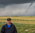
This feature embedded in an isolated storm cell at 9:11 am CDT on Saturday, May 28, 2022, sure looked like a tornado, but was in fact only a very pronounced rain shaft. Our vehicle is westbound on US Highway 20 near mile marker 157 in Hamilton County, Iowa. We were on our way to Memorial Day weekend cemetery visits just north of, and in Des Moines. Luckily, we did not have to drive into the rain ahead as we turned south on Interstate 35 a short distance later. Nikon D7200 DSLR camera.


Radarscope image corresponding to the time of the photo above it. The blue target icon is our position.

Read more...

Ominous Camping Trip View

Wednesday, May 18, 2022


This was our view as we neared our camping destination at Governor Dodge State Park in southwestern Wisconsin on Friday evening, May 13, 2022. The camera looks northeast at 7:10 pm CDT, while on US Highway 151 about 5 miles south of Dodgeville, Wisconsin. Severe-warned thunderstorms were occurring near the city of Madison--about 50 miles distant--and were moving in a NNE track.


7:14 pm. Looking northeast on US Highway 151, about 1.4 miles south of Dodgeville. Luckily for us the line of storms continued to track just east of our campground, with just garden variety storms occurring during the night. Nikon D7200 DSLR camera.


Radarscope image capture corresponding to the top photograph. Our position is indicated by the target icon, with arrows pointing toward the severe-warned areas.

Read more...

Lunar Eclipse Event: Seeing Red

Tuesday, May 17, 2022


An eclipsed supermoon rises beside the old water tower located at County Home Road (E34) and Highway 13 north of Marion, Iowa at 10:44 pm CDT, Sunday, May 15, 2022. Maximum lunar eclipse was still 27 minutes away. Air temperature was 59 degrees F. 2.5 second exposure at f/3.5, ISO 160, 18mm focal length. Nikon D7200 DSLR camera.

Read more...

Super Flower Blood Moon Eclipse

Monday, May 16, 2022


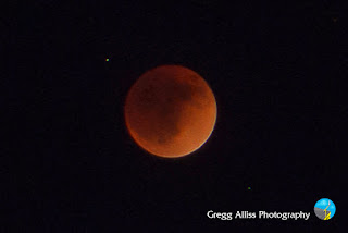
The total lunar eclipse event that occurred over North America from Sunday, May 15 - Monday, May 16, 2022 was also called a Super Flower Blood Moon. Thankfully, skies were clear and temps moderate (upper 50s) in the Cedar Rapids, Iowa metro area. The penumbral phase of the eclipse began at 8:32 pm, and ended at 1:50 am CDT. The duration of totality was about 90 minutes, with maximum eclipse occurring at 11:11 pm CDT. The above image looks southeast over an old water tower as seen from County Home Road (E34) near the intersection of Highway 13, north of Marion, Iowa, and was captured about 21 minutes before maximum totality. 2.5 second exposure at f/4.5, ISO 160, 34mm focal length.


11:11 pm. At maximum totality. Captured from Alburnett Road in the Bowman Meadows housing development of Marion. The tiny objects above and left, and below and right of the moon are fifth and sixth magnitude stars in the constellation Libra. 1.6 second exposure at f/5.6, ISO 400, 55mm focal length. Nikon D7200 DSLR camera.

Read more...

Distant Storms Disappear

Wednesday, May 11, 2022


A distant line of thunderstorms can be seen low on the western horizon in this capture from Bowman Woods Park in Cedar Rapids, Iowa at 8:04 pm CDT, Monday, May 9, 2022. Although the storms packed some punch in western and central Iowa, they completely broke apart before they reached this location. Air temperature at this moment was 84 degrees F, dew point 69 degrees. In the background is Bowman Woods Elementary School. Nikon D7200 DSLR camera.


Radarscope capture, corresponding to the time of the image above it. The target icon was my location, with an arrow pointing to the storms in the picture.

Read more...

April 30 Line of Storms Blow Through

Sunday, May 1, 2022


A line of non-severe storms blew through the Cedar Rapids, Iowa area on Saturday, April 30, 2022. This was a precursor to a larger, "main event" that occurred farther east into Illinois later in the day. Above, the line of storms approaches my spotting location at Noelridge Christian Church in Cedar Rapids from the southwest at 2:55 pm CDT. 


2:56 pm. Looking northwest at the approaching gust front, forming a bit of a shelf cloud.


2:58 pm. Gust front almost overtaking me. High wind speeds never exceeded 30-35 mph at this location as the front blew through. Nikon D7200 DSLR camera.


Radarscope image corresponding to 2:49 pm. The blue target icon indicates my position.

Read more...

  © Blogger template On The Road by Ourblogtemplates.com 2009

Back to TOP