
Photogenic Severe Weather Finally Breaks Out
Friday, July 4, 2025

HAPPY FOURTH OF JULY!
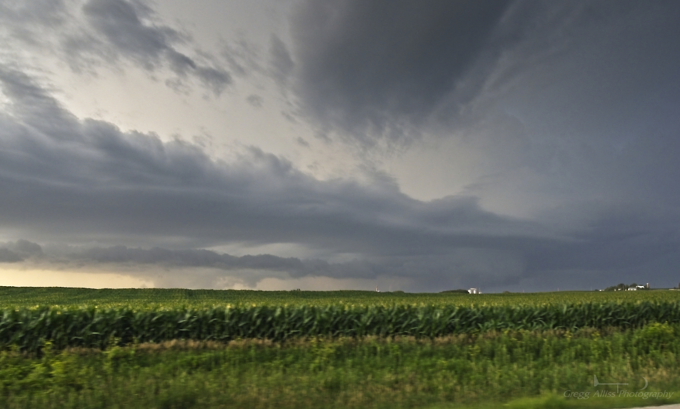
Severe weather, especially photogenic severe weather, had been almost non-existent in the vicinity of the Cedar Rapids, Iowa metro area during the 2025 season. On Thursday, July 3 that finally ended. Non-severe storms approached Cedar Rapids from the north and west during the 6 o'clock hour, but quickly fizzled out as they approached the city as had been the case all year since storm season began. But a cell moving east in the system went severe at 7:55 pm CDT. Reacting quickly, I took with me some of my bare spotting essentials (camera) and headed north for a possible intercept. The image above looks north at 8:05 pm as I was eastbound on County Home Road, just north of Marion, Iowa. The storm stretched from the towns of Quasqueton to Manchester in the north.

8:18 pm. An inflow cloud (a very good sign) is seen here to my northwest while I was northbound on Highway 13 about a mile north of Central City in Linn County, Iowa. Sun rays emanate from behind the cloud. The inflow cloud was feeding into the storm out of the picture at right.
8:21 pm. Another good sign: The inflow cloud is feeding directly into a lowering feature (right). This image looks north from Highway 13 about 1.5 miles east of Coggon, Iowa in Linn County. At this moment the storm was directly over Manchester, Iowa in Delaware County.

Radarscope image corresponding to the photograph above it, showing a small hail core over Manchester. My relative position to the storm is shown as a blue target icon.

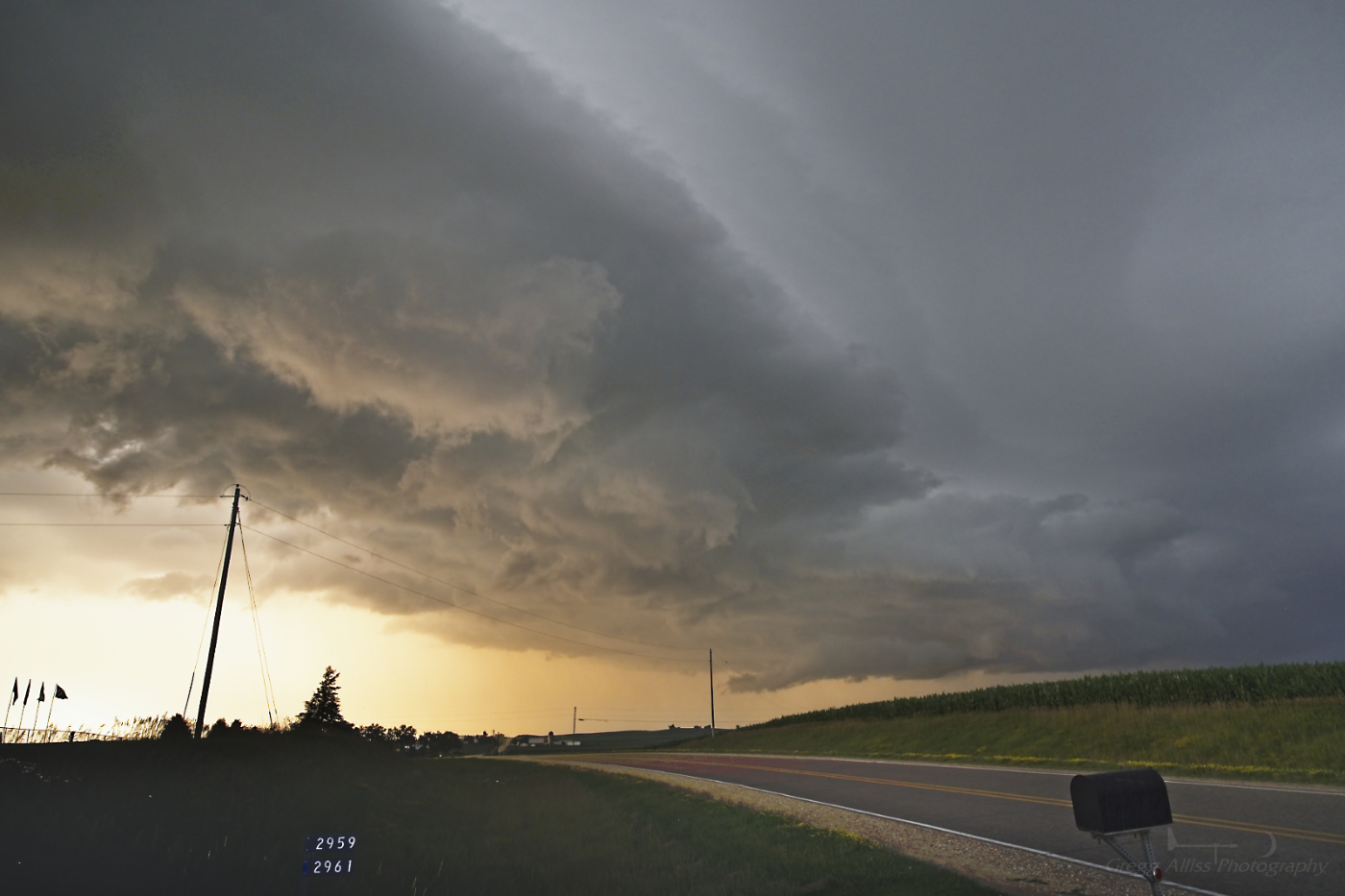
8:26 pm. Northbound on Highway 13, about 2.5 miles south of Ryan, Iowa. Storm is displaying a funnel-like feature. Was it? Unknown.

8:27 pm. Similar capture of the storm a short time later. Funnel-like feature is compelling.

8:27 pm. Close-up capture.

8:32 pm. Now at a stationary spotting location: The Golden Church, 3 miles ENE of Ryan, Iowa in Delaware County, Iowa. This image looks north. The setting sun mixes beautifully with the angry clouds, moving right-to-left.

8:32 pm. Severe-warned storm to my northeast. The lowering appears to have several inflow clouds feeding into it.

8:32 pm. Panorama version, five images stitched together.
8:33 pm. A nice mix of light and dark in the turbulent clouds. The storm's lowering can be seen at right.
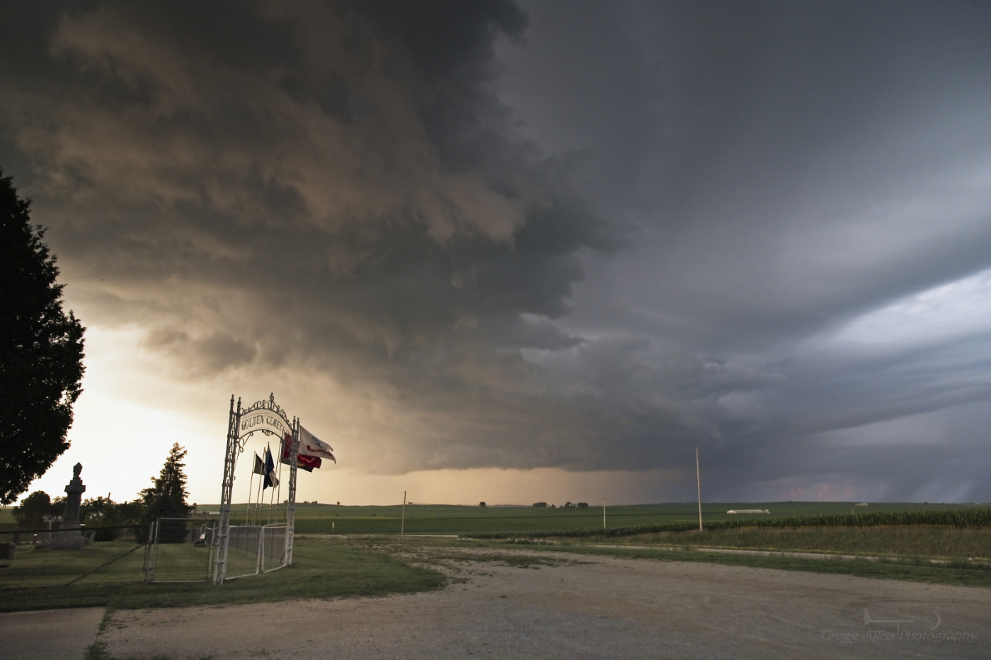
8:34 pm. Similar capture. The Golden Cemetery, adjacent to the church, can be seen at left.

8:34 pm. Front view of the church looking northwest as the storm clouds roll in.

8:34 pm. Side view looking north.

Radarscope image for 8:35 pm. About this time, with the rain and wind about to unload on me, I quickly decided to head back for home.

8:45 pm. Looking east at the departing storm system while southbound on Highway 13, south of Ryan, Iowa. I barely evaded to wind and rain and drove into the clear. Most definitely the best visual storm encounter of the year. Finally! Nikon Z6ii camera.
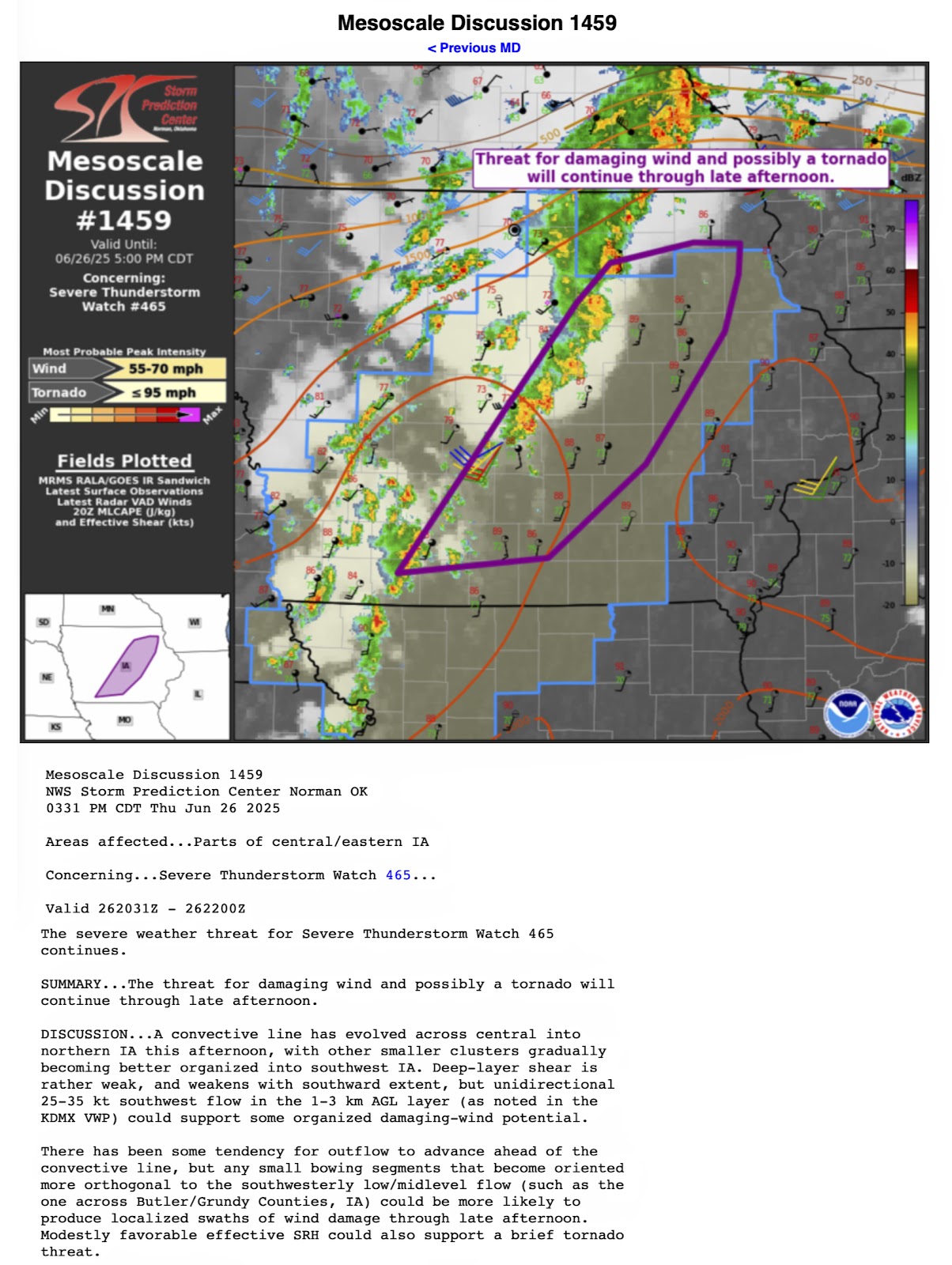
Mesoscale Discussion 1459, released on Thursday afternoon.


0 comments:
Post a Comment