'Derecho' in the Conversation, But Not Quite

Thursday, July 31, 2025


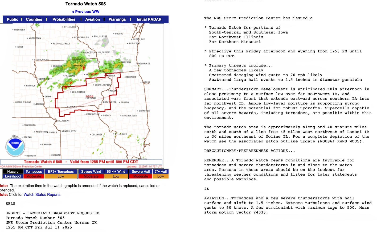
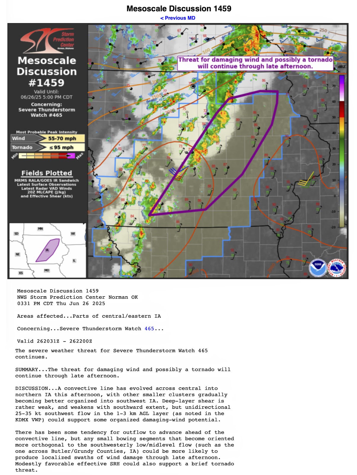
For the first time since last March an SPC Moderate Risk (above) was forecasted into eastern Iowa at 3:00 pm CDT on Monday, July 28, 2025, with higher risks for tornadoes in eastern South Dakota and western Minnesota. Included in this convective outlook discussion was the dreaded word "derecho." (We all remember August 10, 2020...) Indeed tornadoes formed in eastern South Dakota, then turned linear with winds packing 85-100 mph as the storms moved into northwest Iowa by 10:00 pm.


A potent line of storms then proceeded east, maintaining much of its energy along the way. Because of this, the National Weather Service issued Severe Thunderstorm Watch 555 (above) at 10:05 pm CDT. This included north, central and eastern Iowa. 


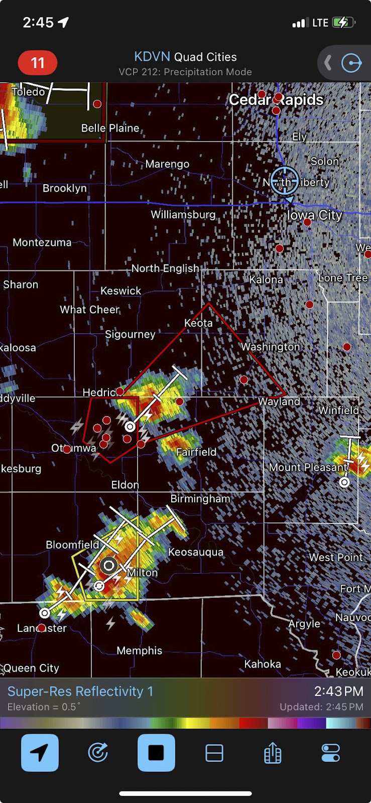
At 1:25 am CDT, Tuesday, July 29 my weather radio roused me from sleep. Above is a Radarscope image at that moment, with severe-warned storms running from just northeast of Des Moines in the south to around Decorah in the northeast. Some winds in this line were being reported as gusting up to 80 mph. Note the extended severe warning polygons as far east as Delaware and Jones counties ahead of the storm.


2:03 am. At home and spotting from my back deck in the Bowman Woods Park area of Cedar Rapids, Iowa, lightning flickered from behind advancing clouds as seen in this image looking northeast. Image is a  13 second exposure at f/4.5, ISO 250, 24mm focal length.


2:05 am. Cell phone emergency alerts are transmitted, with the simultaneous sounding of sirens in the Cedar Rapids area (for the expected high winds).


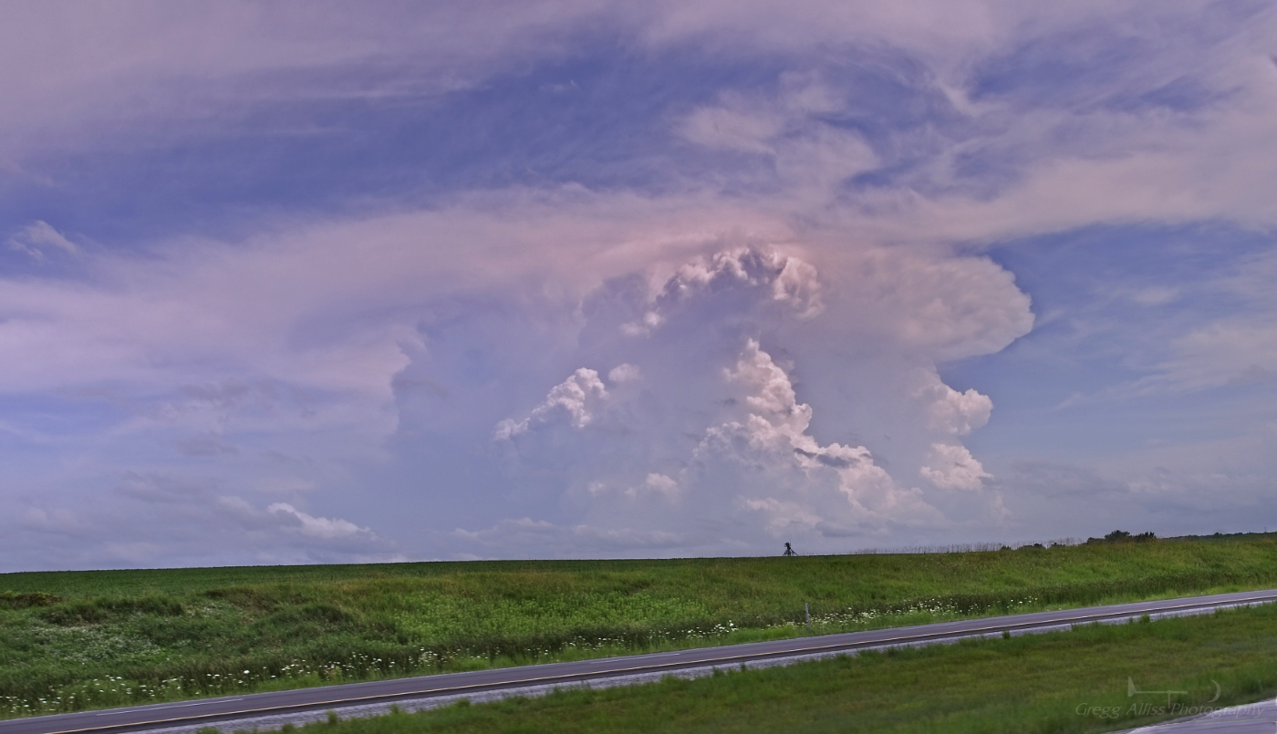
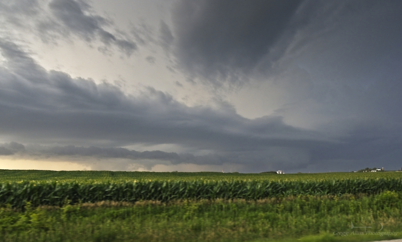
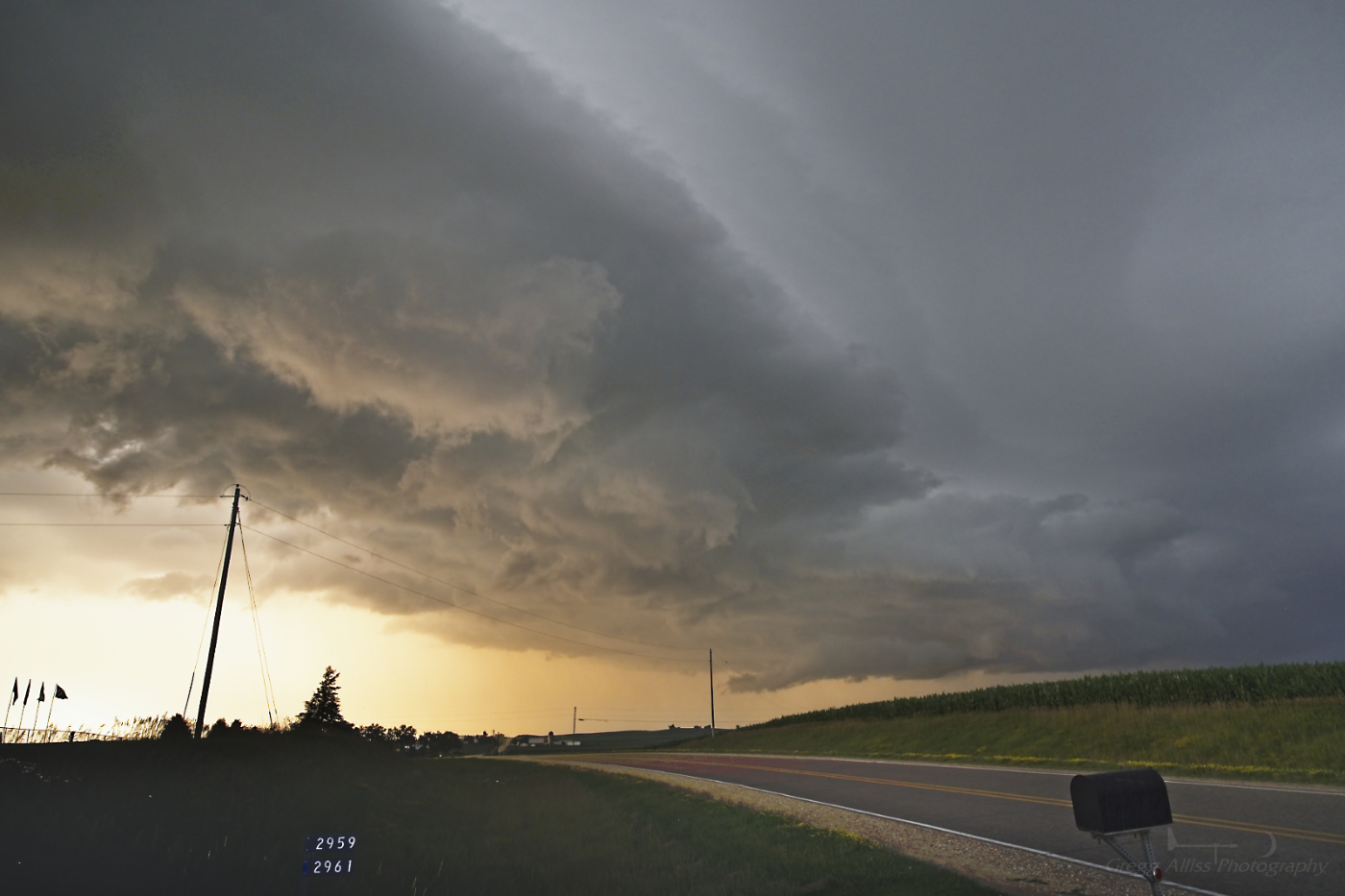
2:09 am. The unmistakable structure of a shelf cloud was now moving into the area with high winds. This image looks northeast and is an 8 second exposure at f/4.5, ISO 250, 24mm focal length.


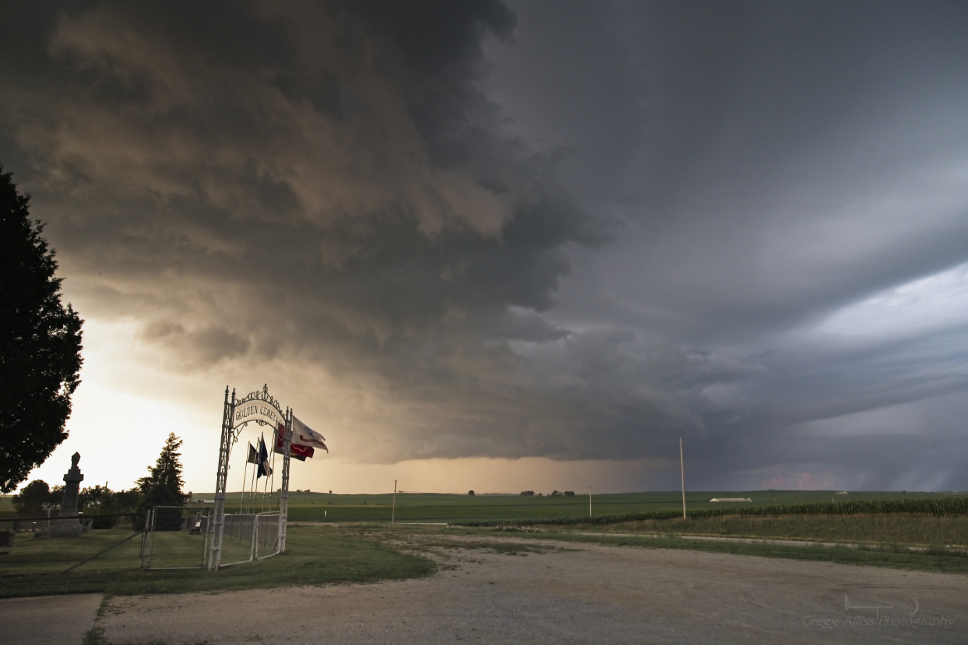
2:10 am. Similar image. Clouds were moving left-to-right in these images. 5 second exposure at f/4.5, ISO 250, 24mm focal length. Nikon Z6ii camera.


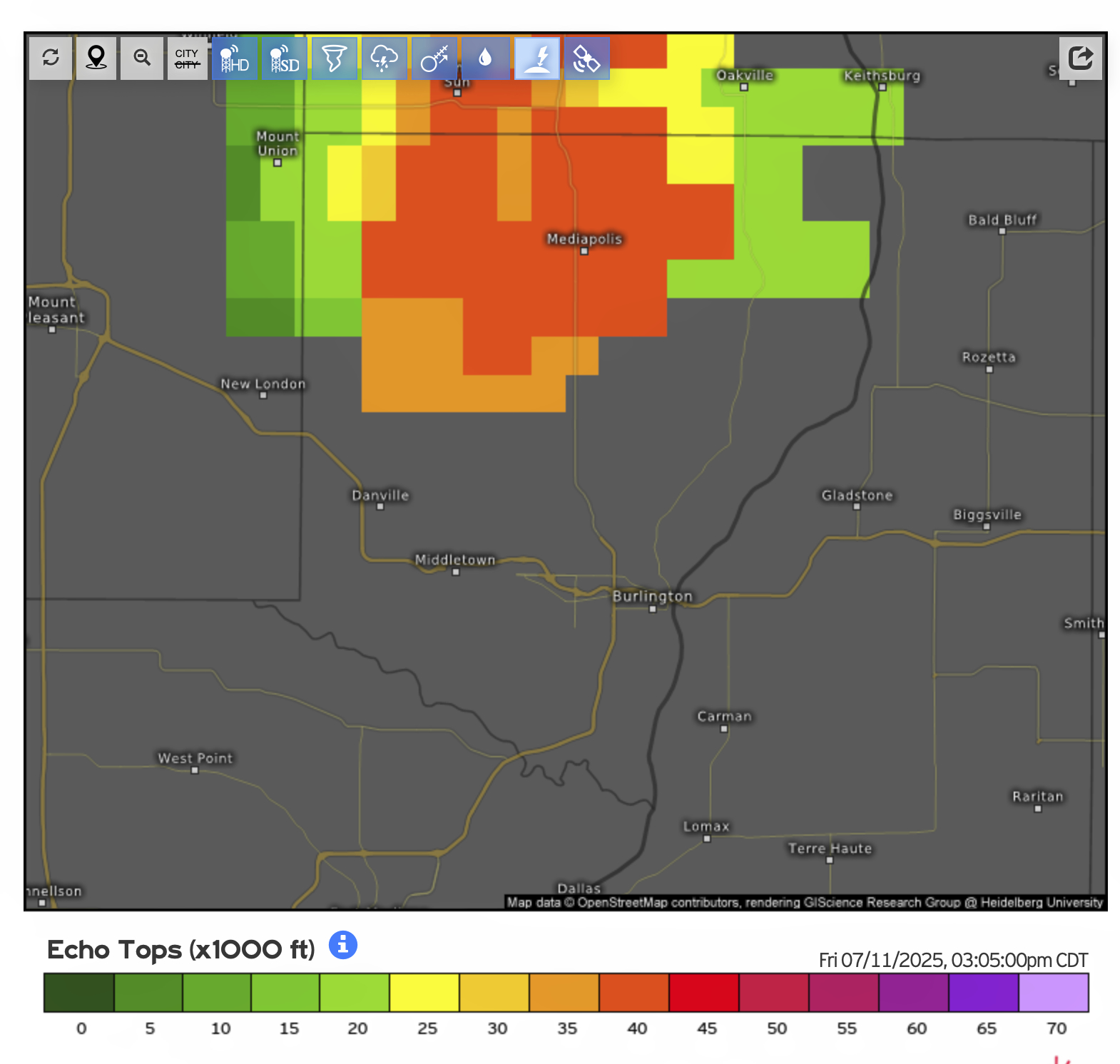
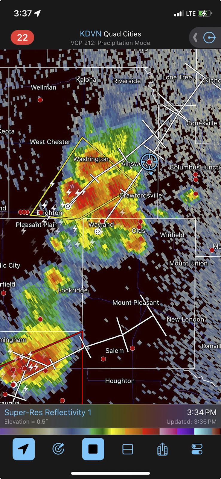
Radarscope image for 2:12 am. The blue target icon is my location. Note the significant hail core area between Manchester and Ryan, Iowa. A maximum wind gust of around 60 mph occurred at my location at 2:15 am.


2:24 am. Very large bow echo storm--stretching from Montezuma in the south to Postville in the northeast--but as it turned out, short of the "derecho" criteria. In my neighborhood very little storm damage was evident, mostly twigs and small branches.


Read more...

July 11 Severe Weather Arrives in Southeast Iowa

Wednesday, July 16, 2025


Conditions for severe weather on Friday, July 11, 2025 were favorable in parts of Missouri, Iowa and Illinois, with an emphasis in southeastern Iowa where the Storm Prediction Center (SPC) posted a 5% hatched probability of tornadoes. The Categorical, Tornado, Hail and Wind outlooks issued at 11:30 am CDT are shown above.


SPC Mesoscale Discussion 1641, posted at 12:18 pm CDT for about half of the state of Iowa. 


12:55 pm CDT. Tornado Watch 505 is issued for much of southeast Iowa and some of northwest Illinois.


2:15 pm. Time for me to fly. Storm cell near Ottumwa, Iowa is tornado warned and I am on the road southbound on Interstate 380/US Highway 218 on an intercept course. Radarscope image above is from 2:45 pm, showing tornado-warned polygon, and my mobile location (blue target icon).


3:05 pm. Visible storm cell with billowing cumulonimbus to my southeast. Though not severe warned, its echo tops (above) were reaching 40,000 feet.


3:09 pm. Photo capture of this storm cell to my southeast while southbound on US Highway 218 just south of Hills, Iowa in Johnson County. 


Radarscope reflectivity image corresponding to the photo above it, with the storm cell being shown at right (near Wapello, Iowa).


3:13 pm. Same storm cell to my southeast while southbound on US Highway 218, about one mile south of the Kalona, Iowa exit (Exit 80) in Johnson County. The storm was now located at the border of Henry and Des Moines counties in southeast Iowa. Surprisingly enough, this potent cell was not severe warned. 


3:32 pm. Now at a stationary spotting location on Yucca Avenue just south of Highway 92, about 1.1-mile east of the US Highway 218 exit for Ainsworth, Iowa in Washington County. The image above looks south at an updraft feature.


3:32 pm. Looking east from this location. The updraft at center exhibits an inflow cloud and small funnel.


3:33 pm. Similar capture of the updraft feature to the east, now without its funnel.


3:35 pm. Updraft, inflow and small ragged wall cloud appendage. 


3:37 pm. Radarscope reflectivity image showing severe-warned storm approaching my location.


3:39 pm. Looking southwest at the incoming severe-warned storm cell.


3:39 pm. Similar image looking south as the storm approaches. Two storm chasers confer in the background to continue east on Highway 92.


3:43 pm. Now relocated east at the Cotter Presbyterian Church on County Road W66, about .3-mile south of Highway 92 in Louisa County, and about 3.6 miles east of US Highway 218. This image looks southwest. Though visually impressive, the storm has just lost its severe warning.


3:44 pm. Similar capture with the church in the picture. Nikon Z6ii camera.


3:46 pm. Radarscope image, showing my location inside a notch of the storm. I now decided to head for home, and drove through drenching rain for about 15 minutes before conditions finally improved.


Read more...

Independence Day Sparkling Skies

Thursday, July 10, 2025


In the past few years we have avoided the downtown Cedar Rapids, Iowa fireworks crowd in favor of an amazing private display near Shueyville, Iowa in Johnson County--plus the opportunity to fish in a large pond before the show! The three images above are iPhone 11 video frame captures from 9:54 pm CDT on July 4, 2025 during the "grand finale" phase. Note the reflections in the pond toward the bottom.

Read more...

Summer Updraft

Tuesday, July 8, 2025


An isolated strong, but not particularly powerful storm produced this updraft view on Monday, July 7, 2025 as seen from Boyson Road, just east of Brentwood Drive NE near the border of Cedar Rapids and Marion, Iowa. The Nikon Z6ii camera image was captured at 3:00 pm CDT and looks northeast. The storm was located about 22 miles distant, between the towns of Anamosa and Monticello in Jones County.


Radarscope reflectivity image for 3:04 pm, showing the storm (in polygon) and its relation to Cedar Rapids.

Read more...

Photogenic Severe Weather Finally Breaks Out

Friday, July 4, 2025


HAPPY FOURTH OF JULY!


Severe weather, especially photogenic severe weather, had been almost non-existent in the vicinity of the Cedar Rapids, Iowa metro area during the 2025 season. On Thursday, July 3 that finally ended. Non-severe storms approached Cedar Rapids from the north and west during the 6 o'clock hour, but quickly fizzled out as they approached the city as had been the case all year since storm season began. But a cell moving east in the system went severe at 7:55 pm CDT. Reacting quickly, I took with me some of my bare spotting essentials (camera) and headed north for a possible intercept. The image above looks north at 8:05 pm as I was eastbound on County Home Road, just north of Marion, Iowa. The storm stretched from the towns of Quasqueton to Manchester in the north.


8:18 pm. An inflow cloud (a very good sign) is seen here to my northwest while I was northbound on Highway 13 about a mile north of Central City in Linn County, Iowa. Sun rays emanate from behind the cloud. The inflow cloud was feeding into the storm out of the picture at right.


8:21 pm. Another good sign: The inflow cloud is feeding directly into a lowering feature (right). This image looks north from Highway 13 about 1.5 miles east of Coggon, Iowa in Linn County. At this moment the storm was directly over Manchester, Iowa in Delaware County. 


Radarscope image corresponding to the photograph above it, showing a small hail core over Manchester. My relative position to the storm is shown as a blue target icon.


8:26 pm. Northbound on Highway 13, about 2.5 miles south of Ryan, Iowa. Storm is displaying a funnel-like feature. Was it? Unknown.


8:27 pm. Similar capture of the storm a short time later. Funnel-like feature is compelling.


8:27 pm. Close-up capture.


8:32 pm. Now at a stationary spotting location: The Golden Church, 3 miles ENE of Ryan, Iowa in Delaware County, Iowa. This image looks north. The setting sun mixes beautifully with the angry clouds, moving right-to-left. 


8:32 pm. Severe-warned storm to my northeast. The lowering appears to have several inflow clouds feeding into it.


8:32 pm. Panorama version, five images stitched together.


8:33 pm. A nice mix of light and dark in the turbulent clouds. The storm's lowering can be seen at right.


8:34 pm. Similar capture. The Golden Cemetery, adjacent to the church, can be seen at left.


8:34 pm. Front view of the church looking northwest as the storm clouds roll in.


8:34 pm. Side view looking north.


Radarscope image for 8:35 pm. About this time, with the rain and wind about to unload on me, I quickly decided to head back for home.


8:45 pm.  Looking east at the departing storm system while southbound on Highway 13, south of Ryan, Iowa. I barely evaded to wind and rain and drove into the clear. Most definitely the best visual storm encounter of the year. Finally! Nikon Z6ii camera.


Mesoscale Discussion 1459, released on Thursday afternoon.


Read more...

Distant Updraft

Tuesday, July 1, 2025


In keeping with the norms during the 2025 severe-weather season, storms avoided the Cedar Rapids metro  area on Sunday evening, June 29, but about 40 miles to its northeast this lone mushroom cloud updraft formed, sporting a pileus feature on top. This image was captured at 7:47 pm CDT. Pileus are typically formed by drier air with a higher lifting condensation level which often prevents vertical growth and leads to its distinctive smooth cap shape. Nikon Z6ii camera.


Radarscope image corresponding to the photo above it, showing my location (target icon), and an arrow pointing to the mushroom cloud located in Delaware County, Iowa.


Read more...

  © Blogger template On The Road by Ourblogtemplates.com 2009

Back to TOP