
Shrinking Violence
Saturday, August 29, 2020

This was the Storm Prediction Center (SPC) Convective Outlook posting at 7:52 am CDT, Friday, August 28, 2020, forecasting another strong chance for severe weather in Eastern Iowa. Just the thing storm-weary Cedar Rapidians did not want, as cleanup work continues from the devastating derecho that occurred nearly three weeks ago. But by 10:00 am some meteorologists were speculating a lesser impact or storms not initiating at all. Around 2:10 pm a small storm cell began forming northwest of Ames, Iowa.

Mesoscale Discussion 1616, released at 2:56 pm, with an 80% probability of a severe thunderstorm watch issuance. Conditions appeared to be on schedule.

3:00 pm. SPC Convective Outlook is downgraded to a Slight Risk for severe weather for Eastern Iowa.

Slight Risk or not, storms were growing along a cold front boundary and moving east in these 3:09 pm (top) and 3:15 pm (bottom) Radarscope images near Marshalltown, Iowa. A severe thunderstorm warning had been given to this storm cell around 3:00 pm.

3:15 pm. Severe Thunderstorm Watch 466 is issued by The National Weather Service for much of Eastern Iowa. It looked like the earlier prediction of severe weather was now a reality. Time to set up my spotting position on Quiver Court in Marion, Iowa, just off Boyson Road and just west of Alburnett Road.

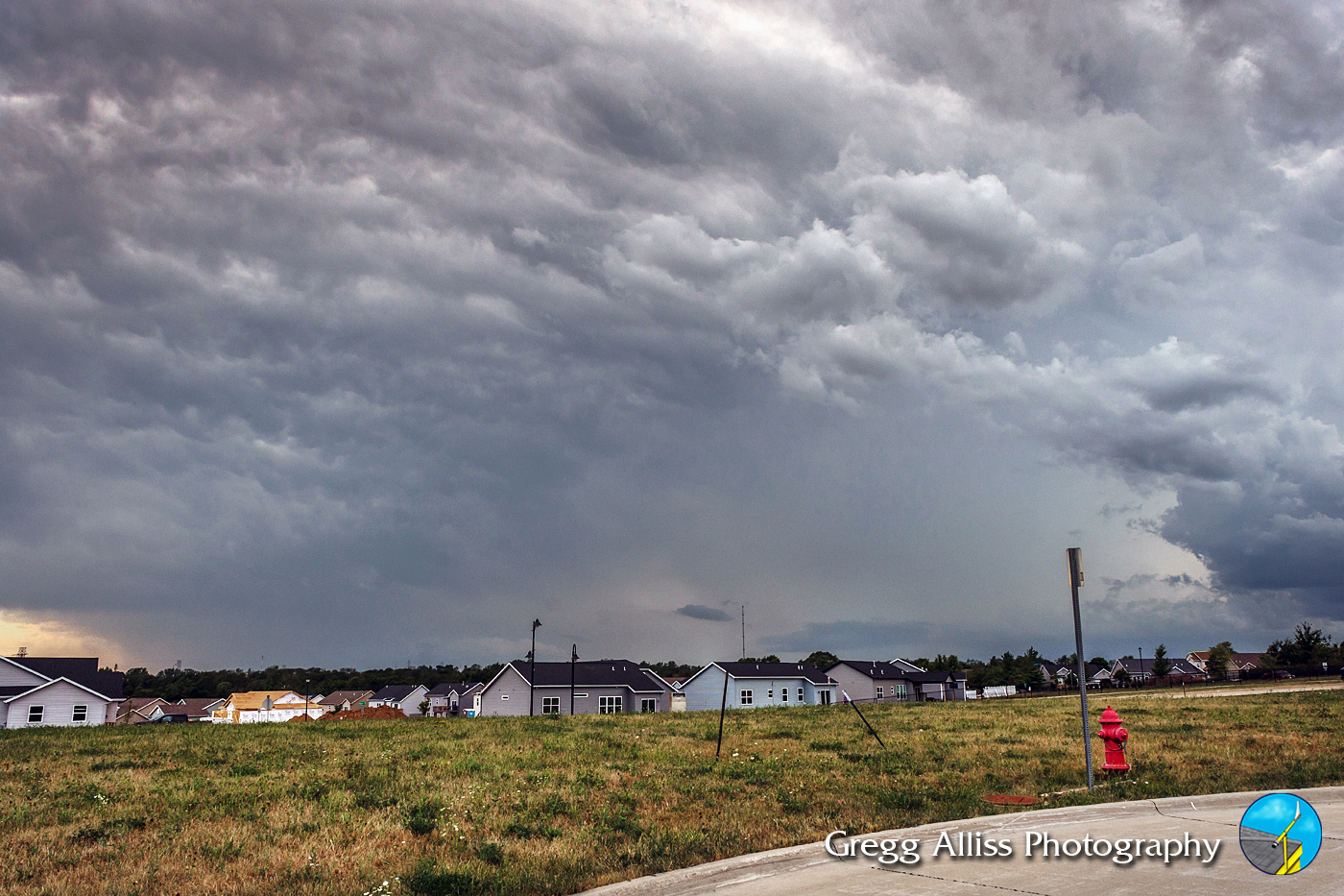
3:40 pm. At my spotting position. Approaching severe-warned cell is now very apparent in this panoramic image looking west. Most intense area of the storm at this moment was located about 50 miles distant, near the town of Gladbrook in Tama County.

Similar panorama at 3:45 pm.

3:57 pm. Storm cell looking much more menacing, with the probability of it holding its intensity all the way to Cedar Rapids becoming seemingly more probable. Storm was about 40 miles distant, with its more intense area located near the town of Traer in Tama County. A smaller section of the bigger cell had now separated from it, and this was advancing east toward Cedar Rapids--smaller and a little less powerful.
4:17 pm. Looking west. Sky looking ominous but storm beginning to weaken. Most intense area of the storm was located about 27 miles distant, near the town of Garrison in Benton County.

4:19 pm. Similar image with my spotting vehicle included.

4:25 pm. Looking northwest at the shrinking storm cell, still severe-warned. Area seen in the background was located about 20 miles away, east of Garrison, Iowa.

4:31 pm. Storm cell with inflow cloud at left.

4:31 pm. Similar panoramic version.

4:33 pm. Panorama of storm cell, with Quiver Court and my vehicle shown in the foreground.

4:40 pm. Storm has weakened and the severe warning is dropped--much to the delight of the Cedar Rapids metro area. However, no rain has fallen on the water thirsty land from this near miss. Nikon D7200 DSLR camera.

Progression of the storm from Radarscope frame captures (3:05-4:25 pm), illustrating its reduction in size and strength as it tracked east.

5:44 pm. Unique outflow boundary feature formed after the storm had passed. Outflow boundaries form in some thunderstorms when rain-cooled air sinks out of the storm and impacts the ground. It then spreads out away from the storm and creates kind of a mini cold front. When these types of signatures appear on radar, storms can continue to pop up in random places away from the original storm.


0 comments:
Post a Comment