
Round Two of May 25 Storm
Wednesday, May 30, 2018

With the severe warning being lifted in central Iowa just before 8:10 pm CDT, Friday, May 25, 2018, I left the Benton County area of US Highway 30 south of the town of Keystone. Another severe-warned storm was moving SE north and east of Marion, Iowa. Staying on 30 until I reached the northbound option of Highway 13, I encountered a shelf cloud vista (above)--loaded with lightning--at 8:44 pm while being located about a half-mile south of US Highway 151 in Marion. This storm was about 25 miles distant and closing.

Radar screen capture corresponding to the photo image at top--showing my location--with arrows pointing to the leading edges of the shelf cloud.
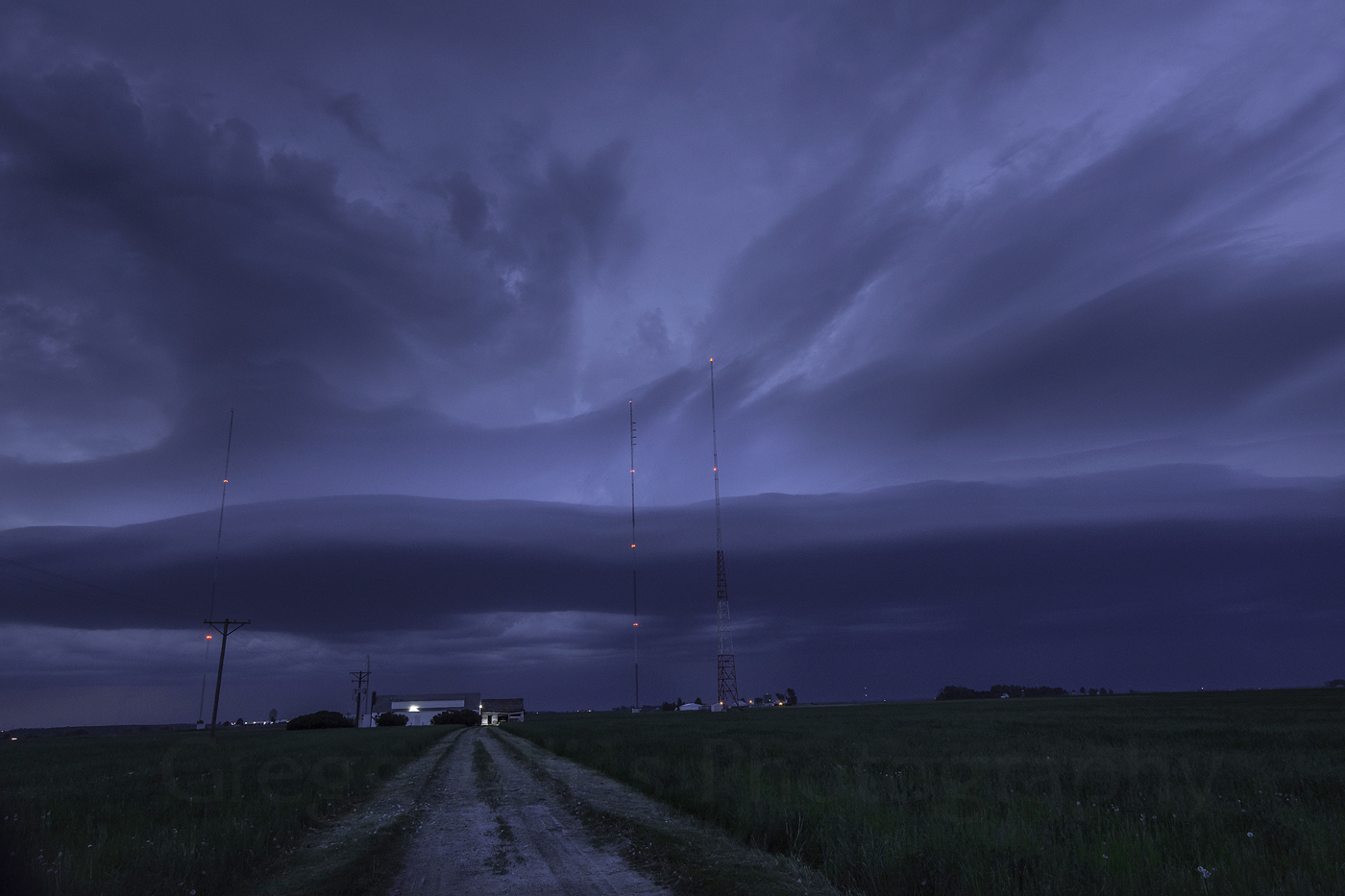
8:52 pm. Stationary at the WMT AM600 transmitter on Radio Road, about .3-mile east of Highway 13 and northeast of Marion. The approaching shelf cloud is now about 14 miles distant. 1/5-second exposure at f/5.6, ISO 500, 16mm focal length.

8:53 pm. Dramatic section of the shelf cloud, looking east down Radio Road. This section of the storm was located about 20 miles away. 1/5-second exposure at f/5.6, ISO 500, 16mm focal length.

8:56 pm. Also striking was this west-edge section of the shelf cloud, backlit by the setting sun. 0.8-second exposure at f/8, ISO 500 and 16mm focal length.

9:00 pm. Panorama from west-to-east. Leading edge now just about 8 miles distant. The wind was already beginning to pick up and the temperature to drop. Image is a stitch of 6 separate vertical exposures, each 0.8-second at f/8, ISO 500 and 16mm focal length. Nikon D7200 DSLR camera.


0 comments:
Post a Comment