Total Tornado Tally Difficult To Quantify
Saturday, January 20, 2018
As a storm spotter/chaser I have been asked numerous times, "how many tornadoes have you seen?" A seemingly straightforward question, but as I will illustrate on this posting, very difficult to answer. Factors such as obstructions preventing the observation of the condensation funnel all the way to the ground, rain wrapping, and darkness all confuse the issue.
In my younger days there were a few tantalizing incidents that could have been tornado encounters. In the summer of 1963 in Polk City, Iowa as our family was on its way to camping at Jester Perk. Our car was stopped and rocked at the town square by tremendous wind and blinding rain. Trees were uprooted in and around the Des Moines area. But never did we see a funnel. On the road one October day in the early 1990s near Ottumwa, Iowa. A cold air funnel began to drop miles in front of our car. My camera sat in the back seat, sans film. As we drew nearer to it, the ground became rain shrouded, and I thought I could briefly make out a funnel near the ground through the rain curtains. But no confirmation was made.
Confirmation of a tornado finally came on Saturday, April 9, 2011, part of an early-season tornado outbreak that took place in western Iowa. The image above shows a tornado as it approached Mapleton, Iowa at 7:24 pm. Tornado? Yes. Confirmed EF3 tornado that damaged about 60% of the town.
The photograph above appears to show a funnel near the ground at 7:48 pm as we were eastbound on County Highway E16 at at 130th Street, and about 8.5 miles east of Mapleton. Tornado? Possibly. The photo looks back toward the direction of the Mapleton tornado track (see map above), so was this the occluding Mapleton tornado, or a separate funnel? Was it touching the ground at this moment? Growing darkness made this hard to tell. The background of the photo was illuminated by a lightning flash.
Northbound on Highway M31 south of Arthur, Iowa. Upper image at 8:25 pm April 9, 2011, showing a wedge with multi-vorticies and lower image showing it as an elephant trunk a few minutes later. Tornado? Yes. Confirmed EF2 tornado.
8:31 pm and eastbound on Highway 175, east of Arthur and west of Odebolt, Iowa. Tornado? Yes. Wedge tornado. But is this the Arthur tornado rejuvenated or the Odebolt tornado which crossed its path? Probably the latter. (See track map above).
8:38 pm. Looking north from Hope Avenue at Highway 175, 2 miles east of Odebolt. Tornado. Yes. Confirmed EF3 tornado which took a northerly track. Tornado appears to be a multi-vortex wedge.
9:01 pm. Looking north from Lee Avenue at 255th Street, one mile east of US Highway 71 and less than 3 miles southeast of Early, Iowa. Tornado? Yes. Confirmed EF2 wedge.
9:10 pm. Looking northwest from County Highway M50, just south of County Highway D15 at Nemaha, Iowa. Tornado? Most definitely yes! Confirmed EF3 wedge in which we were probably in its outer circulation.
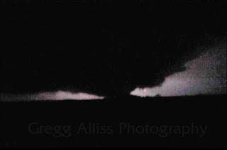
9:46 pm. Looking north from County Highway D15, about 1.5 miles west of Knoke, Iowa. Tornado? (See arrow) Probably. But is this a new cyclic tornado or a continuation of the Early or Nemaha tornadoes? Darkness and some of the image cut off at left makes this difficult to answer.
Looking north on Interstate 380, southeast of Brandon, Iowa at 6:25 pm, June 8, 2011. Tornado? Probably not, though definitely a funnel under a wall cloud. Darkness coupled with the funnel being rain wrapped made this a difficult call.
Southbound on US Highway 218, just south of the Interstate 80 interchange at 6:30 pm, July 12, 2014. Tornado? Possibly. (See arrow). Unfortunately, trees are in the way and the area of interest is rain wrapped. This storm did produce a confirmed tornado near West Branch, Iowa as it moved east.
Looking northwest from E0132 Road at US Highway 56/64, 2.2 miles west of the town of Felt in the Oklahoma panhandle at 4:41 pm on May 16, 2016. Tornado. Yes. My first tornado observed in broad daylight.
4:49 pm, eastbound on US Highway 56/64, east of Felt, Oklahoma. Same storm. Tornado? Probably not. Although the cloud indicated by the arrow appears to be touching the ground, this is probably an outflow downdraft interaction from the supercell.
5:40 pm, May 16, 2016. Looking southwest from US Highway 385, about 8 miles north of the town of Dallam, and about 21 miles north of Dalhart in the Texas panhandle. Tornado? Yes. Confirmed and located about 30 miles distant, near the New Mexico/Texas border.
Looking southwest along US Highway 34, about 2.5 miles southeast of Mount Pleasant, Iowa at 7:21 pm, June 20, 2015. Tornado? Yes. Tube is all the way to the ground. A very brief spinup. I did not actually "see" this--my camera did--as I was firing off shots into the darkness of the approaching squall line, which contained numerous rotating areas along its leading edge. Discovered it in post-processing.
Southeast view from Oliver Court, just west of Alburnett Road in Marion, Iowa at 7:32 pm, August 4, 2016. Tornado? Possibly. Watched this funnel coalesce and drop from almost directly overhead, but as seen in the images above, the ground directly below it was obscured by rain. Brief event.
Looking north from North Marion Road, just north of County Home Road north of Marion, Iowa at 8:13 pm, June 15, 2017. Tornado? Probably. While spotting this approaching storm I observed rotating activity on its eastern flank (arrow) in curtains of rain, while another rotating wall cloud was occurring at the same time on the west flank. The condensation tube was observable for about 2 minutes.


0 comments:
Post a Comment