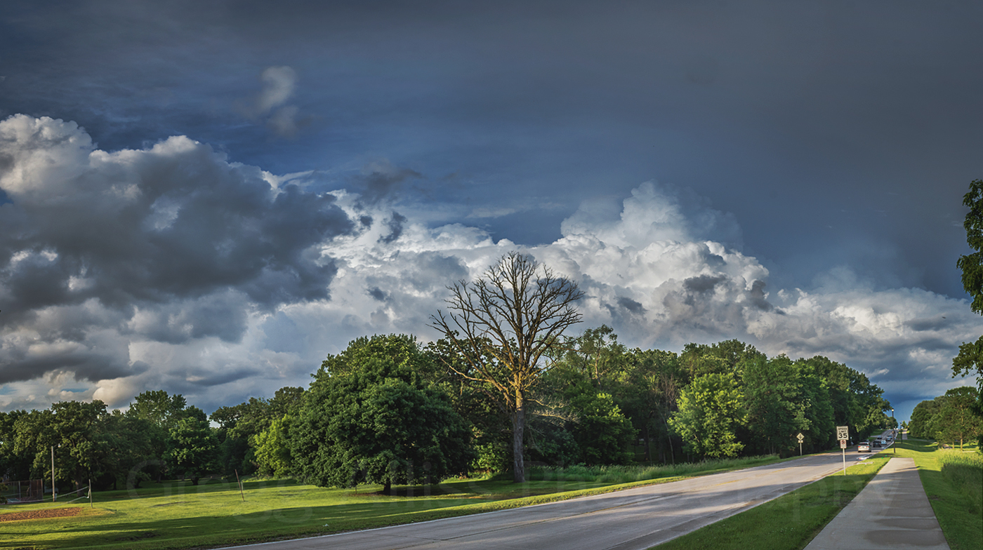
Fourth of July Sky

Sunday, July 7, 2019


Setting up an optimum spot well in advance of the annual Cedar Rapids, Iowa Fourth of July fireworks display, our group claimed this location on the east bank of the Cedar River downtown, next to the Great America building. This and all subsequent images face northwest with Mays Island in the background. Above, a distant storm system hugs the horizon in this image captured at 7:48 pm CDT, Thursday, July 4, 2019. The most intense part of the storm was located about 80 miles away, east of Charles City, Iowa. It had earlier been severe-warned from 6:50-7:30 pm.


9:09 pm. Testing exposure settings as night begins to fall. The distant storm system now appears akin to a mountain range in the background. A portion of the Great American building can be seen at right.
For fireworks display captures, I would use my Nikon D7200 DSLR camera with a Tokina AT-X 116 Pro DX II 11-16mm f/2.8 aspherical lens with a Nikon MC-DC2 remote cord and Vanguard Alta Pro 263 AT tripod. All exposures (of varying time lengths) were captured at f/11, ISO 100 and 16mm focal length. No rain would fall on this fireworks display this night. Temperature at show start was 79 degrees F with 84% humidity.


9:45 pm. Freedom Festival fireworks display begins. Spectators can be seen at lower right. 8 second exposure. Most of the following images are cropped versions done in post-processing.


9:47 pm. 5 second exposure.


9:47 pm. 10 second exposure.


9:47 pm. 5 second exposure.


9:48 pm. 8 second exposure.


9:52 pm. 13 second exposure.


9:57 pm. 10 second exposure.


10:01 pm. 10 second exposure.


10:04 pm. 20 second exposure.


10:06 pm. 13 second exposure.


Uncropped version of image above it, showing a good view of my location.


10:07 pm. 10 second exposure. Part of grand finale sequence.


10:07 pm. 8 second exposure. Part of grand finale sequence. The 2019 fireworks show lasted from about 9:45-10:08 pm.


This image is a stacked group of 5 separate exposures taken from 9:45-9:47 pm. Each exposure ranges from 5 to 8 seconds. Note the waxing crescent moon at left and dark bank of clouds in the distant background.

Read more...

Gust Fronts & Straight Line Winds

Monday, July 1, 2019


At 2:20 pm CDT on Thursday, June 27, 2019 a 210-mile-long gust front (above), stretching from about Dysart, Iowa to about 30 miles west of Wausau, Wisconsin was advancing swiftly southeastward, bringing with it gusty straight-line winds, heavy rain and hail.


By 3:25 pm I was on the road and facing this interesting low hanging scud structure while northbound on Alburnett Road just north of Marion, Iowa and just south of County Home Road (E34).


3:28 pm. First spotting position on North Marion Road, one-tenth-mile north of County Home Road. The panoramic image above looks north. A possible microburst feature can be seen in the background at left center.


3:29 pm. If this was a funnel, it was very brief, high-based and anemic. Image looks north.


3:31 pm. At the very least a rain shaft and at the most a minor microburst feature. Looking northwest from North Marion Road, just north of County Home Road north of Marion. Shortly thereafter the storm began losing its visual appeal from this location, so I moved east on County Home Road, then south back into Marion.


A new severe warning went up near the Anamosa area east of Marion around 3:46 pm (above). The target icon shows my position.


3:48 pm. Brief spotting position number two. Camera looks east at severe-warned cell from 35th Avenue, about a quarter-mile east of 35th Street in Marion.


3:49 pm. A panorama of the same view. The heavy rain and hail core at left is evident.


3:58 pm. Now eastbound (actually northeastbound) on US Highway 151, 1.2 miles northeast of Highway 13 in Marion. Heavy rain and hail feature to my "one o'clock" position. I soon decided to break off pursuit of this storm as it was swiftly moving east and I was out of position. 70-plus mph straight-line winds were generated by this storm.


In just about 20 minutes another area to the northwest also became severe-warned. I had time to go home and collect some addition spotting equipment, then set out north on Highway 13 north of Marion. Above, I am about two miles south of Ryan, Iowa at 5:45 pm. The approaching gust front was adorned with a shelf cloud low on the horizon.


5:49 pm. Last spotting position of the day. Looking north at severe cell from 170th Avenue at 310th Street (D47), about 1.2 miles southeast of Ryan in Delaware County.


Radarscope image capture corresponding to the photograph above it, with my position shown by the target icon.


5:50 pm. Panoramic view of the same storm. Despite its impressive appearance at this time,  in less than 15 minutes the storm began to weaken and the severe warning was allowed to expire. The storm was tracking left-to-right in the picture. Nikon D7200 DSLR camera.


Last shot from the storm--literally a captured lightning bolt. The image is a GoPro Hero 4 Silver video frame grab from about 6:00 pm.


Read more...

Fast Intensifiers On June 24

Wednesday, June 26, 2019


A scattered cluster of small benign storm cells in eastern Iowa suddenly began to intensify around the Cedar Rapids area on the afternoon of Monday, June 24, 2019.  A hefty cell began entering my location in Hiawatha as the two radar images above show--the left at 2:27 pm CDT, and the right at 2:30. Driving heavy rain with 60-plus mph winds at that time prompted a report by me to the National Weather Service in the Quad Cities and minutes later the area just east of here went severe warned.


Above, the storm system continues east (background) as seen from Progress Drive and Martha's Way in Hiawatha at 3:01 pm. Mammatus can be seen in the cloud mass at left center. This was an iPhone 6-Plus camera capture.


By 3:15 pm I had found my way to Alburnett Road and Flight Drive in the Bowman Meadows housing development in Marion, Iowa. The above storm panorama from 3:17 pm spans from east (left) to south (right). This distant area was again severe-warned.


A radar screen capture closely corresponding to the above and below photos. My location is indicated by the target icon, with a line of sight arrow pointing to the distant updraft area residing about 50 miles distant, northwest of Davenport, Iowa.


3:17 pm. Looking southeast at the severe storm's updraft from Alburnett Road and Flight Drive in Marion.


3:18 pm. At nearly the same time, a weaker by still photogenic storm cell had also begun to form about 11 miles to my northeast (above).


3:23 pm. A zoomed-in view of the distant updraft of the departing severe-warned cell. By now the most intense part of this storm was about 55 miles to the southeast, and about 10 miles northwest of Davenport. Nikon D7200 DSLR camera.

Read more...

May 24 Hills Iowa Tornado Sequence Pics

Friday, June 21, 2019


Originally captured as video by my Nikon D7200 DSLR camera, the images above are created frame captures of that video. Using an approximate starting time of 6:48 pm CDT on Friday, May 24, 2019, each of the six EF1 tornado pics have a further time stamp labeled in seconds. First images show a wrapping horizontal vortex, while later ones exhibit a multi-vortex feature on the ground. My location was 540th Street SW, about 3.4 miles WSW of Hills, Iowa in Johnson County. The first image looks northwest while the last image is to my north. The tornado was about 2.5 miles distant.

Read more...

June 15 Multiple Rounds of Storms

Tuesday, June 18, 2019


Much of the state of Iowa was under a Storm Prediction Center (SPC) Slight Risk posting on the afternoon of Saturday, June 15, 2019 (above), and indeed storms began forming just after 1:00 pm CDT.


1:23 pm. Storm Prediction Center posts Severe Thunderstorm Watch #359 for much of Iowa.


I began to formulate an intercept plan with a target of two strong storms areas in Tama County. Because of its closer proximity to Cedar Rapids, I set out for the easternmost cell, located near Dysart, Iowa (circled area in the Radarscope image above, corresponding to 1:27 pm).


Above, I found a spotting location at 26th Avenue at 71st Street (E44), about .75-mile west of Newhall, Iowa. A non-severe storm, 14 miles distant and located between Elberon and Garrison, was approaching me from the northwest at 2:35 pm. Shortly after this time my attention shifted to another storm on radar, this one farther west in Marshall County and now severe-warned. In short order, I  chose to abandon this storm to pursue the new one.


2:55 pm. Westbound on US Highway 30 at 21st Avenue (V66), 3 miles south of Van Horne in Benton County Iowa. In the background at right a large updraft can be seen through foreground clouds. The severe storm cell was located about 32 miles distant, just east of Marshalltown. It was severe warned from 2:35-3:50 pm.


With echo tops on this storm cell billowing to 40,000 feet or more, I chose an advantageous spotting location--this one at the same location where I had monitored the eastern reaches of the July 19 Marshalltown tornado event last year. Above, the camera looks northwest at 3:15 pm from Highway V18 at 320th Street, just north of US Highway 30 in southeastern Tama County. Note the vigorous updraft at left. I chose to check in with the Benton County ARES (Amateur Radio Emergency Services) network frequency, in wary anticipation of incoming dangerous weather.


Radarscope image for 3:20 pm, with my location at the lower right.


3:22 pm. A larger view of the same scene.


Radar frame capture roughly corresponding to the photograph above it. My location is shown by the target icon at bottom right, with the black arrow pointing toward the most intense area of the storm. White arrows indicate the storm's track.


3:22 pm. Vertical capture of the updraft, sporting a beautiful overshooting top.


3:55 pm. Panorama of the storm, now visibly weakening. In fact, it had lost its severe warning five minutes before. I politely checked out of the Benton County ARES net and headed for home.


But the day's storms were not done yet. A new line of severe storms began organizing to the west of Cedar Rapids between the five and six o'clock hour. After adding spotting partner Billy Gant for a new intercept, I chose this location--74th Street at 30th Avenue (Highway 201), one mile south of US Highway 30 and three miles north of Norway, Iowa in southeastern Benton County--just in the nick of time. A shelf cloud from a quickly approaching gust front was bearing down upon us. Above, the camera looks west along 74th Street at 6:40 pm.


Radarscope image roughly corresponding the photograph above it, showing the severe-warned line of storms and our spotting position. Storm movement was due east.


6:42 pm. Panoramic capture of the same view.


6:42 pm. Looking northwest. Shown is the northern edge of the shelf cloud.


6:45 pm. Looking west down 74th Street at a possible forming and incoming funnel. Brief and weak tornadoes sometimes spinup along the leading edges of gust fronts such as this.


6:46 pm. The funnel cloud was looking more pronounced. It did not drop to the ground, but the ensuing rain sure did. Long lasting drenching rain followed us all the back home after we finally bailed out of this location. Wind speeds probably approached 60 mph here. A full afternoon/evening of volatile weather on this day to be sure! Nikon D7200 DSLR camera.

Read more...

June 12 Cedar Rapids Linear Storms

Saturday, June 15, 2019


A (non-severe) line of linear storms approached Cedar Rapids, Iowa just before 6:00 pm CDT on Wednesday, June 12, 2019. Though not overly powerful, they were nevertheless aesthetic in appearance. The image above, captured at 6:07 pm, looks northwest over Bowman Woods Park in Cedar Rapids. The storm is less than five minutes away.


6:07 pm. Panorama version of the incoming line of storms.


6:08 pm. Rain saturation in the clouds is beginning to show. Wind speeds of 40-50 mph occurred as the storm passed through this location, including heavy rain and BB size hail.


College of DuPage GOES16 visible satellite image, corresponding to 6:01 pm. My location is indicated by the target icon.


Radarscope image corresponding to 6:10 pm. The storm was moving in a southeasterly direction.


An hour later another line of storms passed just north of my location. In the image above, thunder was rumbling from this storm at 7:23 pm. Panoramic view looks northeast from Boyson Road, just east of Brentwood Drive NE in Cedar Rapids.


Similar shot at 7:25 pm. Nikon D7200 DSLR camera.


Read more...

  © Blogger template On The Road by Ourblogtemplates.com 2009

Back to TOP