
Optical Phenomena, Stormy Skies
Friday, June 27, 2025
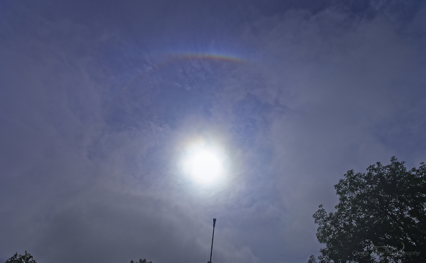
During the two-day span of June 25-26, 2025, the Cedar Rapids, Iowa area had a little bit of everything overhead, with optical phenomena and some stormy skies. The image above looks southeast at a partial sun halo at 9:16 am CDT, Wednesday, June 25. Sun halos are caused by ice crystal refraction high in the atmosphere and often precede precipitation. In this case, a rain shower arrived at this location on Brentwood Drive NE in Cedar Rapids about 15 minutes later.

8:25 pm. Another optical phenomenon: Crepuscular rays beam forth from behind a line of thunderstorms located 50-60 miles distant in Black Hawk and Buchanan counties in Iowa. This image was captured from Noelridge Christian Church in Cedar Rapids.

8:27 pm. Looking north. Backlit storm cell located in Buchanan County, southeast of the town of Oelwein. This image was also captured from Noelridge Christian Church.
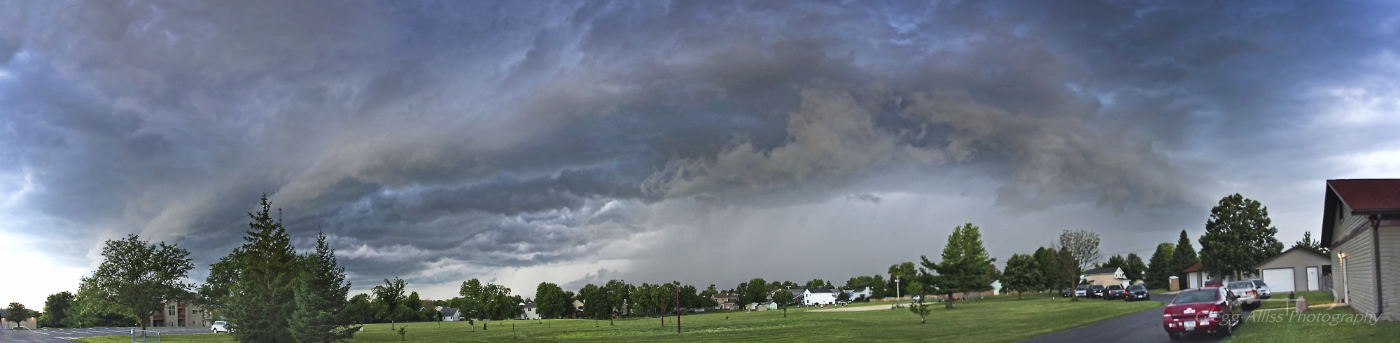
These images were also captured from Noelridge Church. Panoramic view of an incoming shelf cloud looking northwest at 6:51 pm CDT, Thursday, June 26, 2025.

6:53 pm. Looking southeast at leading edge of approaching shelf cloud (left), with the trailing "whale's mouth" feature at right.

6:55 pm. Looking northwest at strong downdraft area containing heavy rain. Nikon Z6ii camera.


0 comments:
Post a Comment