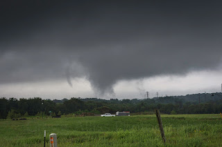
Tornadic Circulation Under the Radar
Sunday, June 24, 2018
A Slight Risk convective outlook was posted by the SPC for the central part of the state of Iowa for Wednesday, June 20, 2018. The eastern limit of the Slight Risk stretched to about Cedar Rapids, my location. At 3:05 pm CDT, Tornado Watch 195 was issued for much of central and eastern Iowa. Severe weather was already under way, with a tornado warning having been issued for eastern Mahaska and western Keokuk counties in southeast Iowa around 2:30 pm. At that time the storm was about 50 miles distant and tracking to the northeast. Local surface conditions at 3:00 pm included: 70 degrees F, 69 degree dew point, 82% humidity and winds out of the ESE.
With the severe-warned box now placed just southwest of Iowa City and the system moving northeast, it was time to get out and select a spotting position. With limited confidence that the storm would hold its severity, I set up shop around 3:45 pm on Oliver Court in Marion, less than a mile away from home. Oliver Court is located in a yet-undeveloped part of the Bowman Meadows housing area, and affords clear views of the sky in all directions. In just minutes, I was facing a very low cloud base (above) with interesting activity beneath it in the southeast sky. This mildly rotating ragged cloud base was located about 7 miles distant, near the town of Bertram.
3:49 pm. This panoramic image stretches from the east sky (left) to the south sky and shows the true overall structure of the cell, which was not as obvious to the naked eye. Striations accent this storm's rotating structure.
3:49 pm. Extreme zoomed-in shot of the rotating low cloud base.
3:50 pm. Medium distance zoom of the underside of the low cloud base. It was exhibiting mini funnels around the periphery of the rotation and prompted me at this time to make an amateur radio report to the Linn County ARES net.
3:52 pm. Radarscope Pro screen capture of my position (blue icon), with the white arrow pointing to the area of interest (note the lack of a severe warning there).
3:53 pm. This obvious funnel (or funnels) formed and I suddenly began to wonder "Am I missing something??" The radar showed no severe weather boxes, the weather radio produced no alerts and there was minimal if any amateur radio traffic for my immediate location.
3:54 pm. The same funnel as it continued to approach my position. Now though, in less than five minutes the low cloud base and lowering had completely dissipated. My experience here in this short ten minute time span feeling alone in my observations significantly illustrated the National Weather Service's credo for spotting: "Don't assume everybody else has seen and reported this event." Nikon D7200 DSLR camera.
IEM radar base reflectivity map for 3:55 pm. Note the severe-warned area located south of my position (target icon).
Interior view of my spotting vehicle, showing my communication and informational devices.


0 comments:
Post a Comment