Convection Junction, What's Your Function?

Thursday, August 21, 2025


The atmosphere in the midwest, and especially Iowa during August 15-17, 2025 proved ripe for storms, with many convective updrafts forming in the hot and humid conditions, but with few going severe. The images above and below were exceptions, with a potent severe-warned storm system rolling across north central and eastern Iowa through the midday and evening on Friday, August 15. These images, captured at 7:08 pm CDT (above), and 7:09 pm (below), look northeast at the departing system as seen from the Holiday Inn Express in Urbandale, Iowa.


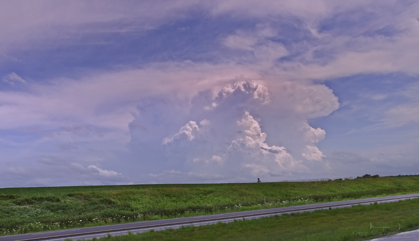
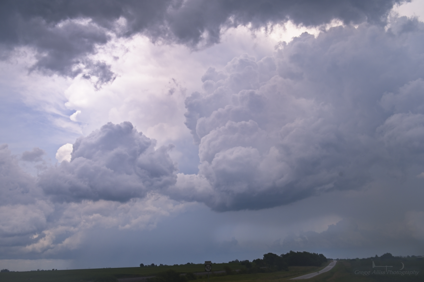
Fast forward to Sunday, August 17. A new set of storms, with powerful updrafts and some even with lowerings formed in eastern Iowa during the evening. None of these went severe warned by the National Weather Service (NWS). This image of a growing updraft looks west at 5:05 pm CDT from Bowman Woods Park in Cedar Rapids, Iowa.


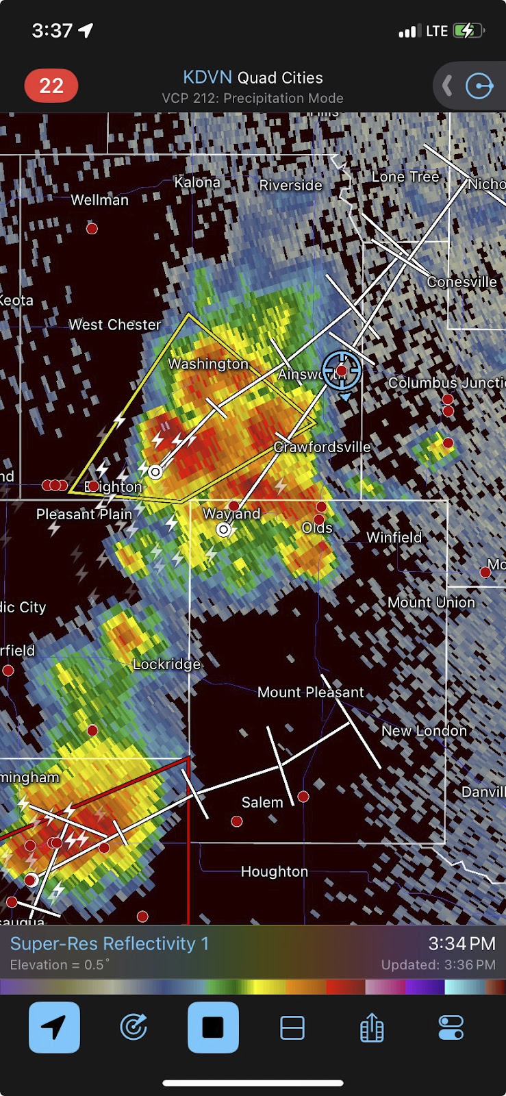
Radarscope image for 5:10 pm. The polygon box over Benton County is an advisory, not a severe warning.


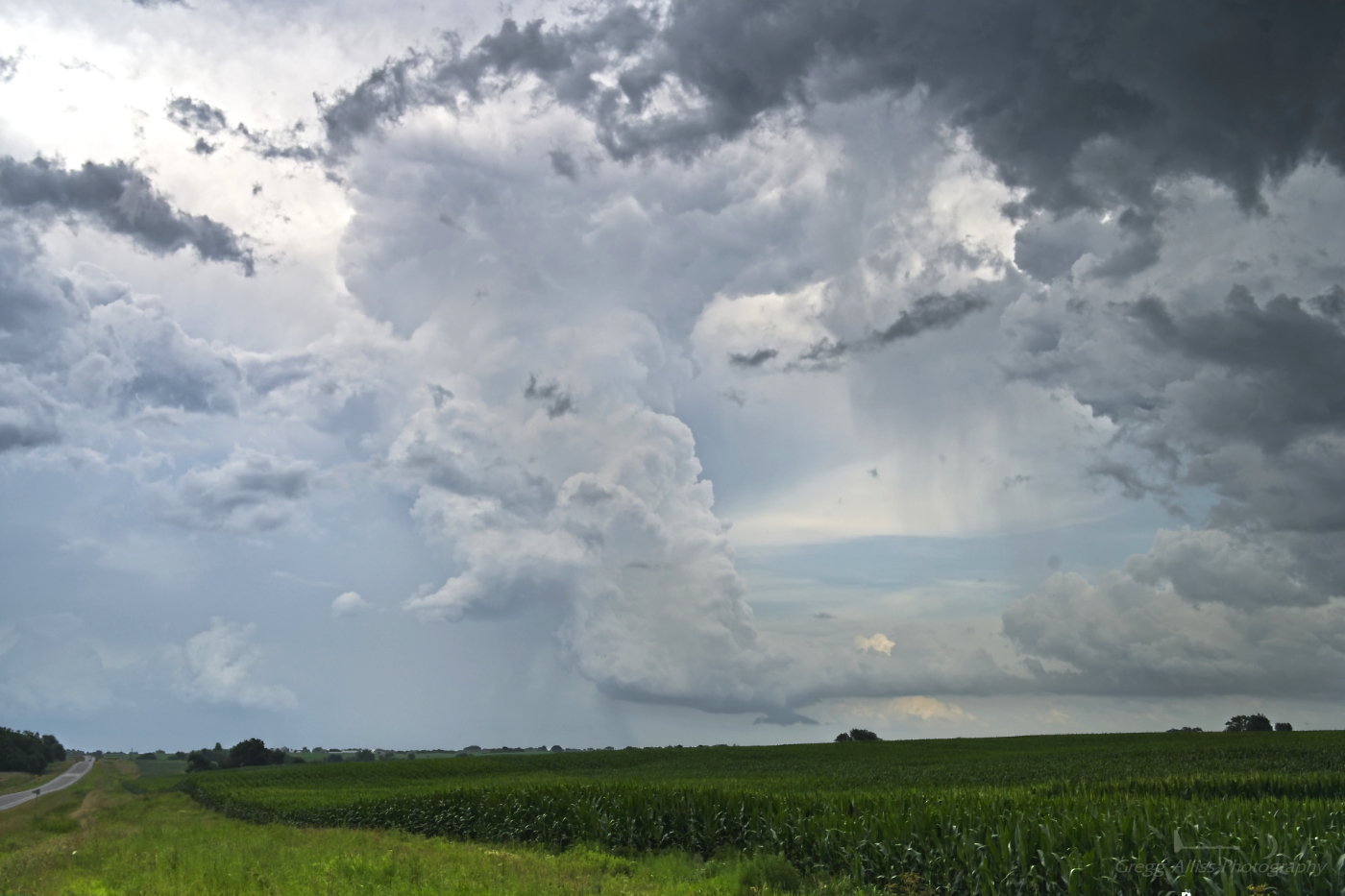
5:22 pm. Looking north from the eastern border of Bowman Woods Park. Storm's anvil has a ragged appearance, not the smooth cauliflower look of a strong storm.


Radar capture for 6:19 pm. Storm looks linear and is staying north of Cedar Rapids. 


6:32 pm. "Tail-end Charlie" of the storm, centered on Coggon, Iowa in northern Linn County.


6:37 pm. Updraft looking northeast. 


6:58 pm. Similar image, but with a curious ring-like feature in the clouds--most likely from ice refraction in the upper clouds.


7:03 pm. New vigorous updraft forming as seen from the same location, but to the south. 


7:16 pm. I had actually set out on foot to capture the movement of this storm since it was so close! This image looks south from Boyson Road near the Boyson Park trailhead in Marion, Iowa. Very robust looking updraft with a forming darkening base. 


Corresponding reflective radar image to the photo above it. The blob of red east and southeast of Cedar Rapids from this cell is very evident. 


7:17 pm. Similar image with the darkening storm base appearing from the gap behind the trees.


7:19 pm. Similar image with the dark storm base now very evident to the eye.


7:25 pm. Farther east on Boyson Road near Alburnett Road in Marion. Lowering appearing from the storm cell looking southeast. An obvious lowering, but without an obvious rotation.


7:26 pm. Looking east from this location. Another cell with another strong updraft.


7:26 pm. Lowering in the southeast sky.


7:31 pm. Downdraft rain base looking southeast.


7:32 pm.  Similar image. Rainfall and lightning were becoming more intense. It was now time to move back toward home (on foot)!


8:02 pm. Back at home. Sky to the east was now on fire from the departing storm, with the added bonus of some mammatus formations in the mix.


8:06 pm. Similar image.


8:10 pm. Sky still ablaze but mammatus formations now obscured. Lots of convection on this day, but no severe warnings... (What's your function?) Nikon Z6ii camera.


Read more...

Pictures From The Derecho--Five Years Ago Today

Sunday, August 10, 2025

It's already been five whole years since the infamous derecho roared into Eastern Iowa on August 10, 2020. Few Iowans had ever even heard of the word "derecho," but most all would remember it thereafter. The following photos were from my spotting location that day on Quiver Court in Marion, Iowa during the storm and along and near Boyson Road after it had wrought its destruction. The last image shows the Milky Way, seen with the naked eye in metro Cedar Rapids that night, visible because of the widespread power outages.


Read more...

'Derecho' in the Conversation, But Not Quite

Thursday, July 31, 2025


For the first time since last March an SPC Moderate Risk (above) was forecasted into eastern Iowa at 3:00 pm CDT on Monday, July 28, 2025, with higher risks for tornadoes in eastern South Dakota and western Minnesota. Included in this convective outlook discussion was the dreaded word "derecho." (We all remember August 10, 2020...) Indeed tornadoes formed in eastern South Dakota, then turned linear with winds packing 85-100 mph as the storms moved into northwest Iowa by 10:00 pm.


A potent line of storms then proceeded east, maintaining much of its energy along the way. Because of this, the National Weather Service issued Severe Thunderstorm Watch 555 (above) at 10:05 pm CDT. This included north, central and eastern Iowa. 


At 1:25 am CDT, Tuesday, July 29 my weather radio roused me from sleep. Above is a Radarscope image at that moment, with severe-warned storms running from just northeast of Des Moines in the south to around Decorah in the northeast. Some winds in this line were being reported as gusting up to 80 mph. Note the extended severe warning polygons as far east as Delaware and Jones counties ahead of the storm.


2:03 am. At home and spotting from my back deck in the Bowman Woods Park area of Cedar Rapids, Iowa, lightning flickered from behind advancing clouds as seen in this image looking northeast. Image is a  13 second exposure at f/4.5, ISO 250, 24mm focal length.


2:05 am. Cell phone emergency alerts are transmitted, with the simultaneous sounding of sirens in the Cedar Rapids area (for the expected high winds).


2:09 am. The unmistakable structure of a shelf cloud was now moving into the area with high winds. This image looks northeast and is an 8 second exposure at f/4.5, ISO 250, 24mm focal length.


2:10 am. Similar image. Clouds were moving left-to-right in these images. 5 second exposure at f/4.5, ISO 250, 24mm focal length. Nikon Z6ii camera.


Radarscope image for 2:12 am. The blue target icon is my location. Note the significant hail core area between Manchester and Ryan, Iowa. A maximum wind gust of around 60 mph occurred at my location at 2:15 am.


2:24 am. Very large bow echo storm--stretching from Montezuma in the south to Postville in the northeast--but as it turned out, short of the "derecho" criteria. In my neighborhood very little storm damage was evident, mostly twigs and small branches.


Read more...

July 11 Severe Weather Arrives in Southeast Iowa

Wednesday, July 16, 2025


Conditions for severe weather on Friday, July 11, 2025 were favorable in parts of Missouri, Iowa and Illinois, with an emphasis in southeastern Iowa where the Storm Prediction Center (SPC) posted a 5% hatched probability of tornadoes. The Categorical, Tornado, Hail and Wind outlooks issued at 11:30 am CDT are shown above.


SPC Mesoscale Discussion 1641, posted at 12:18 pm CDT for about half of the state of Iowa. 


12:55 pm CDT. Tornado Watch 505 is issued for much of southeast Iowa and some of northwest Illinois.


2:15 pm. Time for me to fly. Storm cell near Ottumwa, Iowa is tornado warned and I am on the road southbound on Interstate 380/US Highway 218 on an intercept course. Radarscope image above is from 2:45 pm, showing tornado-warned polygon, and my mobile location (blue target icon).


3:05 pm. Visible storm cell with billowing cumulonimbus to my southeast. Though not severe warned, its echo tops (above) were reaching 40,000 feet.


3:09 pm. Photo capture of this storm cell to my southeast while southbound on US Highway 218 just south of Hills, Iowa in Johnson County. 


Radarscope reflectivity image corresponding to the photo above it, with the storm cell being shown at right (near Wapello, Iowa).


3:13 pm. Same storm cell to my southeast while southbound on US Highway 218, about one mile south of the Kalona, Iowa exit (Exit 80) in Johnson County. The storm was now located at the border of Henry and Des Moines counties in southeast Iowa. Surprisingly enough, this potent cell was not severe warned. 


3:32 pm. Now at a stationary spotting location on Yucca Avenue just south of Highway 92, about 1.1-mile east of the US Highway 218 exit for Ainsworth, Iowa in Washington County. The image above looks south at an updraft feature.


3:32 pm. Looking east from this location. The updraft at center exhibits an inflow cloud and small funnel.


3:33 pm. Similar capture of the updraft feature to the east, now without its funnel.


3:35 pm. Updraft, inflow and small ragged wall cloud appendage. 


3:37 pm. Radarscope reflectivity image showing severe-warned storm approaching my location.


3:39 pm. Looking southwest at the incoming severe-warned storm cell.


3:39 pm. Similar image looking south as the storm approaches. Two storm chasers confer in the background to continue east on Highway 92.


3:43 pm. Now relocated east at the Cotter Presbyterian Church on County Road W66, about .3-mile south of Highway 92 in Louisa County, and about 3.6 miles east of US Highway 218. This image looks southwest. Though visually impressive, the storm has just lost its severe warning.


3:44 pm. Similar capture with the church in the picture. Nikon Z6ii camera.


3:46 pm. Radarscope image, showing my location inside a notch of the storm. I now decided to head for home, and drove through drenching rain for about 15 minutes before conditions finally improved.


Read more...

  © Blogger template On The Road by Ourblogtemplates.com 2009

Back to TOP