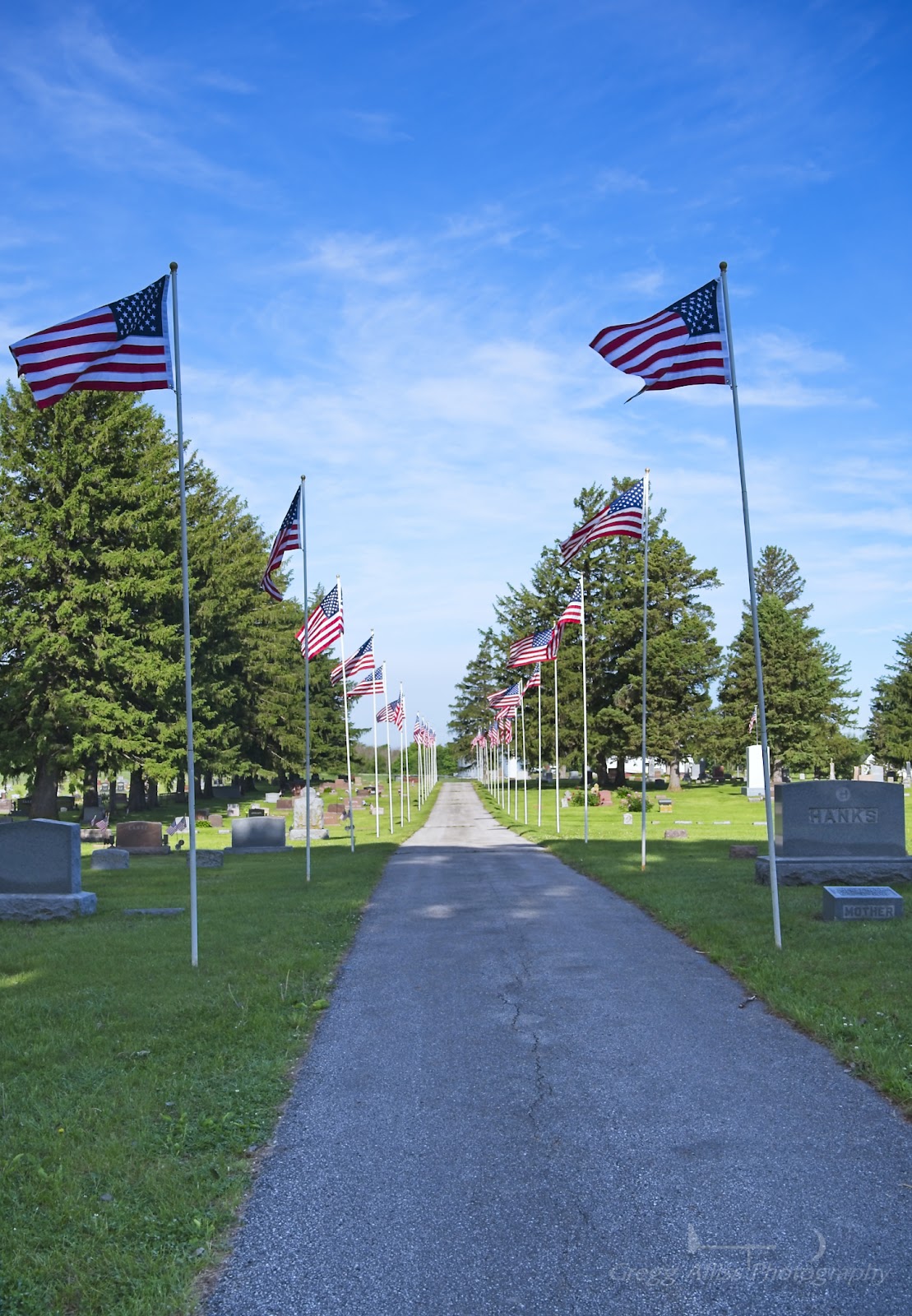
Mare's Tail Memorial Weekend

Friday, May 30, 2025


Skies were sunny with wisps of "Mare's Tails" cirrus clouds in the skies during the morning and afternoon hours of Friday, May 23, 2025 -- Memorial Day weekend. Temperatures were in the mid-to-high 60s, making it ideal to pay respects to departed relatives in central Iowa. The above image was captured at 9:35 am CDT at Cambridge Cemetery, near the town of Cambridge in Story County.


10:05 am. Front view of White Oak Cemetery in the unincorporated town of White Oak in Polk County.


10:27 am. Cory Grove Church just outside Byers Cemetery, near the town of Elkhart in Polk County.


2:27 pm. Veteran's area of Glendale Cemetery in Des Moines. "Mare's tails" (cirrus uncinus) are hook-shaped clouds that form high in the atmosphere. The clouds are often associated with an approaching warm front and can signal that rain is on the way.


Read more...

Beautiful Sky for Opening Night

Wednesday, May 14, 2025


It was opening night for a new season of slow-pitch softball action at Tait Cummins Sports Complex on C Street SW, Cedar Rapids, Iowa on Monday, May 12, 2025 and the heavens seemed to be celebrating as well with an included brilliant sunset. This image was captured at 8:34 pm CDT. Sunset was officially at 8:18 pm. iPhone 11 camera.

Read more...

East Bust

Thursday, May 1, 2025


The Storm Prediction Center's (SPC) outlooks for the state of Iowa early in the morning of Monday, April 28, 2025 seemed to indicate significant tornado, hail and wind areas (above). 


I made the decision to leave home and target New Hampton, Iowa in Chickasaw County for a possible intercept, which was well within the posted SPC Moderate Risk zone. Storms had begun to fire up in far western Iowa, and I reasoned more storms would do the same near this location. Northbound on US Highway 63 just south of New Hampton at 3:06 pm CDT, a small storm cell to my west (above) displayed some promising convection, but it soon dissipated.


3:25 pm. Tornado Watch 181 (above) was issued for a large portion of northern Iowa. Another promising development. After about 30 minutes, however, it was becoming apparent no significant storm cells were developing near me in New Hampton, so I decided to pack up and head west toward Mason City on US Highway 18, where a line of severe warned storms was ongoing.


5:23 pm. Looking northwest at the line of severe warned storms as seen from the interchange of US Highway 18 and Interstate 35 near Clear Lake and just west of Mason City in Cerro Gordo County.


5:54 pm. Looking northwest at a tornado warned area of the storm system as seen from the Interstate 35 rest area near Dows, Iowa in Franklin & Wright counties. The warned area was still some 85 miles distant and moving east.


Radarscope image for 6:22 pm. My location is indicated by the blue target icon.


6:48 pm. Severe warned cells and the setting sun looking northwest beyond my vehicle, located atop the Mallard Avenue overpass on US Highway 18 just southwest of Mason City, Iowa.


Radarscope image corresponding to the photo above it. Note the tornado warned polygon near the Albert Lea area of Minnesota. Storms were creeping closer to me but daylight was now waning fast and I was a long way from home.


7:44 pm. I was now heading back homeward, but the distant pursuing storm clouds were putting on a visual show, as this image looking west from near Waverly, Iowa in Bremer County attests.


8:13 pm. One last stop and look back: looking northwest at backlit storm clouds from the intersection of Reed Avenue (County Road V49, foreground) and Highway 3 (background) just north of Readlyn, Iowa in Bremer County. The capture of the distant cloud images was the best I could accomplish on this day, as severe weather never really materialized in eastern Iowa. In other words, the Moderate Risk was a bust here. Sunset was at 8:00 pm. Nikon Z6ii camera.



Read more...

Three Planets and a Moon

Saturday, April 26, 2025


5:43 am CDT, Saturday, April 26, 2025. Looking east from south of Alburnett Road and Bowstring Drive in Marion, Iowa. At left is thin crescent moon, right of the moon toward center is the dim 0.46 magnitude planet Mercury. At upper right is the -4.24 magnitude planet Venus. Below and right of Venus is the 1.40 magnitude planet Saturn. Image is a 1/320 second exposure at f/7.1, ISO 4000, 56mm focal length. Air temperature was 40 degrees F. The previous evening the celestial bodies formed a "smiley face," but it was unfortunately cloudy. Nikon Z6ii camera.

Read more...

Ran Out of Steam

Thursday, April 24, 2025


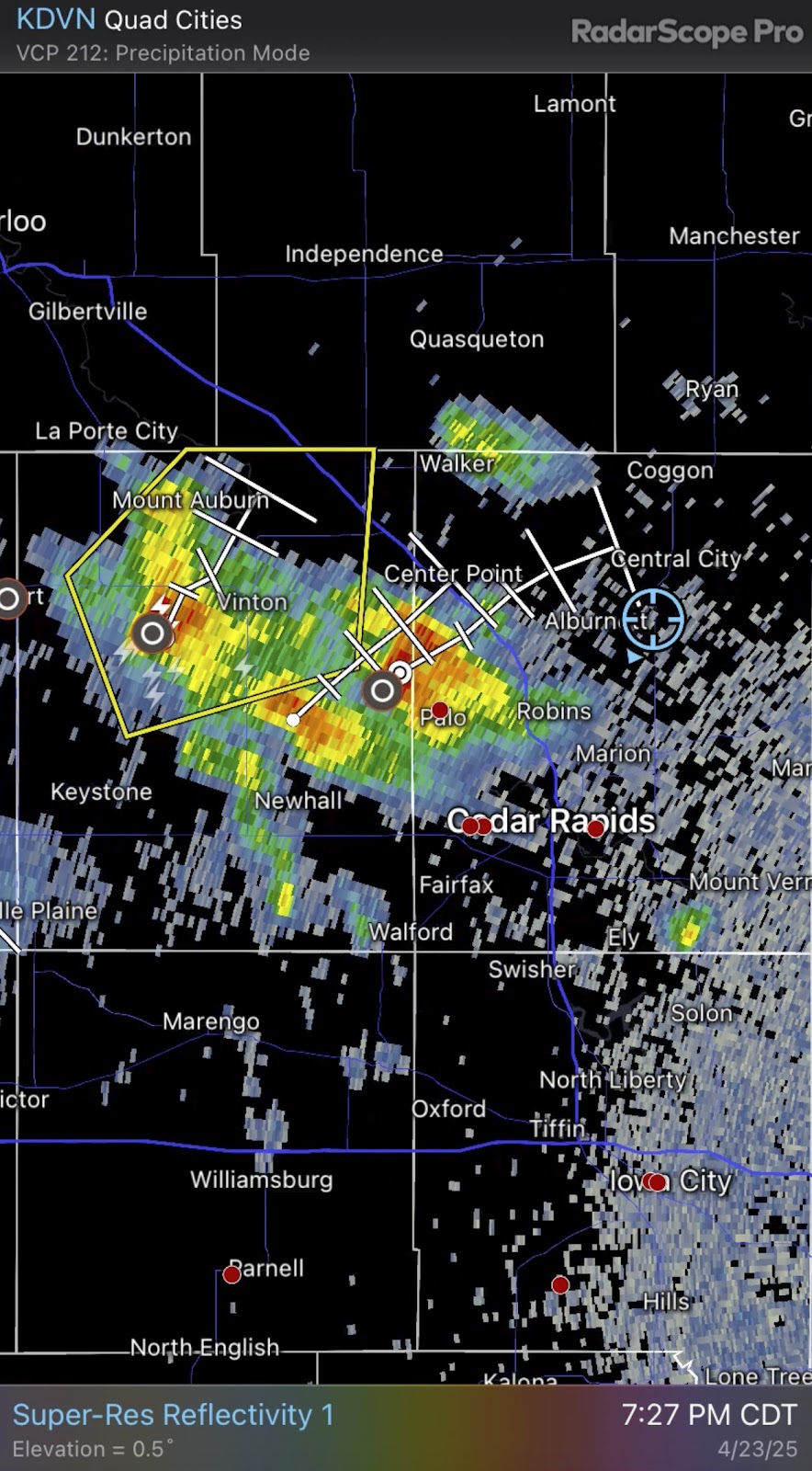
Two severe warned storm cells were moving relentlessly east toward my home area in Iowa during the evening of Wednesday, April 23, 2025, so I quickly took up a spotting position to intercept it at the Linn Cooperative Oil Company facility on Burnett Station Road, just west of Highway 13, and about 3.3 miles east of Alburnett, Iowa. And wouldn't you know it, minutes later it weakened and the severe warning tag was dropped. The 7:27 pm CDT Radarscope image from above shows the severe warned polygon to my west (my location is the blue target icon), just before it ran out of steam.


A west facing view of the approaching storm from my location at 7:26 pm--corresponding to the radar image.


7:44 pm. Despite no longer being severe warned, this storm produced frequent lightning and prominent rain shafts (seen beneath its base). Nikon Z6ii camera.


Read more...

Jupiter, Moon, Contrail

Thursday, April 3, 2025


Appearing prominently in the dwindling light of this image on the evening of Wednesday, April 2, 2025 was the -1.69 magnitude planet Jupiter (left), quarter-moon and a ghostly contrail from a high flying aircraft. This image looks west over Bowman Woods Park in Cedar Rapids, Iowa, and is a 1/25 second exposure at f/4.5, ISO 400, 70mm focal length. Air temperature was 54 degrees F. Nikon Z6ii camera.

Read more...

Lunar Eclipse at the Castillo Fort In St. Augustine

Wednesday, March 19, 2025


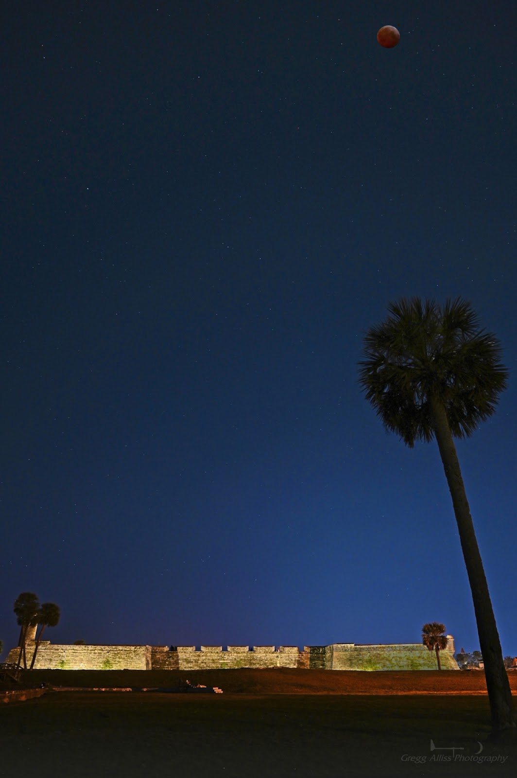
A vacation for a family member's wedding near St. Augustine, Florida provided a more exotic foreground element setting than my Iowa location for the total lunar eclipse event early in the morning of Friday, March 14, 2025--the Castillo de San Marcos fort along the shores of St. Augustine, Florida, the oldest city in America. With warm overnight temperatures (60 degrees F at the time of capture), clear skies and minimal insect interference, the setting was ideal. The image above, which looks south, is a composite of the foreground element and separate shot of the moon. The foreground is a 10 second exposure at f/7.1, ISO 640, 24mm focal length. The moon, captured near totality at 2:54 am EDT, is a 1/10 second exposure at f/4.5, ISO 2500, 70mm focal length. The Castillo fort is a national monument and is illuminated at night. 


Individual shot of the moon with nearby star at 2:35 am EDT--23 minutes before totality. Image is a 1/3 second exposure at f/4.5, ISO 800, 70mm focal length. Nikon Z6ii camera.
Read more...

  © Blogger template On The Road by Ourblogtemplates.com 2009

Back to TOP