Cellular Coverage

Friday, February 26, 2016


The race to get ahead of this severe-warned storm cell, rumbling eastward toward Washington County, Iowa on the evening of Saturday, June 20, 2015, was won when my daughter and I arrived at our spotting location objective, having left earlier from Cedar Rapids. The image above looks west from US Highway 218, just north of the Washington, Iowa exit (66) at 5:24 pm CDT. The core of the storm cell was still some 70 miles distant at this moment, the outer edge of the anvil, about 35 miles.


This image, captured one minute later, looks north from the U-shaped US Highway 218/Highway 92 interchange at Ainsworth, Iowa. A segment of the storm system--which extended south from Marion County to north in Benton County--is seen here. In the foreground is the Ainsworth Four Corners Truck Stop and Highway 92.


By 5:34 pm the edge of the southern storm cell was creeping into view looking southwest along Yucca Avenue, about .25-mile south of Highway 92 and just a little over a mile east of the 218/92 interchange. That cell would produce tornadic spinups near the Mount Pleasant, Iowa area less than two hours later. Nikon D5000 DSLR camera.


Above is a radar screen capture for 5:30 pm. Our position at this moment is marked by a white star.

Read more...

Revisiting June 20, 2015

Tuesday, February 23, 2016


Like a warning display from above, copious amounts of mammatus clouds appeared in the skies
over southeast Iowa on the evening of Saturday, June 20, 2015. That warning was realized as one
hour after the image above was captured at 6:20 pm CDT, severe weather passed through the area, including small and short duration tornadic spin ups. This image looks northeast from 260th Street,
about .1-mile north of US Highway 34 and about 1.3-mile west of the town of New London in Henry
County. The radar capture from this moment (below) shows our position (white star) and an arrow pointing to the edge of the approaching anvil containing the view seen above.


Add a little updraft and a low-base lowering in this image (below), captured at 6:29 pm, looking west. The tall and scrappy foreground feature drifted harmlessly to our north (right). Larger mammatus can be seen in the background at upper right.


More mammatus (image below) looking south at 6:41 pm. In the background is US Highway 34, where our repositioning a few miles west gave us a ringside seat to the storm's main event around
7:20 pm.


Some mammatus began forming in Eastern Iowa as early as 8:30 am on this day. Nikon D5000 DSLR camera.


Read more...

Parting of Waves

Monday, February 22, 2016


This cirrus cloud, which resembled a wide contrail, extended from the western horizon all the way
to the eastern horizon on Saturday evening, February 20, 2016. Cleaving into the cirrus cloud at 5:12 pm CST was a clear wedge of sky. The image looks toward the setting sun over Bowman Woods Park in Cedar Rapids, Iowa. Actual sunset time was 5:45 pm. Nikon D5000 DSLR camera.

Read more...

Super-Charged Atmosphere

Friday, January 29, 2016


It was one of the most impressive lightning displays I had ever witnessed. And no wonder. It was part of an unusually early and powerful tornado outbreak which occurred on Saturday, April 9, 2011 in northwest Iowa. Our two-vehicle storm chase group was in our final half-hour of chasing just before 9:00 pm CDT. I was given a quick opportunity for our vehicle to pull off the road to capture the lightning display. The above image is actually a two-photograph combination, the first at 8:56 pm, the second a minute later. It looks northeast from 255th Street, just .13-mile east of US Highway 71, and about 2.5 miles south of Early, Iowa. In addition to the vivid lightning, the image also shows the road's illuminated shoulder at lower right; blurred trees at left--buffeted by strong RFD winds (moving right-to-left); and a portion of a mesocyclone at upper left. A tornado from this meso was on the ground just northwest of Early at this moment. A highway patrolman stopped and warily asked us what we were doing here before speeding off to the east (background). Shortly thereafter, we resumed the chase and had a dangerous close encounter with an EF2 wedge tornado around 9:10 pm as we entered the town of Nemaha, about seven miles to the northeast. Nikon D5000 DSLR camera.

Read more...

Let It Storm? Let It Storm? Let It Storm?

Tuesday, December 29, 2015


This day on Wednesday, December 23, 2015 should have been a white snowy landscape in Iowa. Instead, it was 55 degrees F with a nearly identical dew point. Even more amazing was the fact that the Storm Prediction Center issued Tornado Watch 561 covering areas in three midwestern states just before 3:00 pm CST. The watch box's northern boundary stretched nearly to Cedar Rapids, Iowa.


Though no tornadoes would materialize in the Cedar Rapids area, an approaching thunderstorm (above) was seen in this image of the SW sky from Bowman Woods Park at 3:33 pm.


At 3:35 pm, a bank of convective clouds, more indicative of spring or summer, stretched across the northwest sky, seen here behind Bowman Woods Elementary School.


The thunderstorm is almost upon this location on Brentwood Drive NE at 4:43 pm. Christmas decorations in the foreground of the image give the moment an almost surreal appearance.


A testament to the abnormal weather conditions of the month and day is this image of my Vantage Vue weather station at 4:08 pm. 22 confirmed tornadoes in five states--two rated at EF3--would drop from this system. A Particularly Dangerous Situation (PDS), infrequent even in the springtime, was issued by the SPC for parts of Louisiana, Arkansas, Mississippi and Tennessee during the event. Nikon D5000 DSLR camera.

Read more...

Dazzling In Drizzle

Tuesday, December 22, 2015


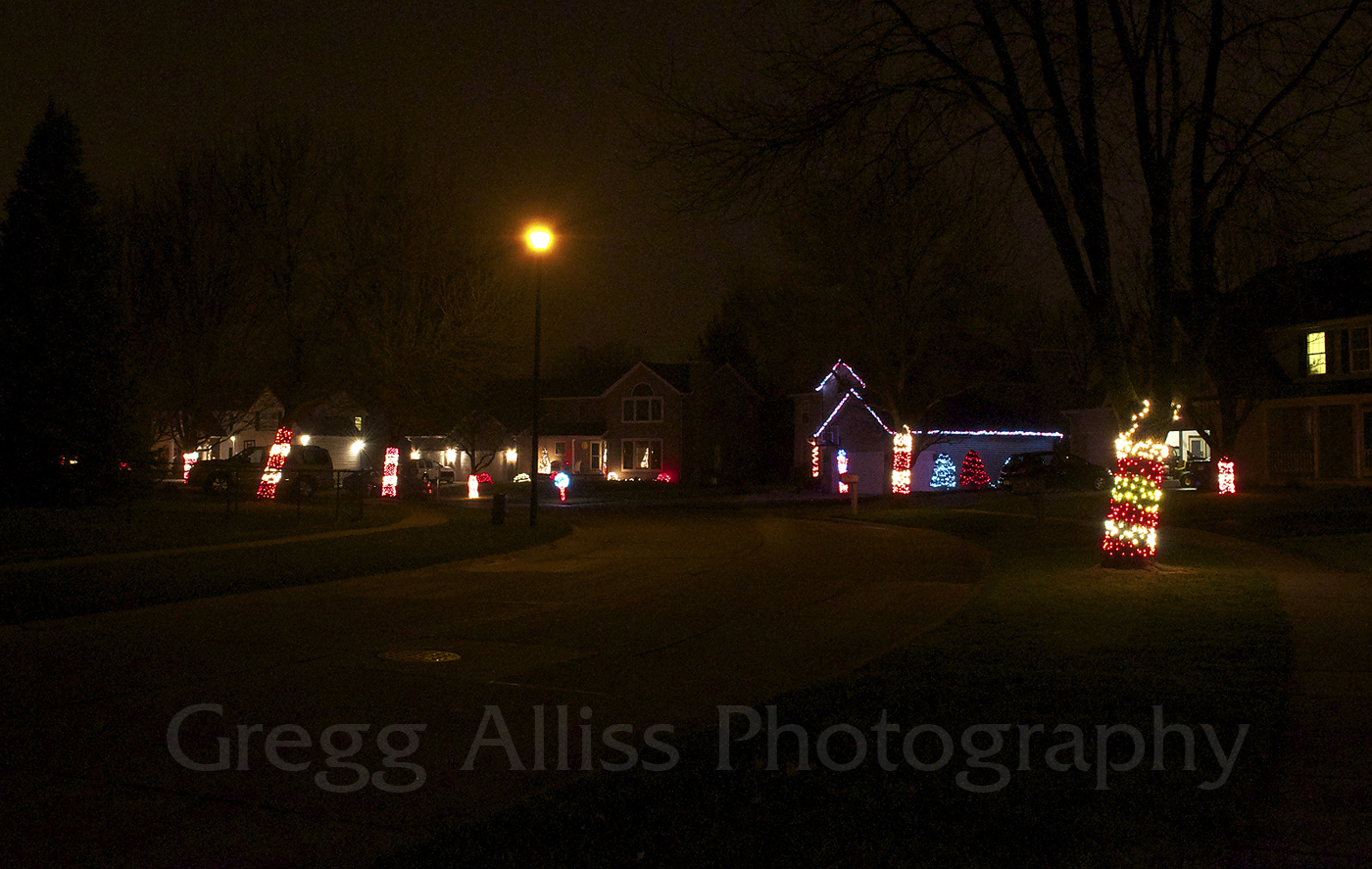
These three images, all from the vicinity of Bowman Lane and Bowman Court NE in Cedar Rapids, Iowa, were shot from 7:03-7:06 pm CST, Monday, December 21, 2015. A light, falling drizzle only slightly subdued the dazzle of the neighborhood Christmas lights displayed there. A three exposures were just over a second long at f/13, 2500 ISO and 18mm focal length. Nikon D5000 DSLR camera.

Read more...

Brilliance In A Bleak Winter Sky

Thursday, December 10, 2015


In an otherwise bleak "hazy shade of winter" sky on Wednesday evening, December 9, 2015, a cloud opening in the west allowed a brief, but brilliant sunset color to pour through. These two images were captured from Bowman Woods Park in Cedar Rapids, Iowa. The image above was shot at 4:42 pm, CST.


This photo, a three-image stitch, was captured at 4:43 pm. A minute or so later, the cloud aperture closed and with it the splash of color. Actual sunset time was 4:35 pm. Nikon D5000 DSLR camera.

Read more...

  © Blogger template On The Road by Ourblogtemplates.com 2009

Back to TOP