Photogenic, Picturesque and Non-Destructive Storm

Saturday, July 15, 2023


Storms began to form in north-central Iowa near the town of Estherville around 1:20 pm CDT, Thursday, July 13, 2023 and began to track to the southeast. By 2:20 pm this line of storms went severe warned and continued on its heading, which was in the general direction of the Cedar Rapids area. Although the line of storms lost its severe warning while in the Franklin and Butler County areas around 4:20 pm, I thought it still might have the potential for some good camera captures. I chose a good open spotting location at Lowe Park in Marion, Iowa (42° 4'5.39"N,  91°36'33.24"W). Since I was not expecting anything special from this approaching storm from a spotting perspective, I only brought my bare minimum gear (hand held weather radio and ham transceiver). The above panoramic image looks north with the storm about 40 miles distant and moving about 32 mph.


5:02 pm. Looking north over a soybean field and the storm continues to press forward.


Panorama at 5:14 pm. Storm is growing on the north and northwest horizon, and it base is beginning to darken.


Radarscope image for 5:15 pm, corresponding to the panoramic image above it. The most intense area of the storm at this time was at its western flank between Gilbertville and La Porte City, containing a hail core. The blue target icon is my location near Marion, Iowa.


5:17 pm. A considerably more ominous sky to the northwest. Parents and their children continued to watch and play ball at the park's diamonds. The storm was now located about 30 miles distant, just northwest of the town of Brandon.


5:36 pm. Northern half of the sky now dominated by dark clouds.


5:45 pm. Approaching storm with one of the park's two parabolic "whisper dishes" in the left foreground.


5:45 pm. A "selfie" from the park's stainless steel "gazing ball," including the reflection of the storm behind me.


5:46 pm. Bright wild flowers contrast with the dark approaching storm in this image looking north.


5:57 pm. Vertical image, showing storm updraft.


6:02 pm. Looking west at the more intense area of the line of storms. Parents and children had finally heeded the threat, and were packing up to go home.


6:03 pm. Radarscope image corresponding to the image above it. Hail core was located between the towns of Vinton and Urbana.


6:06 pm. Line of storms now taking on a shelf cloud appearance as seen in this panorama looking northwest. 


6:13 pm. Looking east at the eastern flank of the line of storms. The storm was moving left-to-right in this image. The western flank regained its severe warning around 6:15 pm.


6:17 pm. Ominous looking storm panorama with hail core, but mostly tracking to my west. Attenders to ball games had mostly departed by this time!


6:18 pm. Looking southwest. Leading edge of the storm almost upon me, but still mostly to my west.


6:18 pm radar capture, showing the eastern part of the storm almost upon my location.


6:19 pm. Panoramic version. A shaft of rain is illuminated by the sun toward the left.


6:20 pm. Storm continues to advance to my west. Note the illuminated rain shaft. The most intense area of the storm system was farther to the west--near the town of Van Horne in Benton County.


6:21 pm. Corresponding radar image.


6:48 pm. Looking northeast at the trailing edge of the eastern flank of my storm. Clearing skies toward left (northwest).


6:48 pm. Panoramic view to the east (left) and south (right). Storm cell can be seen in the background toward the right. An attached inflow cloud is to the left. My spotting vehicle is in the foreground.


6:51 pm. Closeup of the storm feature looking southeast. This cell was located near Mount Vernon, Iowa.


6:52 pm. Similar image with pronounced inflow cloud. Despite more intense weather to my east and west, at my location here I only experienced about ten minutes of rain downpours, but with no hail, and wind speeds never exceeded 40 mph. Great storm photo opps with no damage--best case spotting scenario! Nikon D7200 DSLR camera.


Read more...

Morning Storms Roll Through

Wednesday, July 12, 2023


Rain and thundershowers had moved through the Cedar Rapids, Iowa metro area earlier in the morning on Wednesday, July 12, 2023, but had moved out of the area by 2:00 am CDT. A little over three hours later Severe Thunderstorm Watch 476 was issued for much of the state of Iowa effective from 5:15 am (above image). 


A cell in north central Iowa went severe-warned at 5:20 am. This location (and all the following) is near 33rd Avenue at 12th Street SW in Cedar Rapids. The panoramic image above looks north at 5:43 am. Slivers of sunrise can be seen through the colorful clouds.


5:44 am. Smaller updrafts in a colorful sky looking northwest. At about this time another cell just southwest of Des Moines went severe-warned and contained a sizable hail core.


5:45 am. Similar view looking north.


Fast forward to 8:33 am. The storm near Des Moines had gone linear and had now wheeled to the north where the top third of the line was tracking for Cedar Rapids. This view of the approaching storm looks west.


Radarscope capture for 8:33 am, showing the well-defined severe line of storms approaching Cedar Rapids. 


8:42 am. The line of storms had formed into a classic summertime shelf cloud appearance. This panoramic image looks west.


8:42 am. Closeup of leading edge of the shelf cloud, looking south.


8:42 am. Looking southwest.


8:42 am. Looking west.


8:43 am. Another leading edge capture looking south. Rain and wind were moments away. This system of storms delivered much needed rain to the state of Iowa. My home weather station recorded about .9 inch of rain for the day.  iPhone 11 camera.


Read more...

More Arizona Sky Pictures

Saturday, July 8, 2023


More images from our recent Arizona vacation. The above image shows some impressive "Mare's Tail" (Cirrus) clouds above the Petrified Forest National Park south visitor center on Thursday, June 8, 2023.


Mare's Tail clouds behind petrified stumps at Petrified Forest National Park on June 8.


Sun halo/sun dog created from cirrus clouds while hiking to our backcountry campsite from the Painted Desert Inn (museum) in Petrified Forest National Park on the evening of June 8.


Milky Way, with galactic center at right, seen from our backcountry campsite at 11:49 pm, Thursday, June 8. Image is a 25 second exposure at f/2.8, ISO 1600 and 11mm focal length.


Cirrus/altocirrus clouded sky, looking back from inside the Grand Canyon, while descending to the Colorado River along the South Kaibab Trail Saturday morning, June 10, 2023.


Alto cumulus clouds just before sunrise, seen while beginning the ascent from the Colorado River along the Bright Angel Trail on Sunday, June11. The "Silver Bridge" can be seen over the river at bottom center, the "Black Bridge" in the distant background.


Cumulous clouds in this panoramic view of the sky from a bend in the Bright Angel Trail during ascent to the South Rim on Sunday morning, June 11.


Cumulus clouded sky as seen from the Grand Canyon's south rim late Monday morning, June 12.


South Rim view just after noon on June 12. Rain clouds are forming at left.


Similar panoramic view. Nikon D7200 DSLR camera.


Sunrise over the south rim as seen from Grand Canyon Village on Tuesday, June 13.


Sunrise casting long shadows from distant rock formations, as seen from the south rim on June 13. iPhone 11 camera.


Read more...

Fireworks Grand Finale Images

Friday, July 7, 2023


The image above is a sequence of video frame captures from the grand finale of an Independence Day fireworks display from rural Shueyville, Iowa in Johnson County on July 4, 2023. The grand finale of the display started around 11:20 pm CDT and lasted about a minute. The video was captured from beside a large pond, and the fireworks cast matching burst reflections in the water. 


Individual fireworks video frame capture. 


Still image from 9:55 pm. iPhone 11 camera.

Read more...

Smelly, Unhealthy, but Pretty

Tuesday, July 4, 2023


Wind-driven Canadian wildfires made for hazy daytime skies, noticeably smelly odors and unhealthy respiratory conditions for the state of Iowa during the week of June 25, 2023. The smell at one time reminded me of burning plastic. The "silver lining" to this was the enhanced sunrise and sunsets it produced. The above sunset image looks west from the HallMar Village on C Avenue north of Marion, Iowa at 8:21 pm CDT, Tuesday, June 27. Ground fog can also be seen. Nikon D7200 DSLR camera.


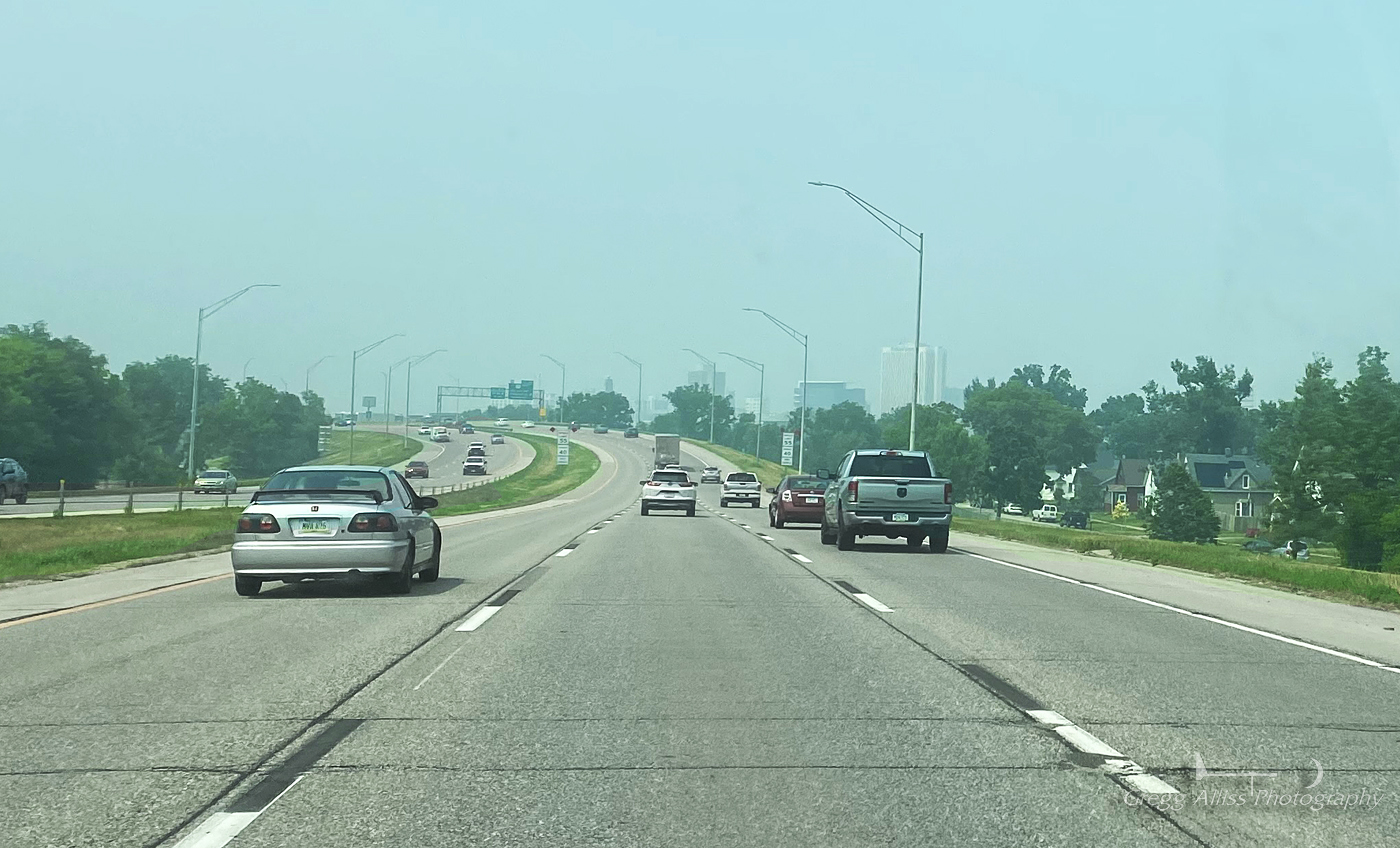
This image was captured earlier in the day at 3:00 pm, approaching downtown Cedar Rapids from the south. Note the hazy skyline in the distance. iPhone 11 camera.


Read more...

  © Blogger template On The Road by Ourblogtemplates.com 2009

Back to TOP