Mammatus? Well, Close.

Friday, November 15, 2024


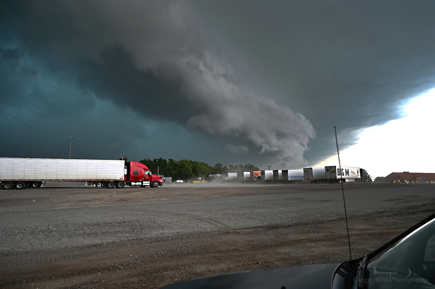
A line of showers was approaching the Cedar Rapids, Iowa metro area on the afternoon of Wednesday, November 13, 2024, and there were turbulent winds aloft associated with it. The above view, looking northwest from the Interstate 380 off-ramp at Boyson Road in Hiawatha, Iowa at 3:06 pm CST, shows the approaching quasi-mammatus clouds over a construction site located there. iPhone 11 camera.


3:32 pm. Looking west from Bowman Woods Park in Cedar Rapids.


3:37 pm. Another view looking west. The spine-like formations reminded me of a giant trilobite fossil in the sky!


Radarscope image of the line of clouds.


3:39 pm. Looking north. The clouds in this area are very turbulent. Not what you usually see in the skies of Iowa in November! Nikon Z6ii camera.


Read more...

Hunter's Supermoon or Super Hunter's Moon

Friday, October 18, 2024


The full moon during the evening of Wednesday, October 16, 2024 was the biggest and brightest of the year, also being classified as a "supermoon." A supermoon is a full moon at its closest approach--or perigee--to Earth. Full moons in the month of October are also known as "Hunter's Moons." The following images of the moon look east beside or over the old First Methodist Episcopal Church at 8th Avenue and 12th Street in Marion, Iowa. The above foreground image was captured at 7:02 pm CDT and is a 3 second exposure at f/7.1, ISO 125, 49mm focal length. The moon is a 1/400 second exposure, f/5, ISO 100, 70mm focal length.


6:56 pm. 1.6 second exposure at f/7.1, ISO 125, 70mm focal length.


6:54 pm. 1/320 second exposure at f/5.6, ISO 125, 70mm focal length. Nikon Z6ii camera.

Read more...

Comet Tsuchinshan-ATLAS--With a Short Window

Tuesday, October 15, 2024


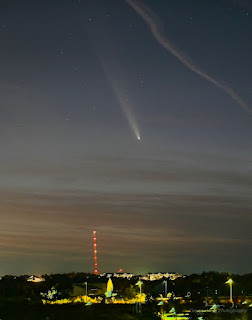
Optimists for the Comet C/2023 A3 Tsuchinshan-ATLAS were predicting brightness surpassing the planet Venus and possibly being visible during the daylight. Reality was that the comet shone at a magnitude of about 3.3 for the northern hemisphere in late September (2024), and was viewed low in the eastern sky before dawn. It shifted to the evening sky on October 10 and made its closest approach to Earth on October 12---which was to be its brightest and best viewing evening. Alas, on October 11, 12 and 14 in the Cedar Rapids, Iowa metro area skies were overcast, precluding any possibility of seeing it on those dates. October 13 offered a brief opportunity to finally see it. On October 13 the comet was beginning to dim (magnitude 3), but I was still able to locate it with the naked eye after the sky began to darken. I had seen a locational graphic on the internet, showing its position roughly between the -3.97 magnitude planet Venus and the -0.07 magnitude star Arcturus. This proved to be very helpful as I had expected it to be closer to Venus. The image above, captured at 7:13 pm CDT, looks west from Lowe Park in Marion, Iowa  (42° 4'5.11"N,  91°36'17.06"W), and is a 5 second exposure at f/4, ISO 125, 37mm focal length. The identical image below contains helpful descriptions of the celestial bodies.


7:28 pm. Growing darkness reveals more of the comet and its tail. 3 second exposure at f/4, ISO 400, 59mm focal length.


7:32 pm. 4 second exposure at f/4, ISO 400, 59mm focal length. By 7:45 pm, the comet became more diffuse and dimmer as it dipped lower toward the horizon and its thicker atmosphere.


Cropped version of the image above it. I would view this comet as slightly less impressive than the Comet Neowise (2020). The best and brightest comet I have ever witnessed was Hale-Bopp in 1997, which peaked at magnitude -1.8, and coming in second was Comet Hyakutake, which peaked at magnitude 0 the year before. Major busts to the eye were the comets Kohoutek in 1973-74 and Halley in 1986. Comet Tsuchinshan-ATLAS continues to be visible in the evenings, but dims with each day. I won't wait around for it to return with a possible better appearance because that won't happen again for another 80,000 years! Nikon Z6ii camera.


Read more...

Severe Weather Over Eastern Iowa--From Space

Saturday, October 12, 2024


During a time of active solar activity, a predicted event for Thursday, October 10, 2024 looked to be even better. The notification shown above from spaceweather.com on October 9, hinted at G4 to even G5 geomagnetic severe storm levels, which could produce communication disruptions and vivid auroral diplays (Northern Lights). 


6:49 pm CDT, Thursday, October 10, 2024. Evening is coming with clear skies, and I selected my aurora viewing location--about 1.1 miles east of Highway 13 northeast of Marion, Iowa (42° 4'18.79"N,  91°32'7.19"W) on Tower View Road. iPhone 11 camera.


7:03 pm. Solar wind data and auroral forecast the Auroral Alerts application, showing promising readings.


7:21 pm. Looking north. The faint shapes of aurora are starting to materialize, despite light disruption from a half-moon. 8 second exposure at f/4, ISO 320, 24mm focal length.


7:32 pm. Looking north. Light pillars from the brightening aurora are becoming evident. 15 second exposure at f/4, ISO 320, 24mm focal length.


7:46 pm. Looking north. Some violet pillars form (left). 13 second exposure at f/4, ISO 500, 24mm focal length.


7:52 pm. Solar wind data and auroral forecast. Note the area of severity in the right panel (red).


8:08 pm. More pillars are forming as the aurora intensifies. 10 second exposure at f/4, ISO 500, 24mm focal length.


8:32 pm. Solar wind data and auroral forecast. Severe red areas have penetrated the northern tier states of the U.S.


8:34 pm. Looking northwest. Red aurora are beginning to form in the geomagnetic storm. Red auroras are caused when solar particles "excite" oxygen atoms at higher altitudes--indicating strong activity, while greens are from oxygen atoms at lower altitudes. 13 second exposure at f/4, ISO 500, 24mm focal length.


8:43 pm. Looking northwest. 20 second exposure at f/4, ISO 200, 24mm focal length.


8:46 pm. Looking north. Brighter auroras beginning to form as storm intensifies. 15 second exposure at f/4, ISO 320, 24mm focal length.


8:52 pm. Looking northwest. Reds, violets and greens showing. 20 second exposure at f/4, ISO 250, 24mm focal length.


8:51 pm solar wind data and 9:04 pm auroral forecast.


8:55 pm. Similar view looking northwest. 20 second exposure at f/4, ISO 200, 24mm focal length.


8:57 pm. Similar view. Red auroras intensifying. 20 second exposure at f/4, ISO 160, 24mm focal length.


9:00 pm. Looking northeast. Reds and greens in bright aurora display. 20 second exposure at f/4, ISO 160, 24mm focal length. 6 second exposure at f/4, ISO 500, 24mm focal length.


9:04 pm. Looking north. Blends of reds and greens. Aurora is exhibiting a "curtain" look. 13 second exposure at f/4, ISO 200, 24mm focal length.


9:09 pm. Looking northwest. Note the Big Dipper at right. 15 second exposure at f/4, ISO 160, 24mm focal length.


9:16 pm. Looking northwest. Storm intensity is beginning to subside. Shortly after this image was captured, I returned home. This geomagnetic storm was comparable to the April 23, 2023 event, but since this time there was a half-moon disrupting the dark skies, I was not able to witness what I called in 2023 "ripples in the atmosphere phenomena." The storm continued at diminished levels through the night. 15 second exposure at f/4, ISO 125, 24mm focal length. Nikon Z6ii camera.


Read more...

Saturday Morning Orion

Monday, September 30, 2024


My intention was to view and/or photograph the Comet Atlas A3 on the morning of Saturday, September 28, 2024. This was to be unsuccessful, but the constellation Orion was glittering beautifully in the southern sky, so I diverted to that instead. The image above, captured at 5:32 am CDT, is a 20 second exposure at f/4, ISO 400, 24mm focal length, and was photographed from White Road at North Marion Road, north of Marion, Iowa. The constellation Orion is seen at center upper, with the bright -1.47 magnitude star Sirius at left. Contrail streaks are seen at lower right. Nikon Z6ii camera.

Read more...

Harvest SuperMoon River...with a Partial Eclipse

Wednesday, September 18, 2024


A "Harvest Moon" is a full moon in the month of September. A "Supermoon" is when the moon is at its closest orbital approach to Earth (perigee) and is in full phase. Now, let's throw in a partial eclipse and you have an "Eclipsed Harvest Supermoon." That all occurred over the state of Iowa during the evening of Tuesday, September 17, 2024. I mulled over the best location to photographically capture the event and finally arrived at the Cedar River in downtown Cedar Rapids, with all its nighttime colorful reflective properties. The above image, which looks southeast from near the old Quaker Oats railroad bridge, is a composite. Time was 9:36 pm CDT, the moment when the moon was 100% full, and eight minutes before maximum partial eclipse. The foreground is a 6 second exposure at f/8, ISO 100, 24mm focal length. The moon itself is a 1/320 second exposure at f/8, ISO 200, 70mm focal length. The moon's reflectivity in the water (center) mingles with the reflected lights of the city. Nikon Z6ii camera.

Read more...

Pre-Dawn Eastern Skies

Sunday, September 1, 2024


The eastern sky during the pre-dawn hour of Saturday, August 31, 2024 was chocked-full of celestial features. This image, captured from the Bowman Meadows housing development at 4:05 am CDT, is a 10 second exposure at f/4.5, ISO 125, 24mm focal length. At right center is the constellation Orion. The bright object at center upper is the -2.27 magnitude planet Jupiter. The slightly less bright object below and left of Jupiter is the 0.74 planet Mars. Above and right of Jupiter is the constellation Taurus. At left in the image is the constellation Gemini.


4:06 am. Rising just above the horizon at about the same time was a thin crescent moon. This is a 10 second exposure (which created the bright Earth-shine appearance) at f/4.5, ISO 125, 70mm focal length. Note the ground fog at center. Nikon Z6ii camera.

Read more...

All Things Low Light

Wednesday, August 21, 2024


The following three images are different examples of recent dark sky/low light photography. 

The image above looks east at a meteor streak (upper right) from Brentwood Drive NE in Cedar Rapids, Iowa at 3:06 am CDT, Sunday, August 11, 2024. It is a 13 second exposure at f/4.5, ISO 1000, 24mm focal length. This was one day before the meteor shower's peak day, as the following night was forecasted to be cloudy (and was). At center in the image is the Pleiades star cluster. The constellation Perseus is at upper left. The bright object between the trees above the roof is the -2.22 magnitude planet Jupiter. The 0.06 magnitude star Capella is seen at far left.


8:29 pm CDT, Friday, August 16, 2024. Looking west at post-sunset sky from the High Trestle Bridge in Boone County, Iowa. The half-mile, 13 story bridge over the Des Moines River is part of a 25 mile pedestrian and bicycle trail that connects the towns of Woodward and Ankeny. Image is a 1/13 second exposure at f/7.1, ISO 100, 33mm focal length. Sunset was at 8:05 pm. 


8:48 pm CDT, Monday, August 19, 2024. A "Super Blue Moon" rises in the eastern sky as seen from Bowstring Drive at Alburnett Road in the Bowman Meadows housing development in Marion, Iowa. This is a composite image. The foreground is a 6 second exposure at f/4.5, ISO 100, 36mm focal length; the moon itself at 1/40 second at f/4.5, ISO 200, 70mm focal length. A Super Moon is defined as a full moon at its closest point to the Earth (perigee). A Blue Moon is a full moon occurring twice in a single month. The next "Super Blue Moon" won't occur again until 2037! Nikon Z6ii camera.

Read more...

Another Derecho, Anyone?

Saturday, July 20, 2024


A derecho is defined as " a storm complex traveling more than 400 miles, producing damaging wind gusts of 58 mph (60 knots) or stronger along its path. Some gusts must exceed 75 mph. The width of the damage path must be at 60 miles wide."


The Storm Prediction Center (SPC) posted a Day 2 Enhanced Risk (Level 3 of 5) for central Iowa to eastern Indiana at 12:30 pm on Sunday, July 14, 2024. This prediction of a large swath of severe weather would indicate a confidence for a derecho-like event. 


11:31 am CDT, Monday, July 15, 2024. The SPC upgrades its outlook to a Moderate Risk (Level 4 of 5), a 10% hatched tornado probability stretching from eastern Iowa to northeast Indiana (above center), and a high probability of wind (above right). 


1:59 pm. Mesoscale 1630 is posted, outlining a 95% probability of the issuance of a severe thunderstorm watch in an area stretching from western Iowa to western Indiana. The actual watch would be issued a short time later.


4:14 pm CDT. Now at my stationary spotting location on Sutton Road (right) at Central City Road (background, left), west of Central City, Iowa in Linn County. A severe-warned storm is approaching from the west (left and left center in image). 


4:26 pm. Looking northeast at the underside of an enormous anvil cloud, ahead of the approaching severe-warned thunderstorm. My spotting vehicle, equipped with amateur radio and weather radio, is seen in the foreground. 


Radarscope image for 4:36 pm CDT, showing the approaching storm beginning to become more linear and bowing out just west of my location. 


4:50 pm. Tornado warning is issued, and sirens sound. Area that is tornado warned is toward the left in the image.


4:52 pm. Radarscope dual pane image, showing the tornado warning polygon, with reflectivity at top, and velocity at bottom.


5:23 pm CDT. Cell phone Emergency Alert sounds, valid until 6:00 pm. I decide to move back south toward Cedar Rapids, where a "tail-end Charlie" storm feature is approaching, which seems more "favorable" for significant severe weather.


5:28 pm Radarscope dual pane image, with a hot spot to my southwest. Now at my new stationary spotting location on North Marion Road, about a tenth-mile north of County Home Road, north of Marion, Iowa in Linn County.


5:31 pm CDT. Looking southwest toward tornado warned area, with the sky becoming very dark in a short amount of time. Nikon Z6ii camera.


5:31 pm. Go Pro Hero 4 Silver video frame capture. Lightning bolt. With the energy of the storm increasing, many positive CG lightning strikes were occurring in this area, including one that struck just 50 yards from this location, sending sparks flying from a telephone pole!


5:33 pm. Tornado warning polygon and my spotting location (blue target icon). 


5:35 pm. Cell phone Emergency Alert for a tornado warning sounds again. 


5:51 pm. Go Pro video frame capture showing estimated 70 mph winds and rain slashing my windshield. I reported this situation to the Linn County Amateur Radio Emergency Services (ARES) network via amateur radio. 


5:55 pm. Emergency Alert sounds again, warning of a severe thunderstorm warning with possible 80 mph winds. Thankfully my spotting vicinity was spared from significant wind or flood damage that impacted other areas, including a 97 mph wind gust reported near Holy Cross in Dubuque County. Some three tornado reports were also confirmed in the state from this storm that was later confirmed as a derecho.


Read more...

  © Blogger template On The Road by Ourblogtemplates.com 2009

Back to TOP