More Palisades Kepler Flood Pics

Wednesday, September 28, 2016


Despite the clear and sunny conditions, water was creeping higher in the Cedar River when these images at Palisades Kepler State Park, southeast of Cedar Rapids, Iowa were captured on Monday, September 26, 2016. Image above was photographed at 4:31pm CDT. The parking lot was blocked off from vehicles from the right of this image to the background.


4:32 pm. Flood waters move quickly from right-to-left in this image from the parking lot area temporarily accessible only by foot.


4:43 pm. Submerged park bench, which once overlooked an extensive beach area along the Cedar River at Palisades Kepler. The Cedar River crested at 21.97 feet in downtown Cedar Rapids at 10:30 am on Tuesday, September 27. Nikon D7200 DSLR camera.

Read more...

More Palo Flood Pics

Tuesday, September 27, 2016


One day before flood crest, I was parked alongside Blairs Ferry Road (E36), seen here at 3:39 pm CDT, Monday, September 26, 2016. Image looks west toward the town of Palo, Iowa. Water is nearly up to the road level.


3:43 pm. Turned back around and headed eastbound toward Cedar Rapids. This image looks north at the swollen Cedar River from a bridge just over a mile east of Palo.


Same moment, but looking the opposite direction on the bridge. Nikon D7200 DSLR camera.

Read more...

Flood Waters In Linn County

Monday, September 26, 2016


Major accumulations of rain from southern Minnesota and northern Iowa in the previous weeks
began flowing into the Linn County Iowa area early on Monday, September 26, 2016. Inundation began by midday. The above image looks northwest at 3:41 pm CDT from Blairs Ferry Road (E36) just east of the town of Palo. The stone in the water in the background bears the name of the town.


A minute later, and now looking southwest toward the Palo Mini Mart, located on 1st Street, which is surrounded by water.


With water levels around 21.5 feet, fast moving water from the Cedar River flows through Palisades Kepler State Park around 4:40 pm.


A park bench once located along the grassy shore of the Cedar River at Palisades Kepler State Park now sits half submerged in flood waters at 4:43 pm. Nikon D7200 DSLR camera.

Read more...

Sunset Following The Storm

Saturday, September 24, 2016


On an afternoon/evening that featured two severe-warned storm cells in Iowa--one north and one south, and a tornado watch to boot, in between were spectacular sunsets. In the image above, captured at 6:24 pm CDT, Monday, September 19, 2016, the sun is behind the ADM plant south of Cedar Rapids while I was northbound on Interstate 380.


Still northbound on I-380, this view looks west over Cedar Lake in Cedar Rapids at 6:29 pm. Nikon D7200 DSLR camera.

Read more...

Thundershower Arrival

Friday, September 23, 2016


A thundershower, complete with heavy rain and lightning was minutes away when captured here at Bowman Woods Park in Cedar Rapids, Iowa. The image looks west over Bowman Woods Elementary School at 5:12 pm CDT, Thursday, September 22, 2016. A training of rain with thunderstorms followed this cell through the night, adding to expected Cedar River flooding conditions for the weekend. Nikon D7200 DSLR camera.

Read more...

Out Of Range, But Not Out Of Sight

Wednesday, September 21, 2016


This slow moving and massive sized storm system, in parts tornadic, is seen in this panoramic image
looking north from the grounds at Noelridge Christian Church in Cedar Rapids, Iowa at 5:35 pm, Wednesday, September 21, 2016. The storm system stretched some 117 miles from west-to-east, with the most intense area (left) near Marble Rock, Iowa in southern Floyd County. The east flank resided near Luxembourg, Iowa in NW Dubuque County. A tornado warning was issued in the Marble Rock area around 5:25 pm. iPhone 6-Plus camera.


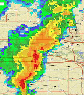
Radar screen capture for 5:35 pm. Target icon shows my position and the arrows pointing to the points of the system.


Fading lightning to the north, as seen from the grounds at Echo Hill Presbyterian Church north of Marion, Iowa at 9:30 pm. The lightning is about 55 miles distant, just north of Oelwein, Iowa. 15-second exposure at f/5, 1000 ISO and 16mm focal length. Nikon D7200 DSLR camera.

Read more...

Spinning Wheels In Tornado Watch 484 Bust

Tuesday, September 20, 2016


With much promise for storm photography grabs following Tornado Watch 484, issued for Eastern Iowa at 2:55 pm CDT, Monday, September 19, 2016, I was primed and ready and with apparent ample time for interception. The first cell went severe in the farthest NE county in Iowa at 2:25 pm, and rolled southeast down the Mississippi River. Still quite a distance from me, but I decided to get close as I could to it. The above image shows the cell in the northeast sky at 4:00 pm as seen from County Home Road (E34), about a half-mile east of the center of Whittier, Iowa. The severe warning was lifted fifteen minutes later from the Iowa border, and I decided end my pursuit at Anamosa, Iowa.


Twin cells moving southeast began firing up ESE of Des Moines and became severe-warned around 4:40 pm, and I headed south to make a play on these. This image shows the anvil of the nearer of the two cells (located about 60 miles to the southwest near Oskaloosa, Iowa) around 5:15 pm, just about the time its severe warning was lifted. I am southbound on the I-380 Five-In-One bridge in downtown Cedar Rapids. I followed on after the southernmost cell, which now had become severe-warned and was going strong, but by Hills, Iowa I knew it was too far away--moving SSE into Missouri. And in between these two cells--CLEAR SKIES. I had just experienced the dreaded tornado watch bust! Better luck next time. Nikon D7200 DSLR camera.

Read more...

Rollin' Over

Monday, September 12, 2016


The very photogenic shelf cloud finally arrived over the position seen above at 6:08 pm CDT, Friday, September 9, 2016.  My vehicle is in the parking lot of Ross Veterinary Clinic on North Marion Road, about .1-mile north of County Home Road. The camera looks southwest.


A minute later and same location, but looking northeast. This area of the gust front produced very little wind, very little rain and virtually no lightning. Nikon D7200 DSLR camera.


NEXRAD radar map of Iowa showing the more intense areas which created the shelf cloud at 3:00 pm (upper) and 6:00 pm (lower). These areas are outlined in white. The white target icon shows my position during these moments.

Read more...

Shelf Cloud Rolls On

Sunday, September 11, 2016


The breathtaking shelf cloud continued to roll east in a huge line as I was northbound on Alburnett Road in Marion, Iowa on Friday evening, September 9, 2016. The above image was captured through the windshield at 6:04 pm CDT as I was just south of Oak Park Circle and about .3-mile south of Echo Hill Road.


6:05 pm. About .1-mile south of Echo Hill Road.


6:05 pm. About .7-mile south of County Home Road.


6:06 pm. About a half-mile south of County Home Road. Edge of shelf cloud in the distance (north) was about 3 miles distant. Nikon D7200 DSLR camera.

Read more...

No Napping This Time

Saturday, September 10, 2016


A line of rain began passing through the Cedar Rapids area around 3:00 pm CDT on Friday, September 9, 2016. Behind it was clearing and a renewed instability. Behind and west of that was a cold front with severe-warned areas in Guthrie and Hamilton counties in Iowa. The line lost its severe warnings as it approached eastern Iowa, but stronger areas remained in the south. There was still a defined line approaching Cedar Rapids just before 6:00 pm, and that, with darkening skies to the west, prompted me to grab my gear and head out. Once in the open, a beautiful shelf cloud appeared,  swallowing up conditions that included 72 degree F temps, 70 degree dew points and 89% humidity. This was a weather photographer's delight: little wind, little rain and no threatening lightning, but a beautiful "end-of-the-world" shelf cloud appearance. In the image above, I am northbound at 6:02 pm on Alburnett Road (W58), about .2-mile south of Tower Terrace, in Marion, Iowa. Image taken through open driver's window looks west.


One minute later and about .2-mile north of Tower Terrace on Alburnett Road.


Moments later. Image looks westward down the left flank of the shelf cloud.


6:04 pm. Shot through windshield. Northbound on Alburnett Road just south of W. Williams Drive in northern Marion. Shelf cloud is now covering half of the sky. Nikon D7200 DSLR camera.


The line of storms which would feature the beautiful shelf cloud was still west of the Des Moines area at 3:00 pm, and sported two severe-warned areas. Note the line of showers moving through the Cedar Rapids area at right, and the sun-renergized area of instability between them.


6:00 pm radar screen capture. My observation position is shown with the target icon and black arrows indicate storm movement. Note the stronger areas of the gust front in the south. Wind gusts never exceeded 39 mph in Cedar Rapids, well below severe levels.

Read more...

Mild Thunderstorms, Nice Visuals

Friday, September 2, 2016


A non-imposing line of thunderstorms (strength-wise) on Monday, August 29, 2016 were still visually gratifying as seen from Eastern Iowa. The four posted images today were captured from Bowman Meadows housing development in Marion, Iowa. The above panoramic image looking southeast shows the line of storms at 4:18 pm CDT. The line stretched some 60 miles. The left portion of the line was about 46 miles distant, the right, 36 miles.


A similar view a minute later.


4:19 pm. Looking southeast. The updraft at far right is located about 36 miles away, near West Liberty, Iowa.


4:20 pm. A weak but photogenic cell located about 53 miles to the SSE, near Columbus Junction, Iowa. Nikon D7200 DSLR camera.

Read more...

  © Blogger template On The Road by Ourblogtemplates.com 2009

Back to TOP