Dusting The Creekside

Tuesday, November 24, 2015


Dry Run Creek in Boyson Park, near the Marion and Cedar Rapids, Iowa boundary, was the setting for these three images. All three look west. Snow had been falling for nearly a half-hour and was beginning to dust solid objects surrounding the creek. When the snow system had exited the next day, some seven inches fell here. Capture times: Bottom image, 4:03 pm CST, Friday, November 20, 2015; Middle image, 4:06 pm; and top image, 4:07 pm. Nikon D5000 DSLR camera.

Read more...

Before The Snow Flew…And During

Monday, November 23, 2015


This image, a two-photo stitch, looks north from Alburnett Road, about .8-mile north of County Home Road, and north of Marion, Iowa at 3:26 pm, Friday, November 20, 2015. Miniature flakes of snow had just begun to filter downward as the first significant snowstorm of the season approached.


32 minutes later, this was the scene at Boyson Park near the border of Marion and Cedar Rapids, Iowa. Heavier snow was now falling, and when the system vacated the area the next morning, some 7 inches of snow had covered the ground. Air temperature for the top image was 33 degrees F. By 10:50 pm the following day (November 21), air temperature was 7 degrees F. Nikon D5000 DSLR camera.

Read more...

November Severe Weather

Thursday, November 12, 2015


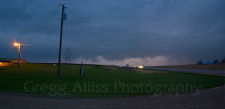
With the SPC forecasting severe weather potential for southern Iowa and northern Missouri two days in advance, storm initiation finally began in western Iowa before noon on Wednesday, November 11, 2015. Tornado Watch 535 was issued for much of eastern Iowa at 3:20 pm CST. A mix of strong CAPE, wind shear and warm air contributed to this unusual November severe event. The above image looks west at an advancing line of severe storms at 4:54 pm from Nutmeg Avenue at 220th Street (County Road G36), one mile east of Highway 1 in central Washington County, Iowa.


As the storm passed overhead, torrents of blinding rain made driving on 220th Street extremely difficult. We witnessed an SUV drive slowly off the road and into the ditch to the left, miraculously recover and pull back up to the road surface, only to slowly go off and into the ditch at right. A small parking oasis just before Highway 1 allowed us to pull into it to wait out the rain and hail. I could not see the hail clearly in the dark, but judging by the impacts on our vehicle estimated it to be penny size. The middle image--a video frame capture--shows a parked dump truck at 5:02 pm, which served as sort of a directional beacon which drew us to the safety of the fortuitous parking area.


This radar image graphic shows our position near the time of the middle image. Small hail cores can be seen in the area, colored in lavender. The early darkness of November made photographing the storm a challenge. Nikon D5000 DSLR camera.

Read more...

Growing Glow In The East

Monday, November 9, 2015


An ever-increasing glow in the eastern sky is seen here at 6:18 am CST, Monday, November 9, 2015, from Progress Drive in Hiawatha, Iowa. This image was captured a half-hour before sunrise and features a waning crescent moon. Air temperature was a crisp 43 degrees F. iPhone 6 Plus camera.

Read more...

  © Blogger template On The Road by Ourblogtemplates.com 2009

Back to TOP