Dusty Sunset

Sunday, September 30, 2012


The influence of the drought of 2012 was quite evident here as dust kicked up from vehicles along the gravel-paved  Radio Road just northeast of Marion, Iowa enhanced the sunset on the evening of Saturday, September 29, 2012. In the top image, located about .9-mile east of Highway 13, dust from my vehicle (left) wafts across the road not unlike the rolling of fog. The image was shot around 6:30 PM. In the bottom image, shot around 6:45 PM, another vehicle raises a cloud of dust as it heads for Highway 13. As the sun was setting in the west, a harvest moon was rising in the east. Sunset was at 6:50 PM.

Read more...

Harvest Moon Over Marion

Saturday, September 29, 2012


A full moon rises over a farmstead along Radio Road, about .7-mile east of Highway 13 just northeast of Marion, Iowa Saturday evening, September 29, 2012. The top image was taken around 6:48 PM, the bottom, a minute later. Both images were shot with a focal length of 116mm. Technical fullness of the moon occurred at 10:19 PM, CDT Saturday. In days before farm combine vehicles with lights, harvest moons allowed farmers to reap their fields by night.

Read more...

Moon River

Wednesday, September 26, 2012


As a tribute to singer Andy Williams and his iconic "Moon River" song, this image shows a "river" of cirrus clouds flowing over a 3/4 moon, creating a halo around it above our house's back roof in Cedar Rapids, Iowa. Williams, a native of Wall Lake, Iowa, passed away today at the age of 84. I actually had the pleasure of meeting Williams in 2008. This image, shot around 8:15 PM, Wednesday, September 26, 2012, is a three-second exposure at f/6.3, 2500 ISO, 18mm focal length and looks east. Here's to you, Andy!

Read more...

Crepuscular Ray Evening

Monday, September 24, 2012


Crepuscular rays emanate upward from behind the western horizon around 7:30 PM, Saturday, September 22, 2012 as seen from the grounds at Noelridge Christian Church in Cedar Rapids, Iowa. Sunset was at 7:03 PM. Clouds near the horizon can block sunlight from reflecting off air, making columns outward from the sun appear unusually dark. These images are 1/4-second exposures at f/10, 320 ISO and 18mm focal length.

Read more...

Two Red Bodies

Sunday, September 23, 2012


One a star and one a planet. The red giant star Antares is shown at left (brightest of the three grouped stars) and the red planet Mars is at right center. Antares shines at magnitude 1.03 and Mars at magnitude 1.22. A little difference in size and distance though. Antares, some 800 times larger than our sun, lies some 604 light years distant while the small planet Mars is a mere 177.6 million miles from Earth. Antares is part of the constellation Scorpius and Mars at this time lies in the constellation Libra. The tower at left background is operated by Century Communications LLC. This image looks southwest from the grounds at Noelridge Christian Church in Cedar Rapids, Iowa and is a 2.5-second exposure at f/6.3, 2500 ISO and 40mm focal length. The last glow of twilight is at lower right.

Read more...

Dippin' Into The Trees

Friday, September 21, 2012


The Big Dipper, the familiar asterism of the constellation Ursa Major, stands out starkly in the northwest sky despite competition from a half moon around 8:19 PM, Friday, September 21, 2012. This image, shot from Bowman Woods Park in Cedar Rapids, Iowa, is a six-second exposure at f/6.3, 3200 ISO and 34mm focal length. The three bright stars of the dipper's "handle" are, from left: Alkaid, Mizar (with dimmer companion Alcor) and Alioth. The top two "pan" stars are, from left: Megrez and Dubhe. The bottom two stars are: Phecda and Merak. All are from 78-121 light years from Earth.

Read more...
Billowing To Life

Tuesday, September 18, 2012


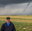
The most active and dynamic storm cell of its group is shown as its updraft (cone shaped structure at upper center) soars to about 55,000 feet on the evening of Tuesday, September 4, 2012. Photo was taken around 5:52 PM from about four miles north of Center Point, Iowa and looks northeast. The updraft, about 65 miles distant, was located near the town of Volney in Allamakee County. A brief tornado was produced from these severe storm cells in Grant County, Wisconsin.

Read more...

Long Tall Self Portrait

Monday, September 17, 2012


With a clear night sky facing west as a backdrop, this 3-second exposure at f/3.5, 1000 ISO and 18mm focal length is my shadow lengthened by parking lot lights at Christ Community United Methodist Church in Marion, Iowa. The time was just before 10:00 PM, Tuesday, September 4, 2012. I had just finished photographing a distant isolated storm cell in the north sky and was preparing to get back in my car when this opportunity presented itself. Also seen is the shadow of a leg of my camera's tripod at center and the shadow of my vehicle at right. I am holding a shutter remote switch in my left hand to allow for the "both hands up" appearance.

Read more...

Billions And Billions Of Stars

Friday, September 14, 2012


There was a lot to see in this view of the northeast sky just before 1:30 AM, Tuesday, September 11, 2012. The ultra-clear sky featured the constellation Perseus (upper left), the star cluster Pleiades (right center), the "head" of Taurus the Bull (partially hidden behind the roof-mounted weather station), the -2.39 magnitude planet Jupiter (left of the station) and the 0.06 magnitude star Capella in the constellation Auriga (left center). This image was taken from Brentwood Drive NE in Cedar Rapids, Iowa and is a 30-second exposure at f/3.5, 400 ISO and 18mm focal length.

Read more...

Night Sky At The DAEC

Thursday, September 13, 2012


The top image is one of 118 images used to create the "stacked" image below.  The images look northeast over the Duane Arnold Energy Center (DAEC) about two miles north of Palo, Iowa, seen from an open area just off Power Plant Road, which leads into the facility. Each image was a 30-second exposure at f/4.5, 320 ISO and 18mm focal length. Total time to create the bottom image (using StarStaX software) was from 10:33-11:39 PM, Sunday, September 9, 2012. The DAEC, which became operational in 1974, is Iowa's only nuclear power plant.

Read more...

Mini Chase For A Better Shot

Wednesday, September 12, 2012


Standing out like a sore thumb as I got off work, this isolated storm cell in the northeast sky was bad weather in an all clear sky. I "chased" it as far as four miles north of Center Point, Iowa to get a better vantage point for my camera. The storm cell was located more than 60 miles away in northeast Iowa, in Allamakee and Clayton counties. Hail over two inches in diameter was reported with these severe storms along with localized wind gusts ranging from 60 to 75 mph. As the high-based storms moved into southwest Wisconsin, at least one tornado formed in northwest Grant County. This view from the County Home Road overpass at Exit 28 of Interstate 380 near Toddville, Iowa was taken around 6:10 PM, Tuesday, September 4, 2012. Note the prominent bright updraft of the storm at center.

Read more...

9-11 Anniversary Morning

Tuesday, September 11, 2012

The -4.17 magnitude planet
Venus and a crescent moon
accentuate the display of
the American flag in the 
morning sky, a nice patriotic 
reminder of the 11th 
anniversary of the terrorist
attacks on the U.S. This
image, looking east around
6:17 AM, Tuesday, September
11, 2012, was captured from
our front porch on Brentwood
Drive NE in Cedar Rapids,
Iowa.

Read more...

Got Milky Way?

Monday, September 10, 2012


This very dark sky looking southwest allowed the Milky Way to appear almost like a line of prominent clouds around 10:30 PM, Sunday, September 9, 2012. These two perspectives look the opposite direction of the nearby Duane Arnold Energy Center about .4-mile distant, and about 2 miles northeast of Palo, Iowa. The hillock in the foreground is illuminated by the power plant. The top image is a 15-second exposure at f/3.5, 1000 ISO and 18mm focal length; the bottom image is a 20 second exposure with the same settings. A same view of the sky from nearby Cedar Rapids would render the Milky Way almost invisible due to light pollution.

Read more...

Two Conflicting Weather Conditions

Saturday, September 8, 2012


If you think this is a shot of a completely clear night sky, look again. An isolated severe storm cell was producing a lightning show even though it was located about 65 miles to north. Photo was taken from just west of the grounds at Christ Community United Methodist Church in Marion, Iowa; the storm was located near the town of Monona, in northern Clayton County in northeast Iowa. Image is a 13 second exposure at f/3.5, 1000 ISO and 18mm focal length.

Read more...

Atmospheric Awe

Thursday, September 6, 2012


I observed these magnificent high-based cumulonimbus clouds from ideal weather conditions north of Center Point, Iowa on the evening of Tuesday, September 4, 2012. All was clear and quiet here, but not there! Both were severe-warned. The closer cloud was located about 65 miles away in southern Allamakee County in Iowa and was exhibiting a strong central updraft (lightest area at top). The more distant cloud (left) was located in extreme southeastern Minnesota.  The small water tower in the background belongs to the nearby town of Walker. Weather conditions at this hour was 89 degrees F with a dew point of 66 degrees.

Read more...

Night Flashes

Wednesday, September 5, 2012


It was one of those situations where, from our house--with all the tree, house and other obstructions--it appeared that lightning was flashing from a clear night sky.  It wasn't. These images captured a distant severe storm cell low on the northern horizon with clouds illuminated by the continuous flicker of lightning. The cell was located about 65 miles away--near the town of Monona, Iowa in northern Clayton County. The camera here was located just west of the grounds at Christ Community United Methodist Church in Marion, Iowa. In the background of each shot is East Robins Road. The top image was a 15 second exposure at f/5, 1600 ISO and 18mm focal length and shot around 9:40 PM; the bottom image is a 30-second exposure at f/4.5, 320 ISO and 18mm focal length, and shot around 9:50 PM. Note the stars surrounding the isolated spectacle.

Read more...

In Harm's Way A Long Way Away

Tuesday, September 4, 2012


This severe-warned storm cell on Tuesday evening, September 4, 2012 in northeast Iowa was unusual in that it was by itself. Completely isolated. Elsewhere there was clear and sunny skies as far as the eye could see. The top two images here look northeast from Wileys Road, a gravel road just west of North Center Point Road, located about four miles north of Center Point, Iowa. The top image was shot at 5:52 PM with a focal length of 200mm. The middle image was shot at 5:50 PM with a focal length of 22mm. The storm was about 65 miles to the northeast and about 10 miles southeast of the town of Waukon in Allamakee County. The bottom image is a DVN radar image capture from 5:48 PM, showing the storm cell's position on the map.

Read more...

Filament Cloud

Monday, September 3, 2012

This cirrus cloud appears to
be made up of interwoven 
filament strands. The cloud
was seen in the north sky
as observed from Bowman
Woods Park in Cedar Rapids
around 7:00 PM, Saturday,
September 2, 2012.

Read more...

Peeking Sun Halo

Sunday, September 2, 2012


A setting sun produced this partial halo effect looking west from Bowman Woods Park in Cedar Rapids, Iowa at 7:00 PM, Saturday, September 1, 2012. The sun was 6 degrees above the horizon at this moment and sunset was at 7:37 PM CDT. When conditions are right water vapor in the frozen upper atmosphere condenses into tiny hexagonal ice crystals which catch the sunlight and bend it, like tiny prisms. Because of the sun's low position in the sky and a cover of trees, only the upper part of the halo was visible.

Read more...

  © Blogger template On The Road by Ourblogtemplates.com 2009

Back to TOP